Richland County History Room
Richland Center, Wisconsin
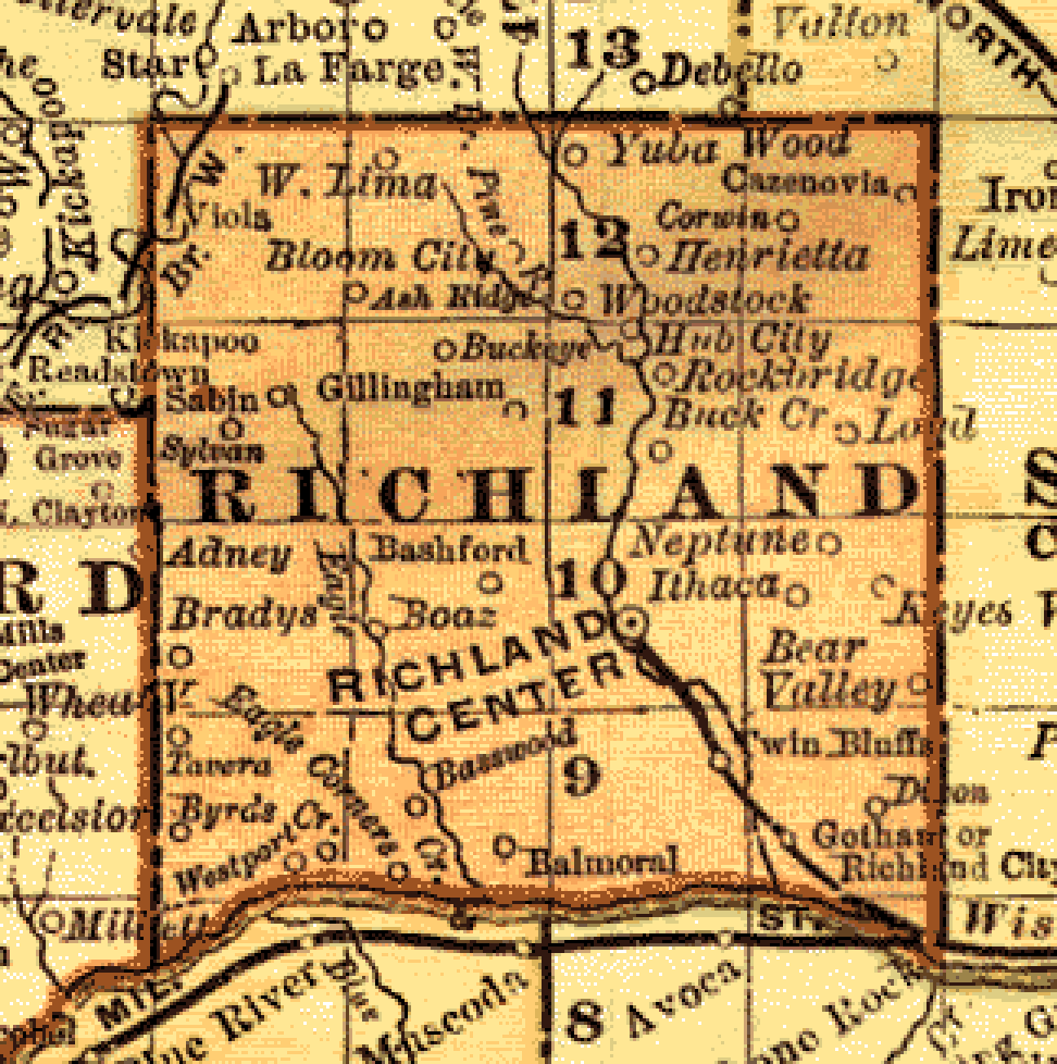
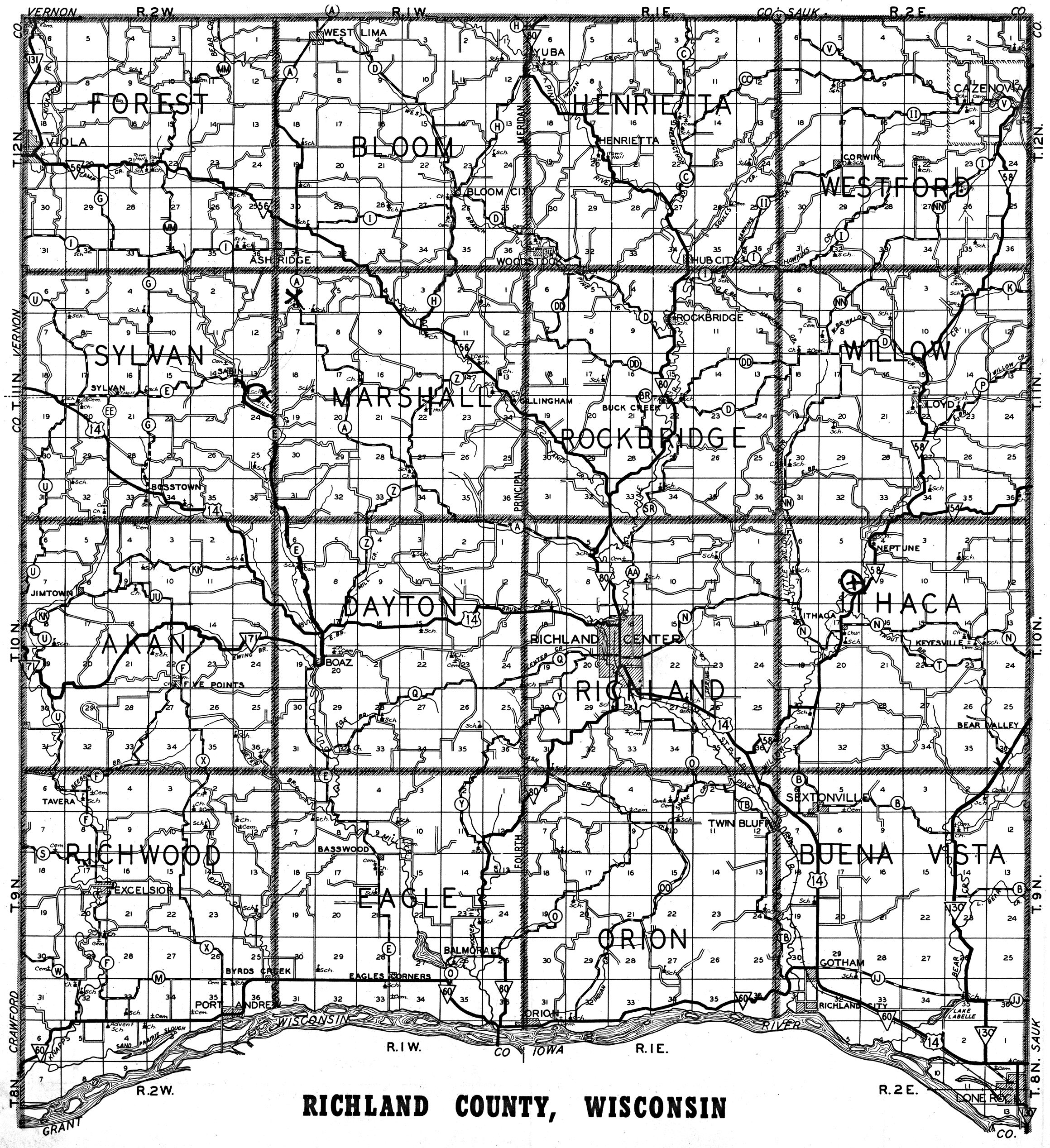
Maps
![]()
![]()
![]()
![]()
![]()
![]()
![]()
| Richland County township changes through the years |
||||||||||||||||
| Richland
County Place Names Map Names of Places in Richland County, compiled by Margaret Scott ca. 1975. Every locality has a name. Not only lakes, streams, cities and villages, but also every ridge, every valley, almost every crossroad, has a name. Once we had 36 Post Offices, many churches, schools, country stores, cheese factories and blacksmith shops scattered throughout the county. The names of these localities are part of our folklore -- yet today, many of these names are almost forgotten. These localities have attempted to be located on this map. Many of these names will not be found on any other map or atlas. The main sources of information were: Soul Survey of Richland County Wisconsin 1959, The Atlas of Wisconsin 1974, The Place Names of Richland County Wisconsin 1973 by Margaret Helen Scott, Town maps supplied by Southwestern Wisconsin Regional Planning commission, and Old newspaper articles -- especially those of Steve Fogo. NOTE: The left side of the label represents the approximate location of the locality, ridge, or the lower end of the valley. |
||||||||||||||||
| View current Richland Center, WI google map with historic buildings marked | ||||||||||||||||
Plats by Year |
||||||||||||||||
| Year | Township | |||||||||||||||
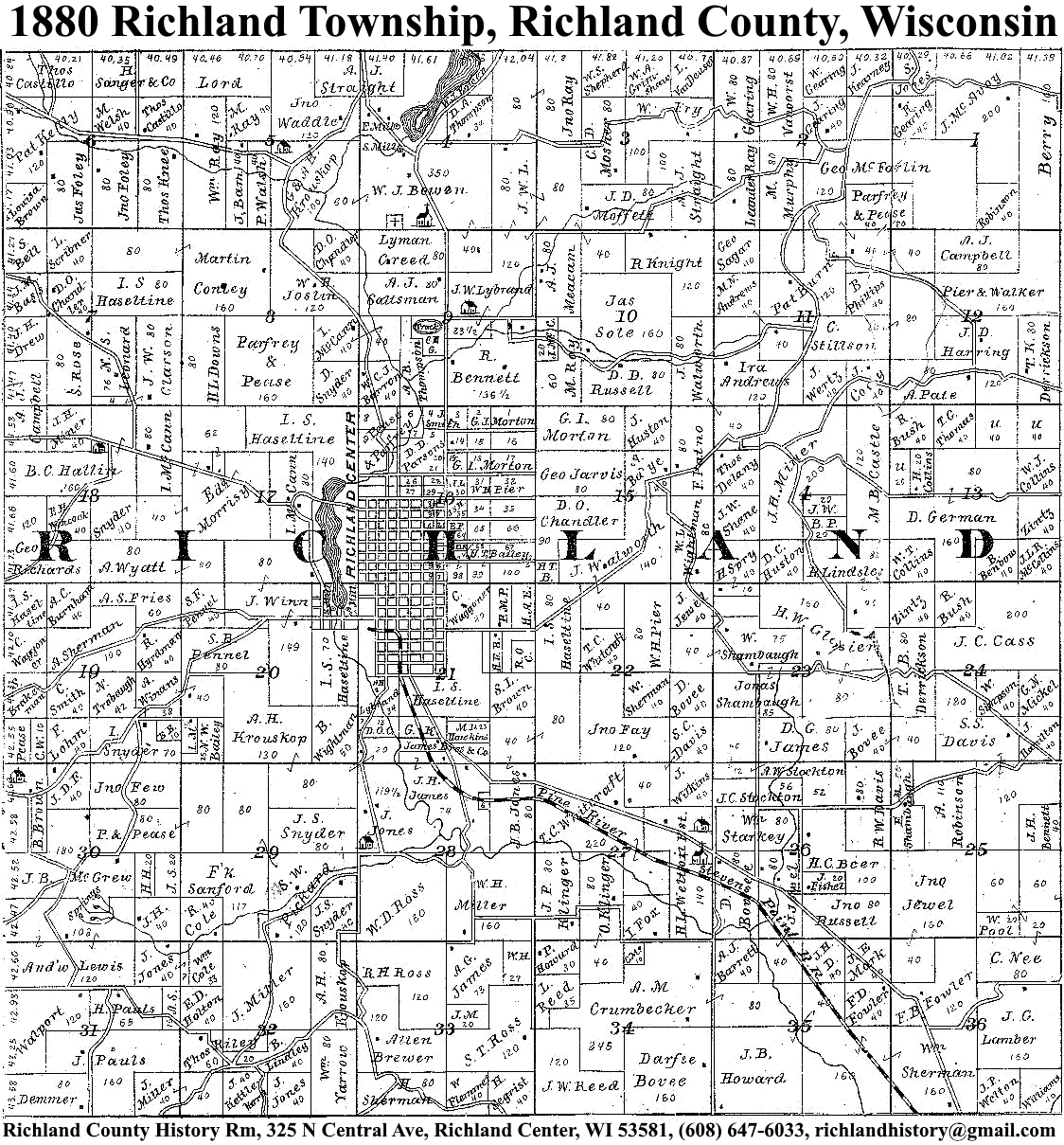
| 1844 | Richland | |||||||||||||||
| 1860 | Eagle | Orion | ||||||||||||||
| 1866 | Forest | |||||||||||||||
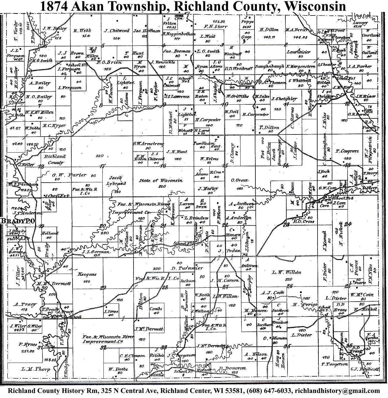
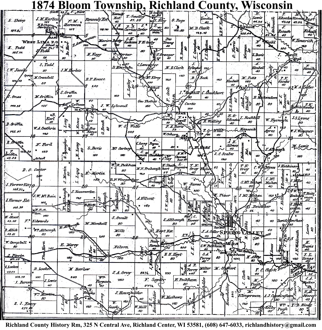
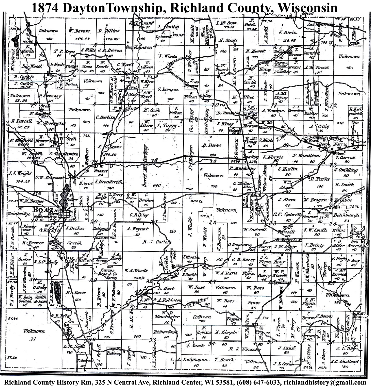
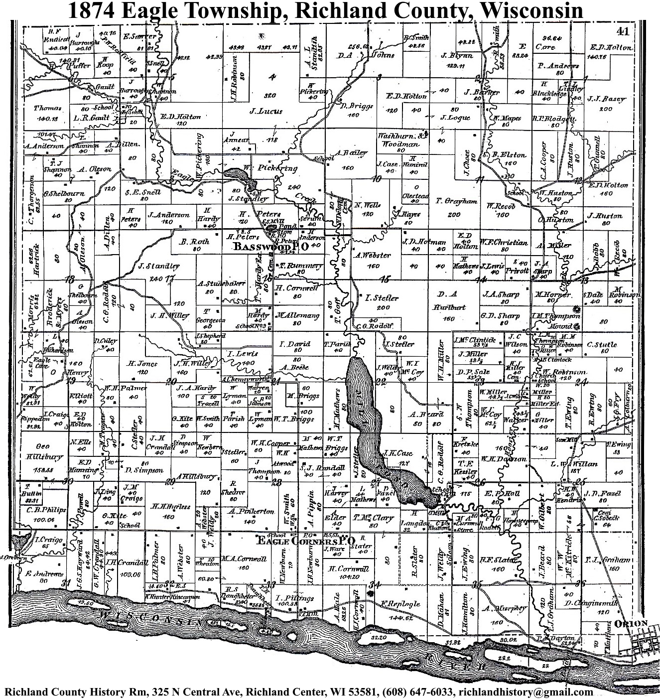
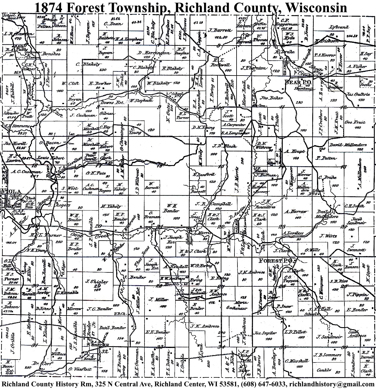
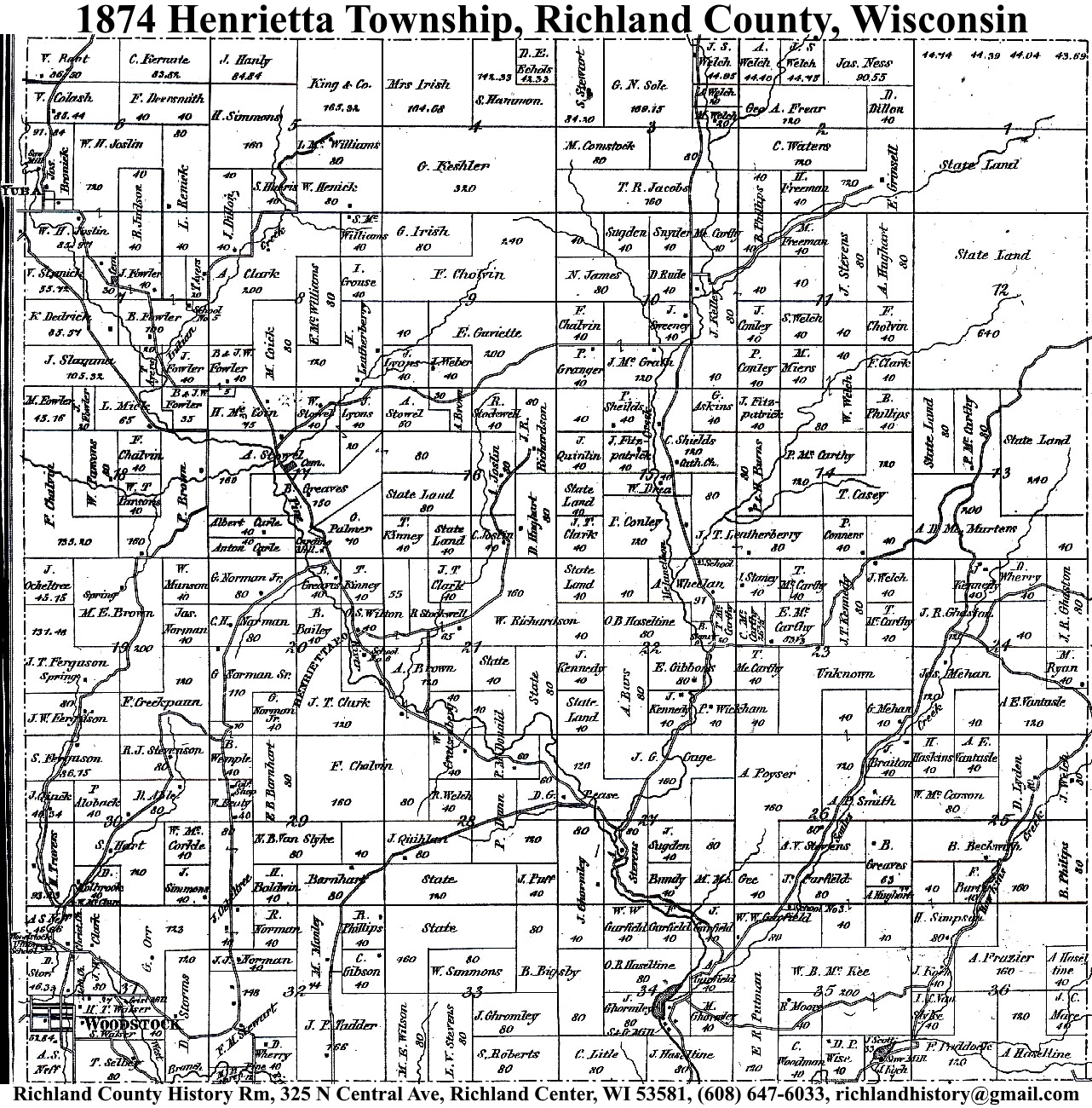
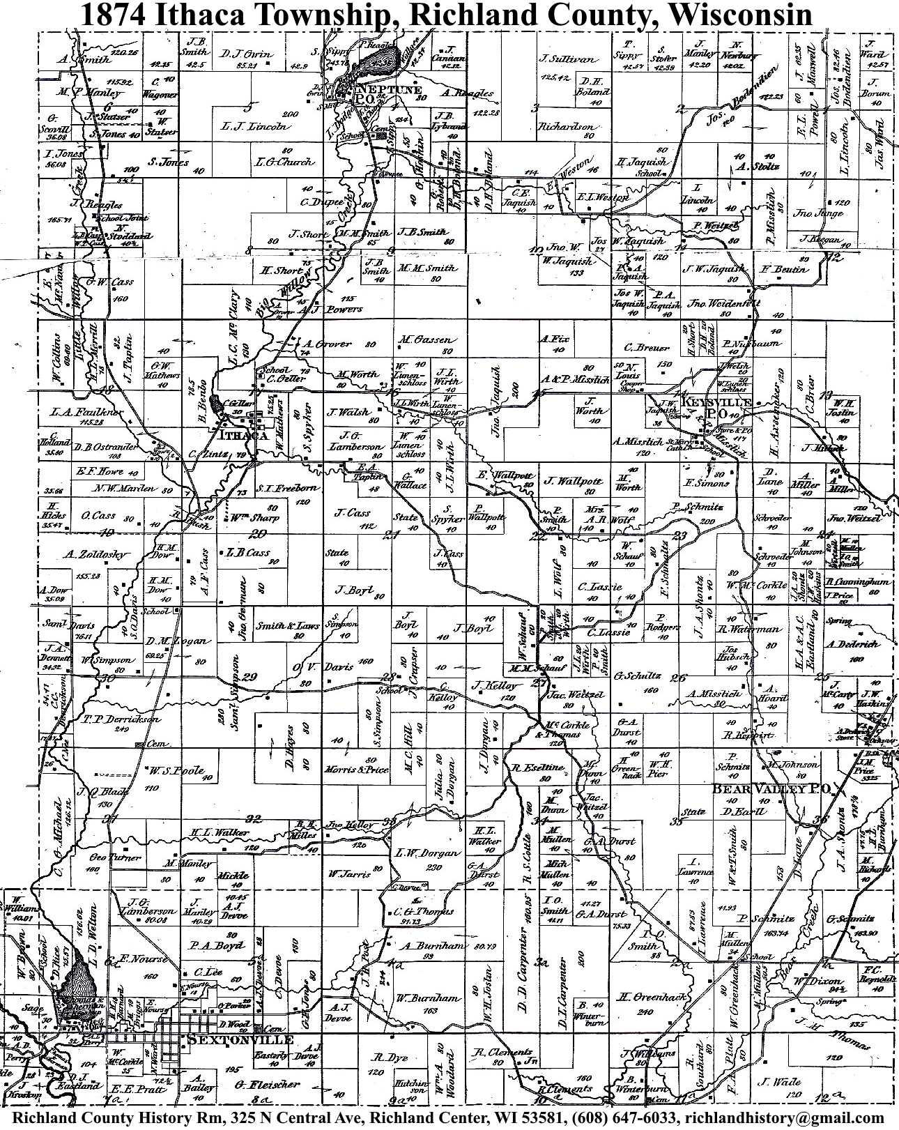
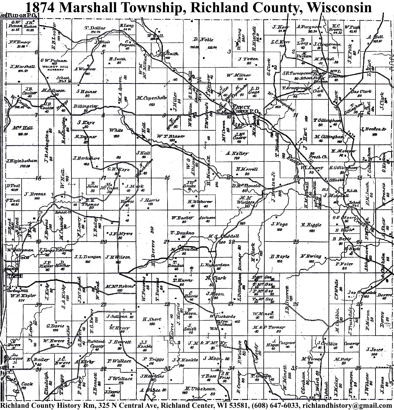
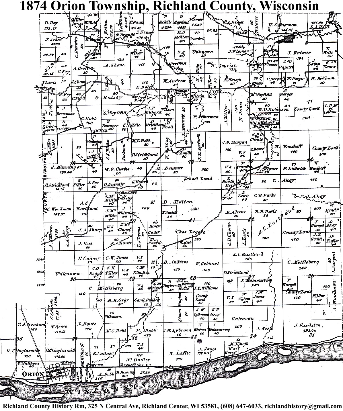
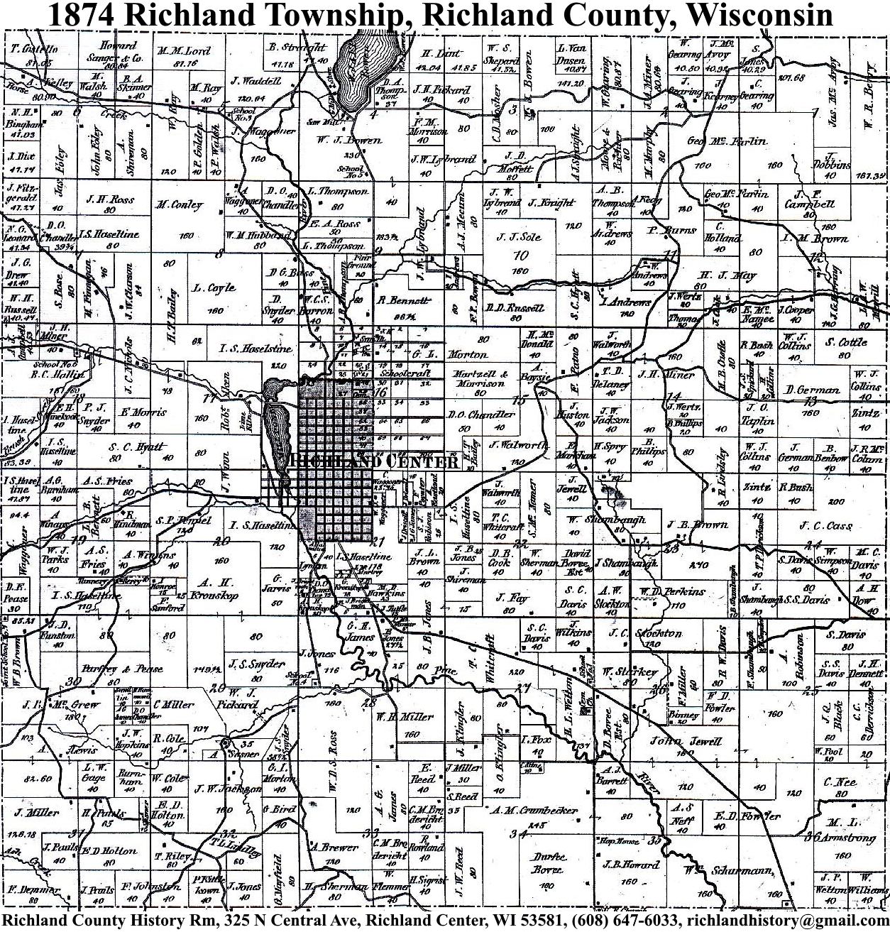
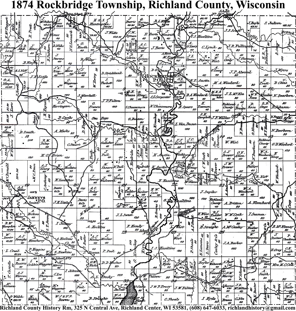
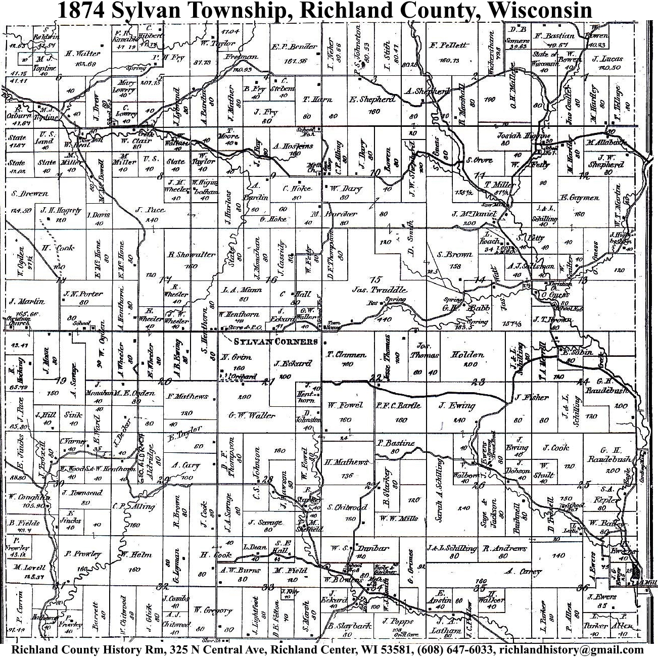
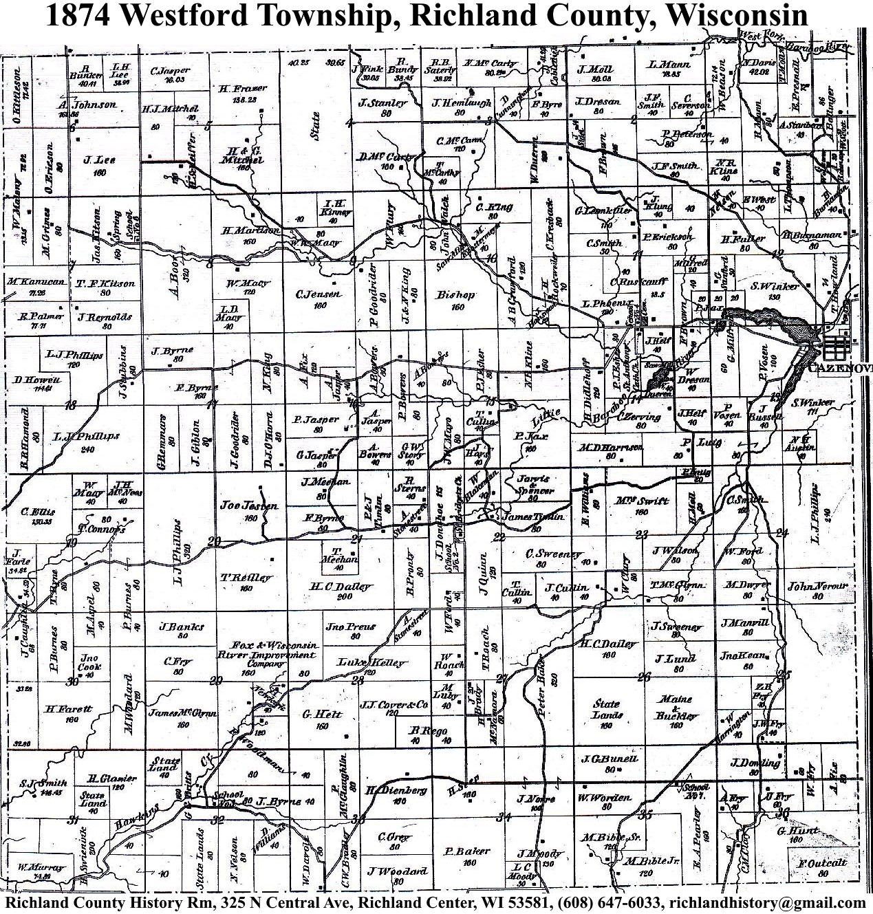
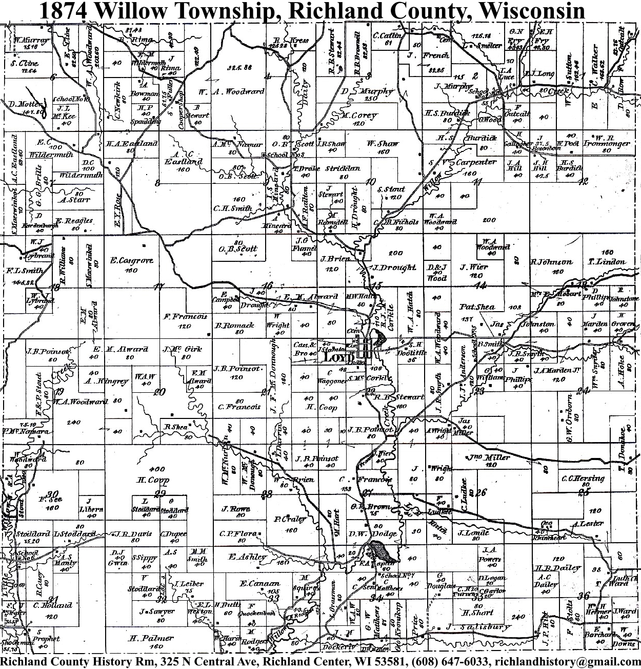
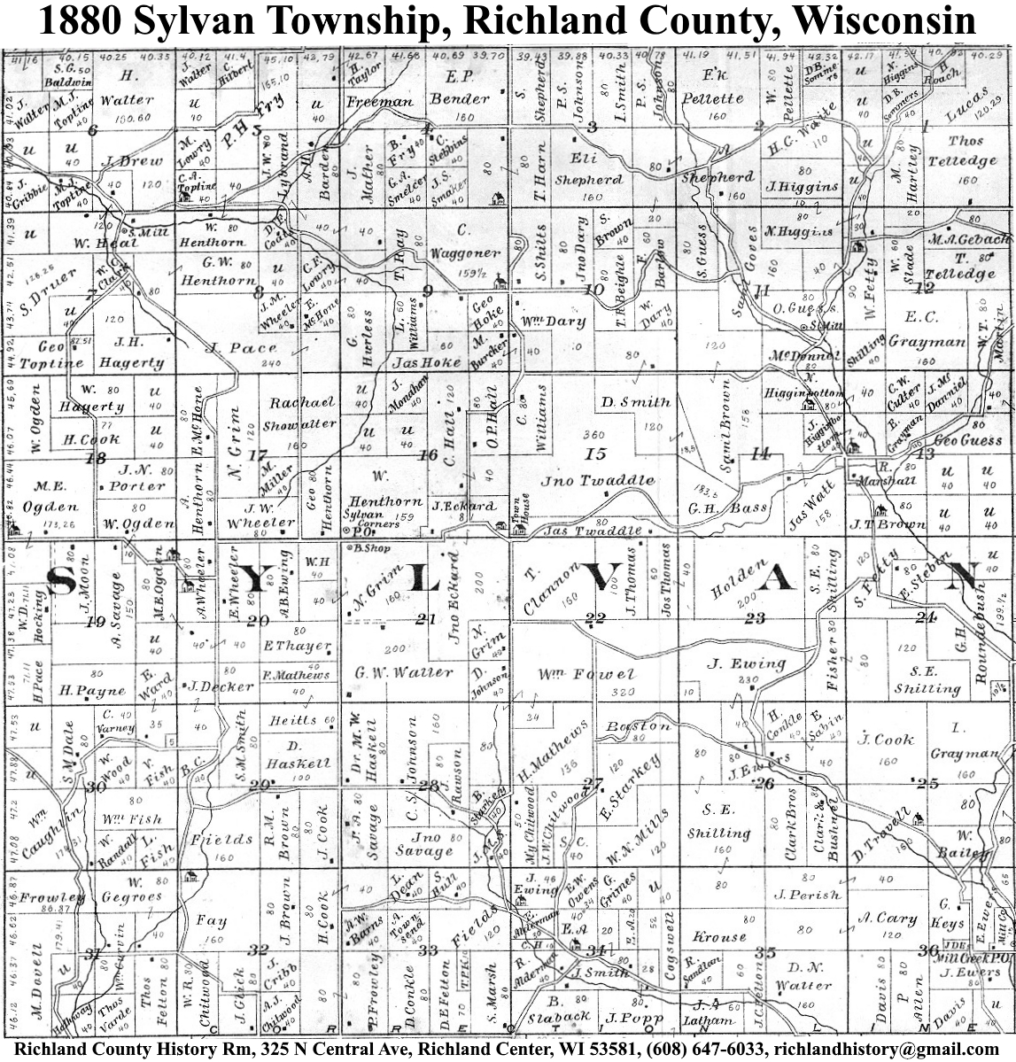
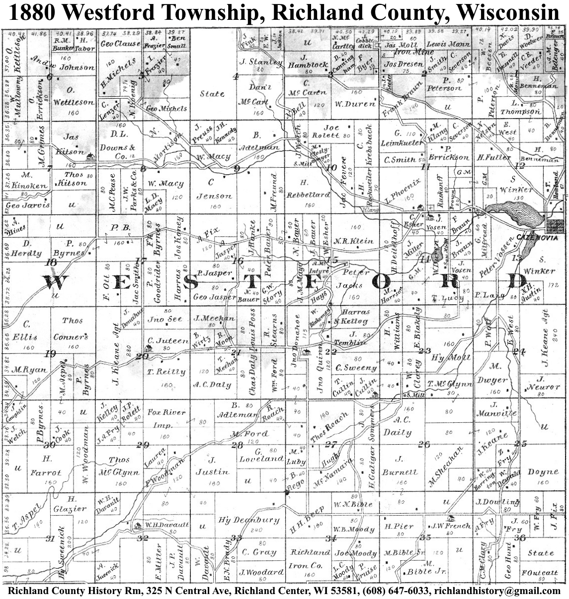
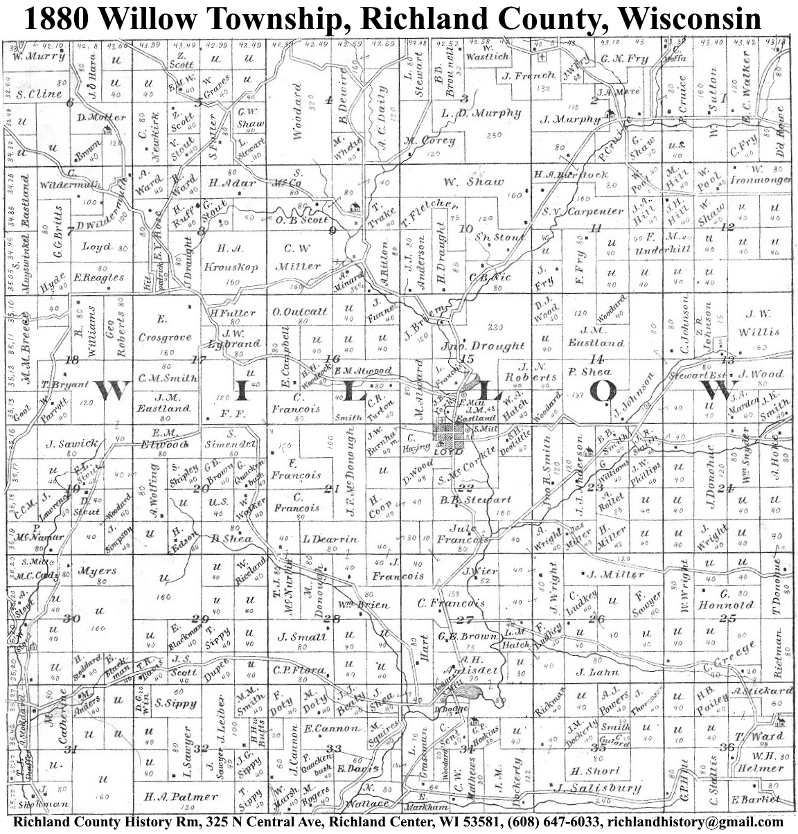
| 1874 | Akan | Bloom | Buena Vista | Dayton | Eagle | Forest | Henrietta | Ithaca | Marshall | Orion | Richland | Richwood | Rockbridge | Sylvan | Westford | Willow |
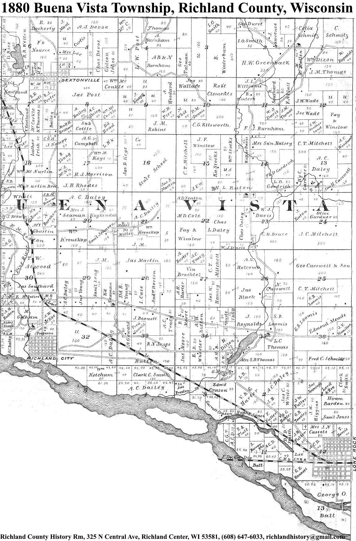
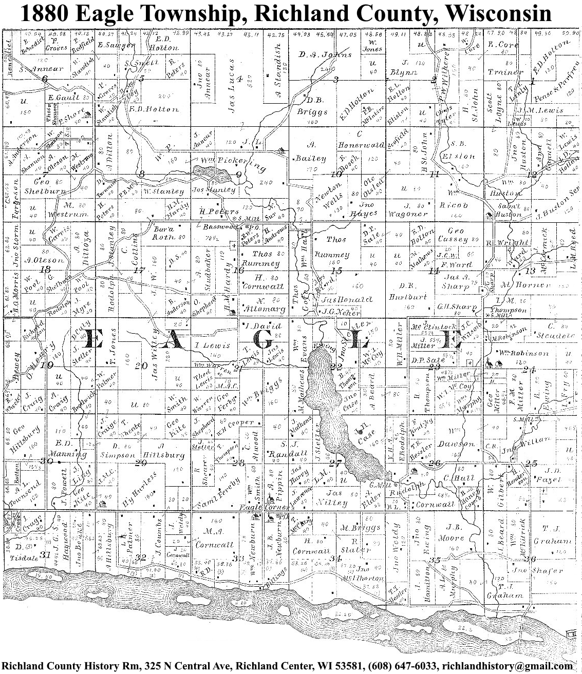
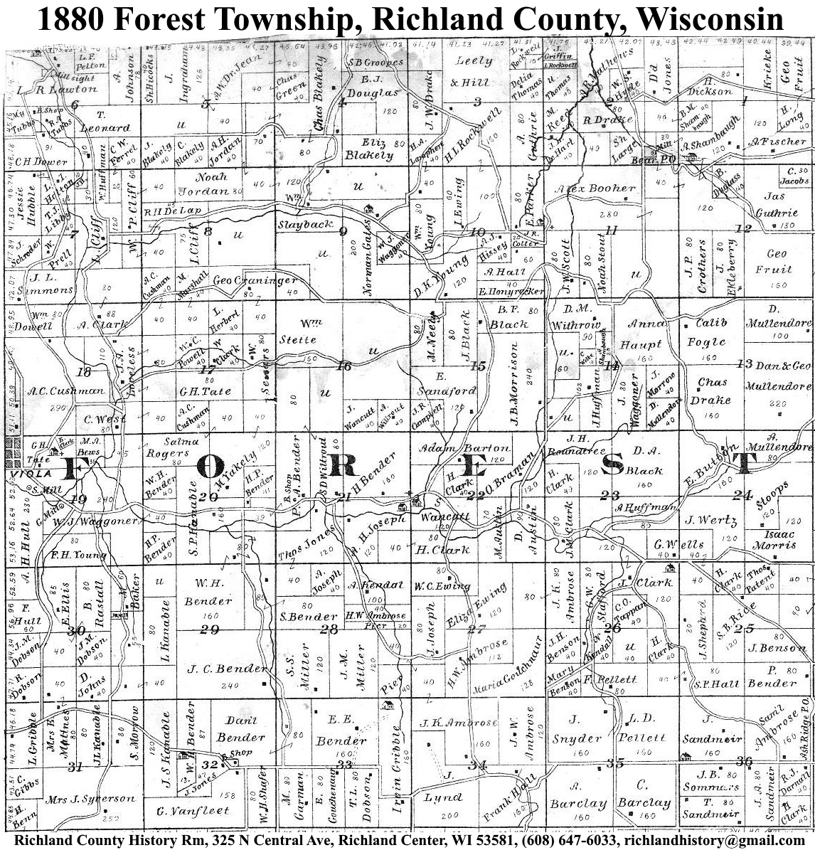
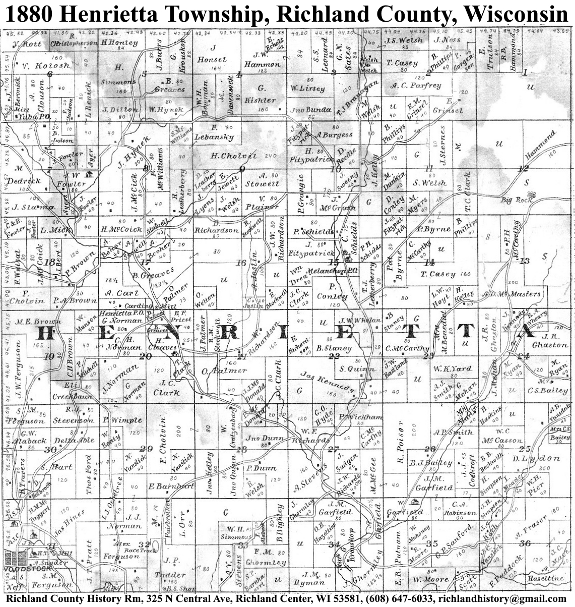
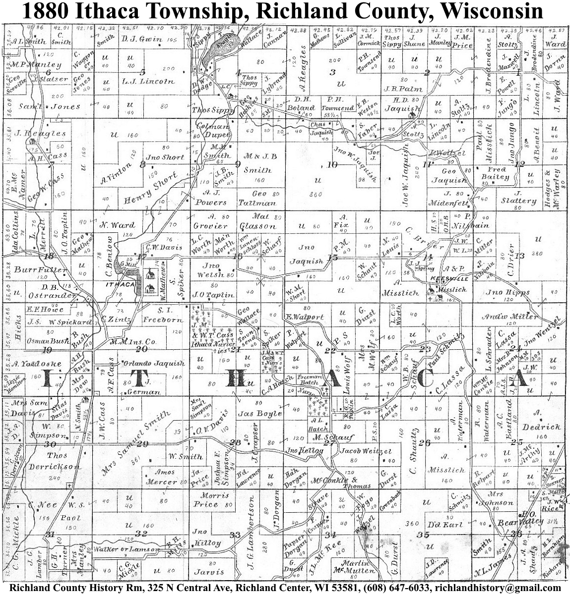
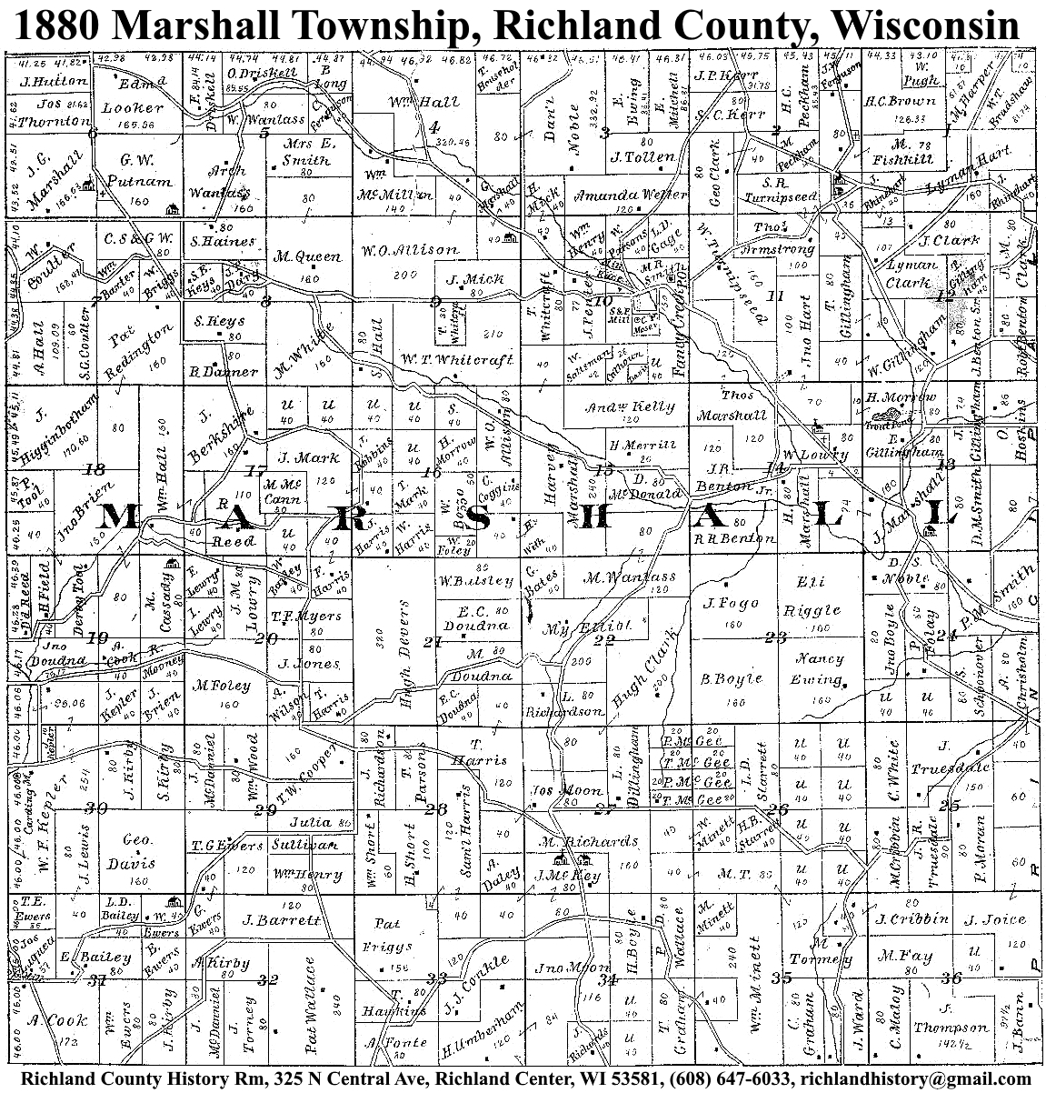
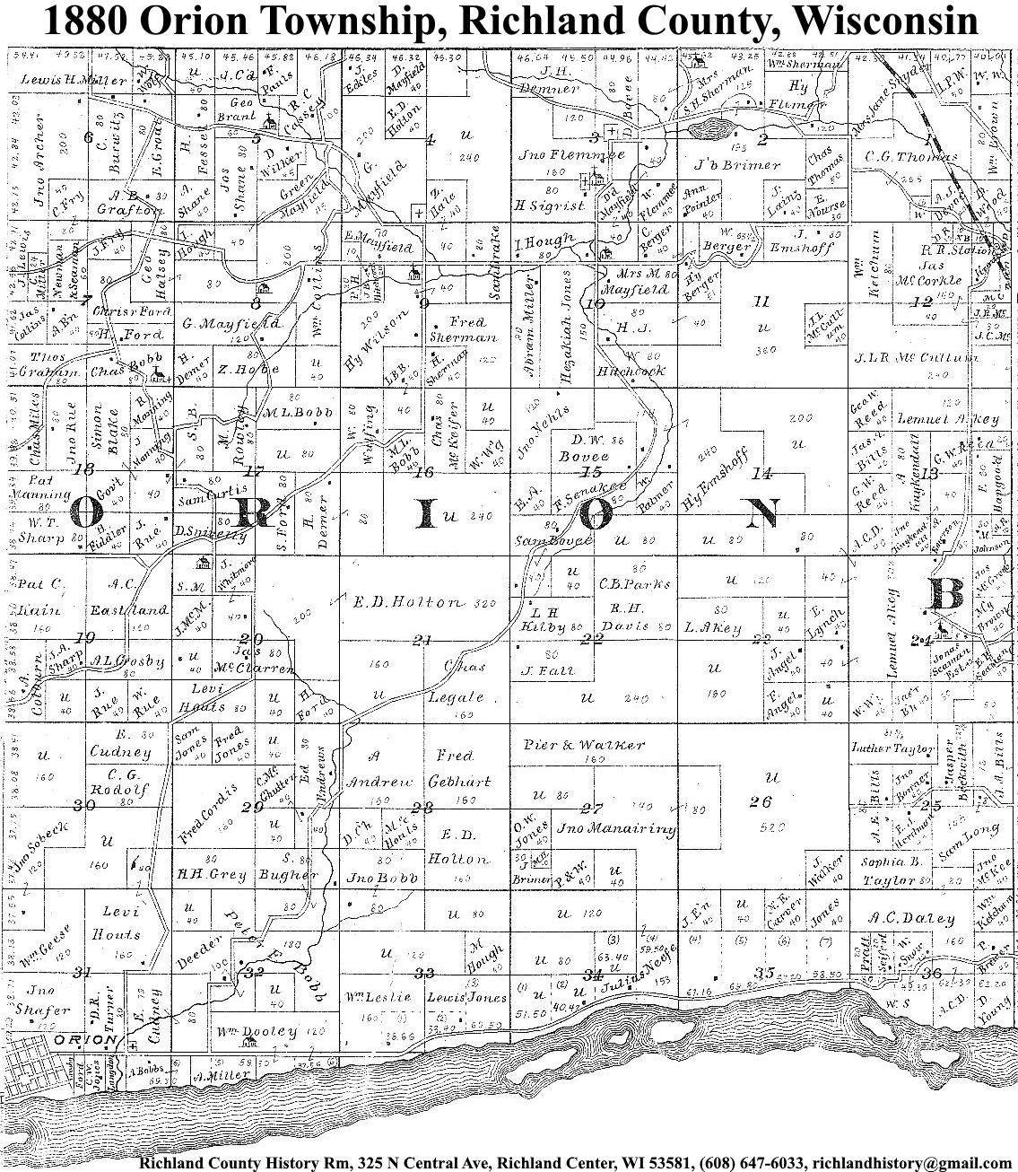
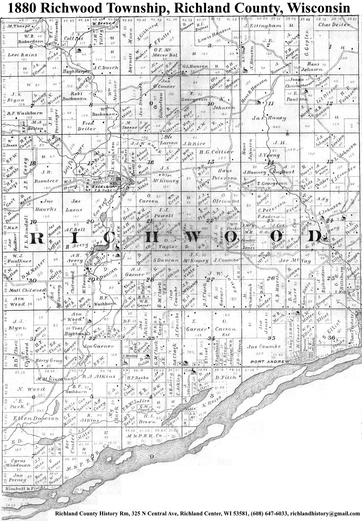
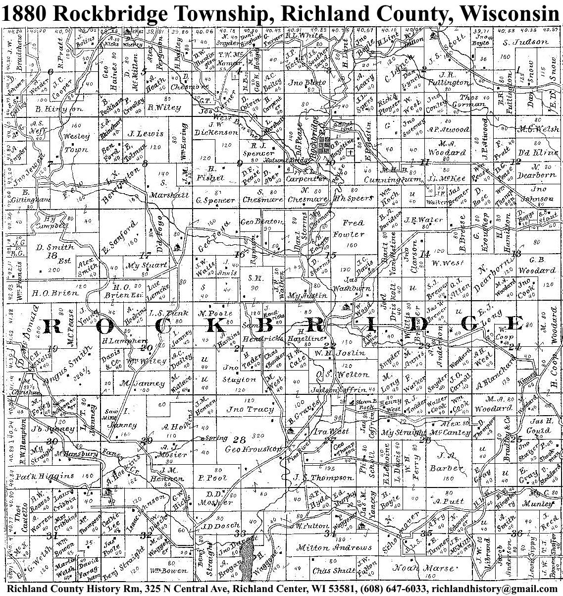
| 1880 | Akan | Bloom | Buena Vista | Dayton | Eagle | Forest | Henrietta | Ithaca | Marshall | Orion | Richland | Richwood | Rockbridge | Sylvan | Westford | Willow |
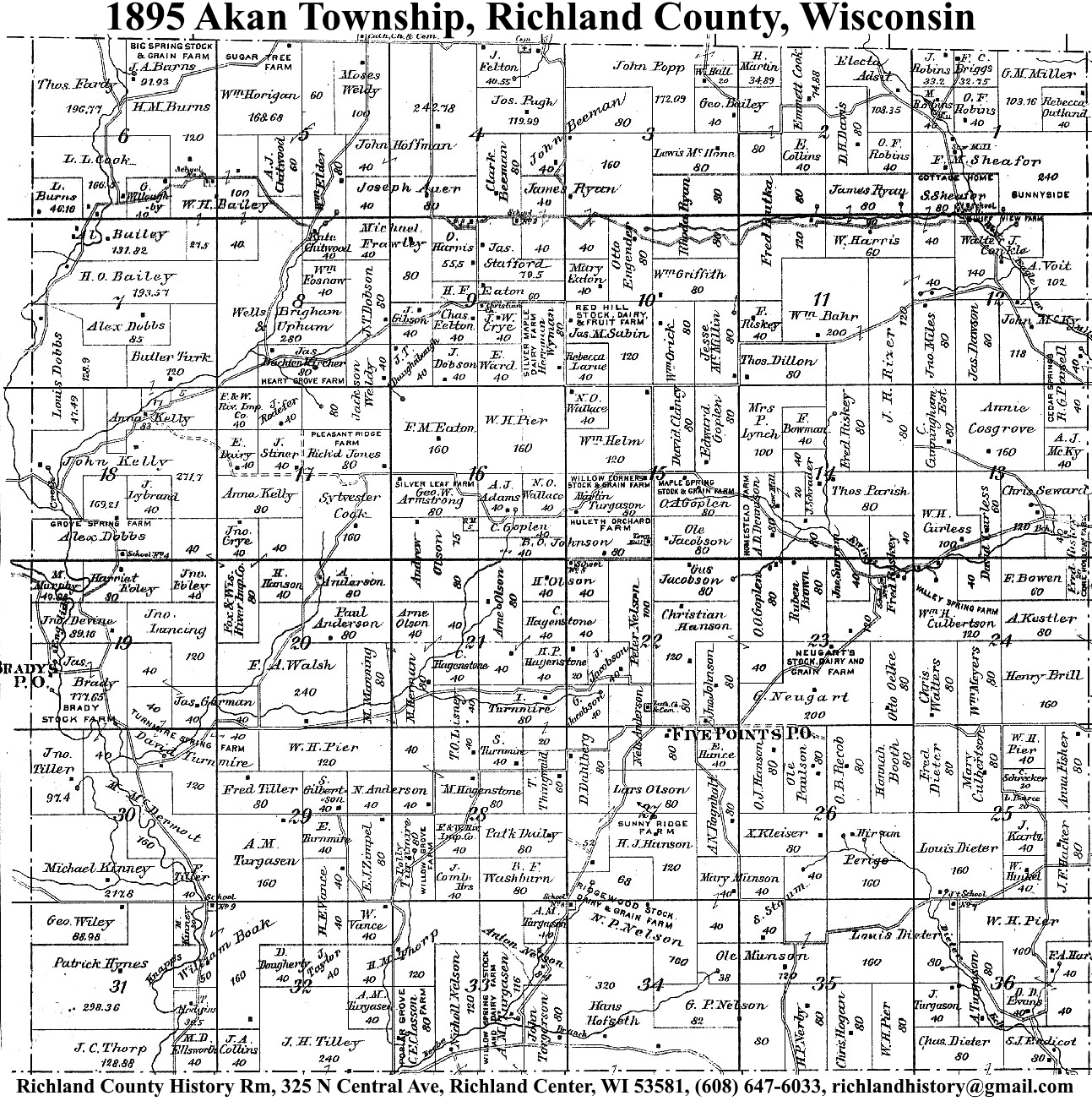
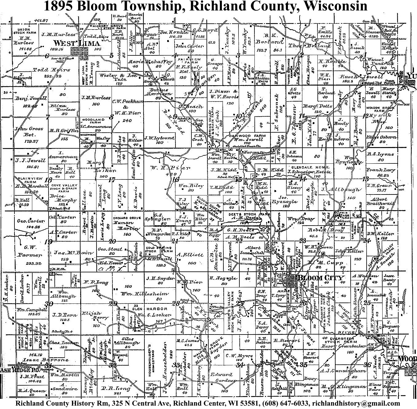
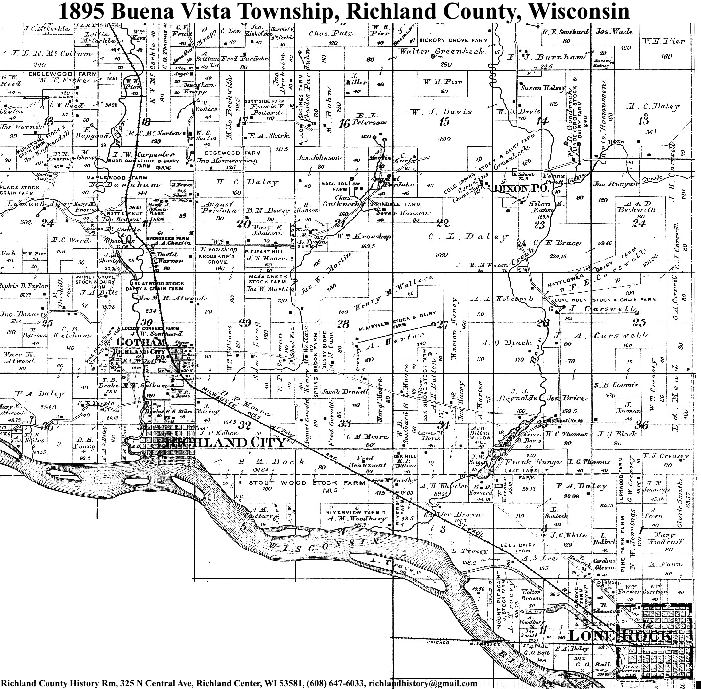
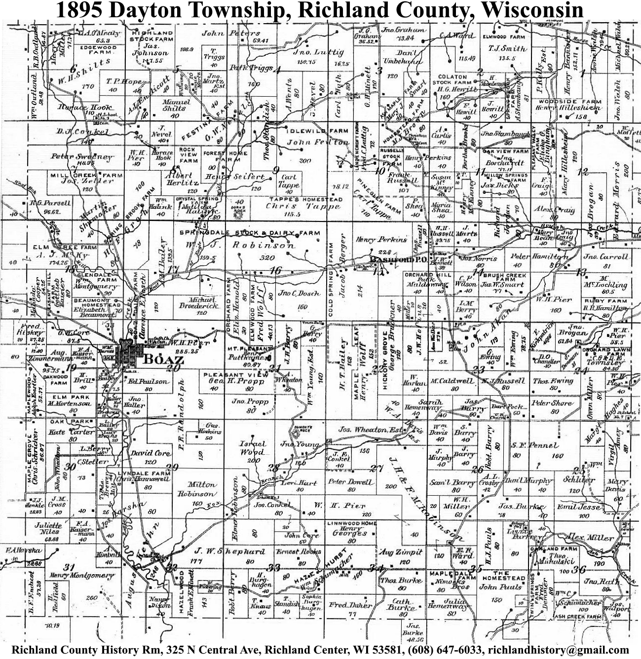
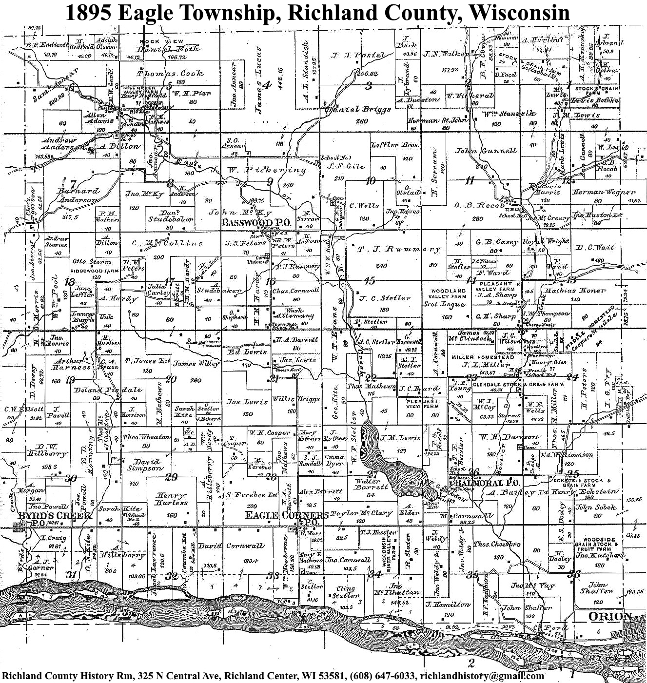
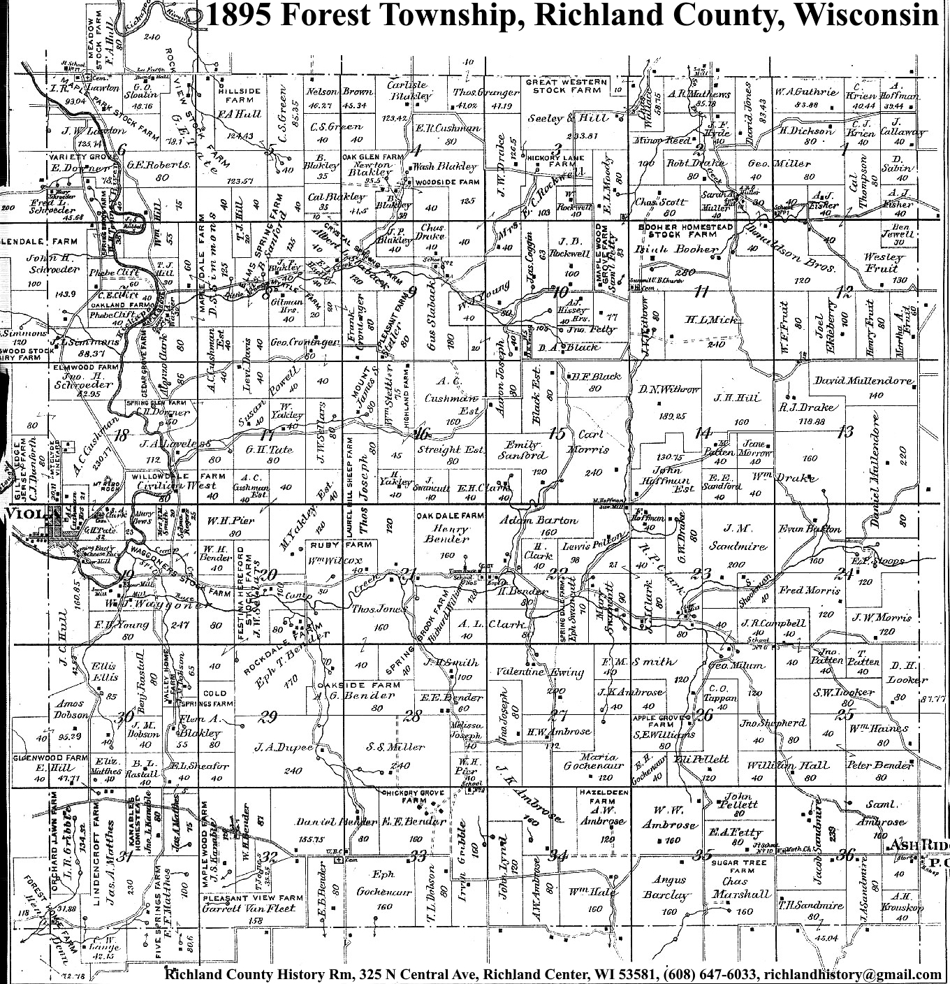
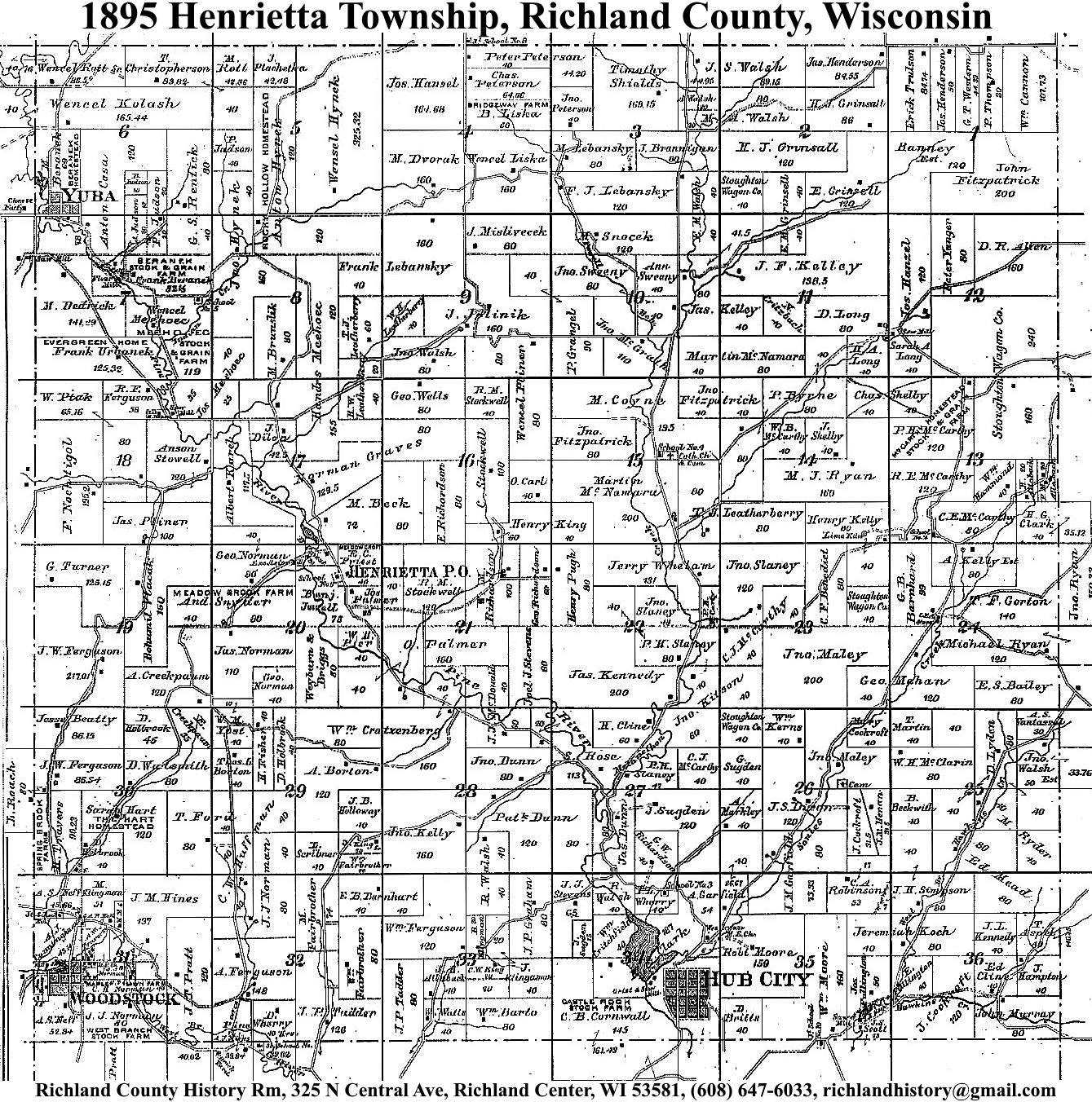
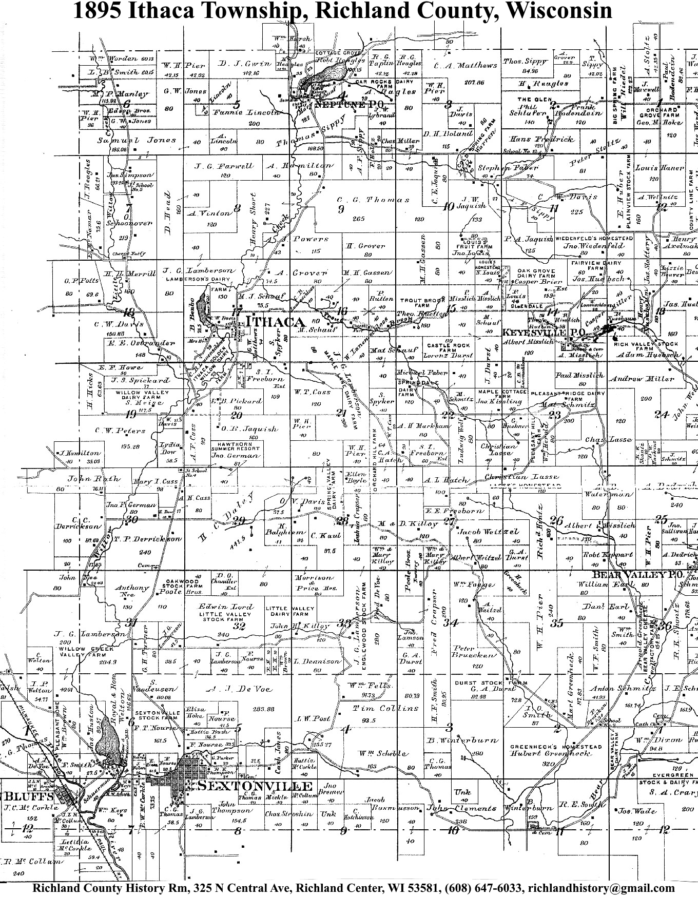
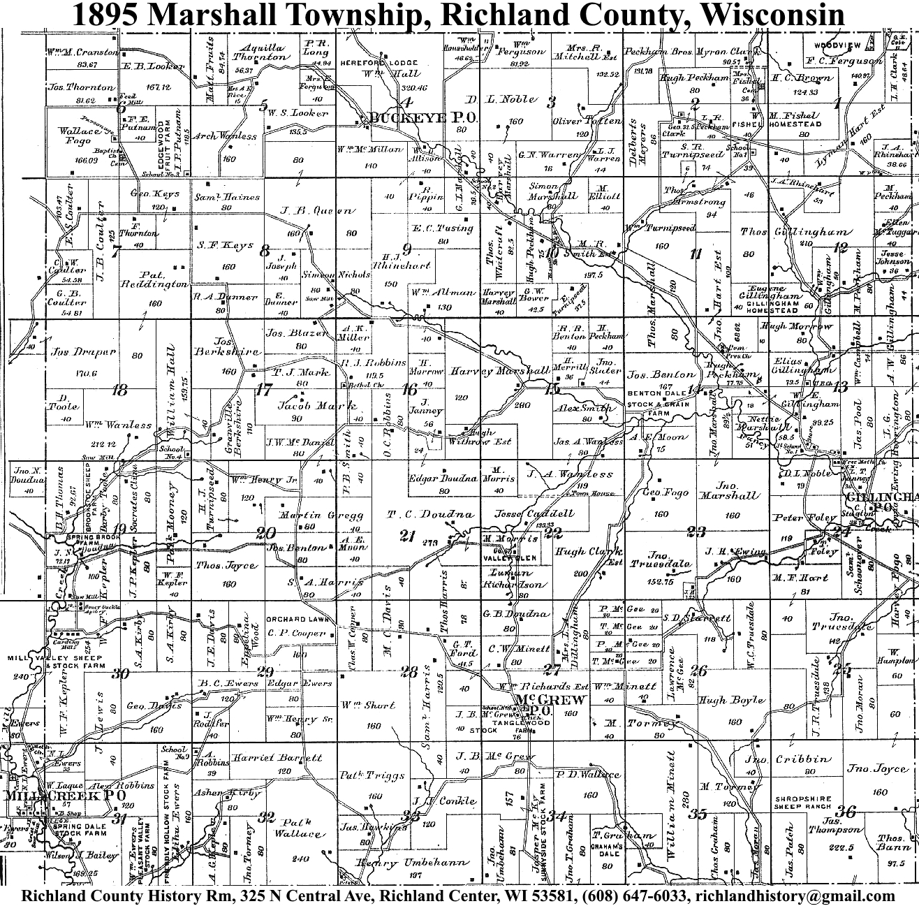
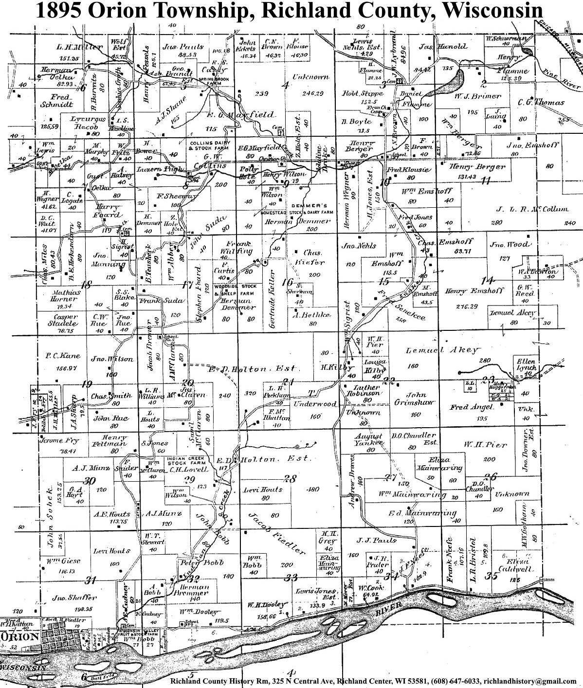
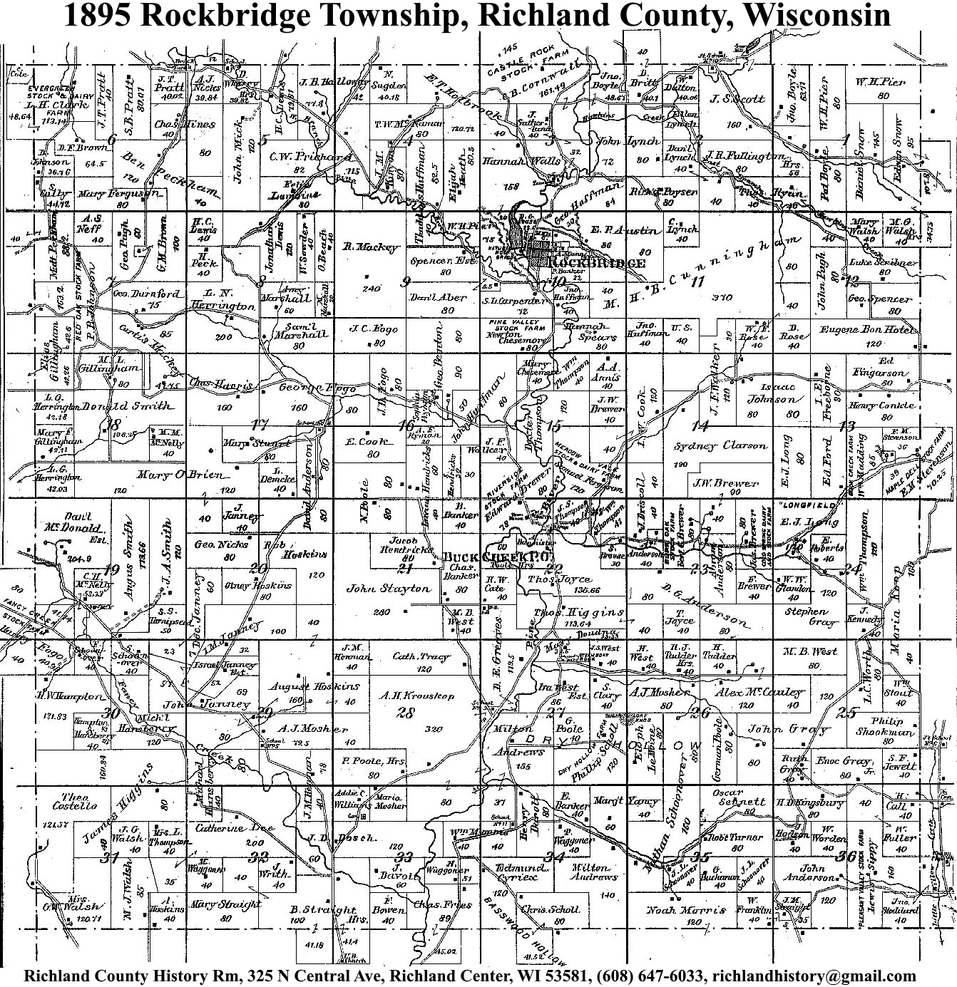
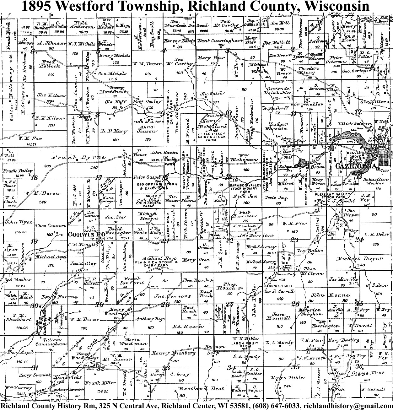
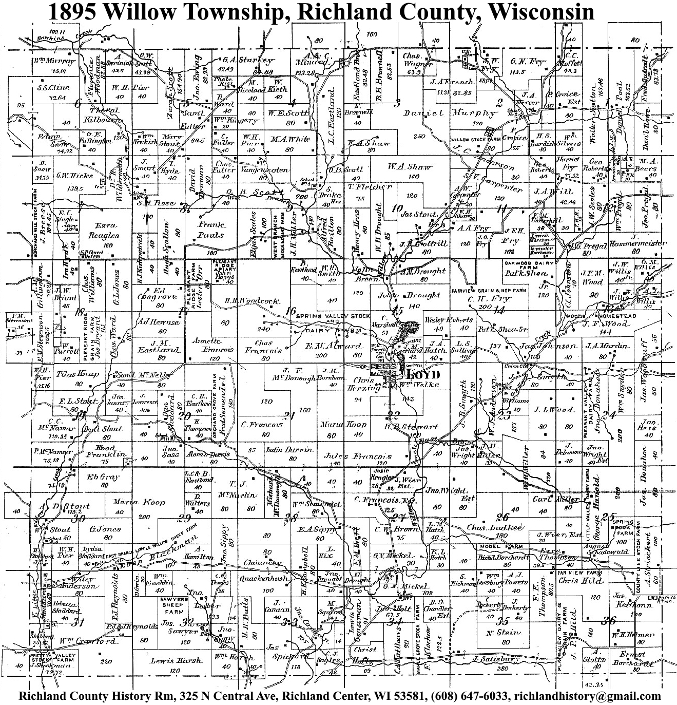
| 1895 | Akan | Bloom | Buena Vista | Dayton | Eagle | Forest | Henrietta | Ithaca | Marshall | Orion | Richland | Richwood | Rockbridge | Sylvan | Westford | Willow |
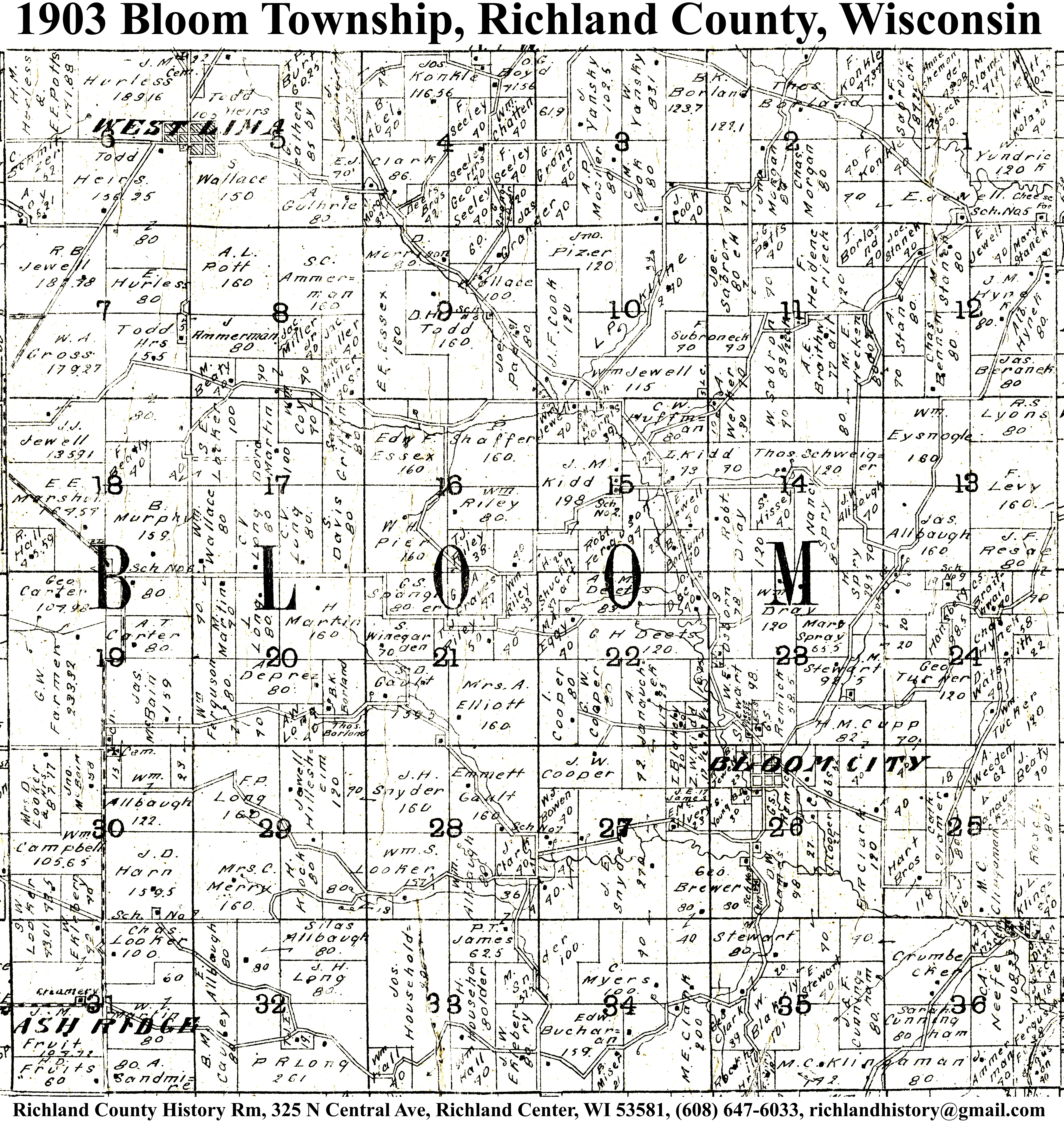
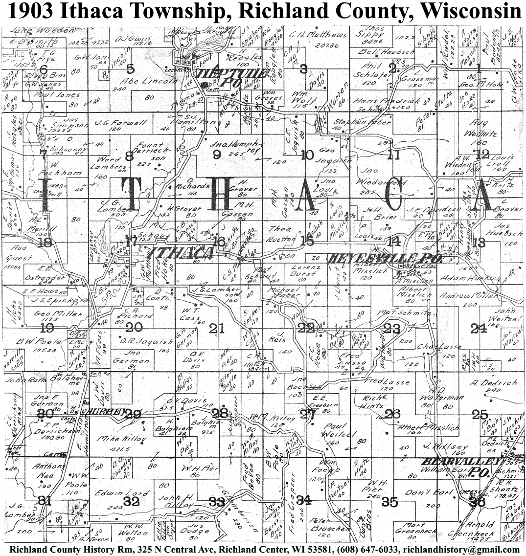
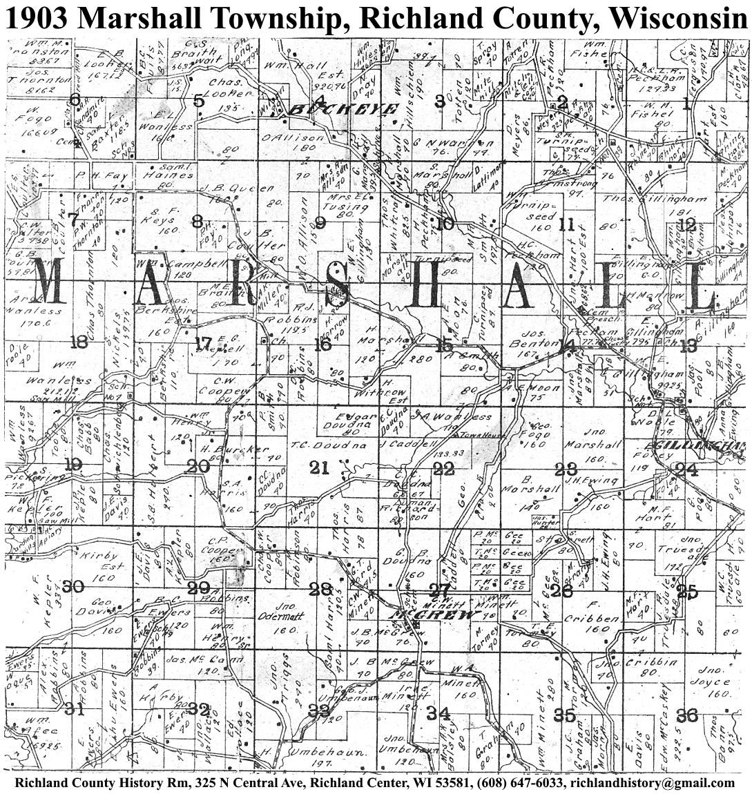
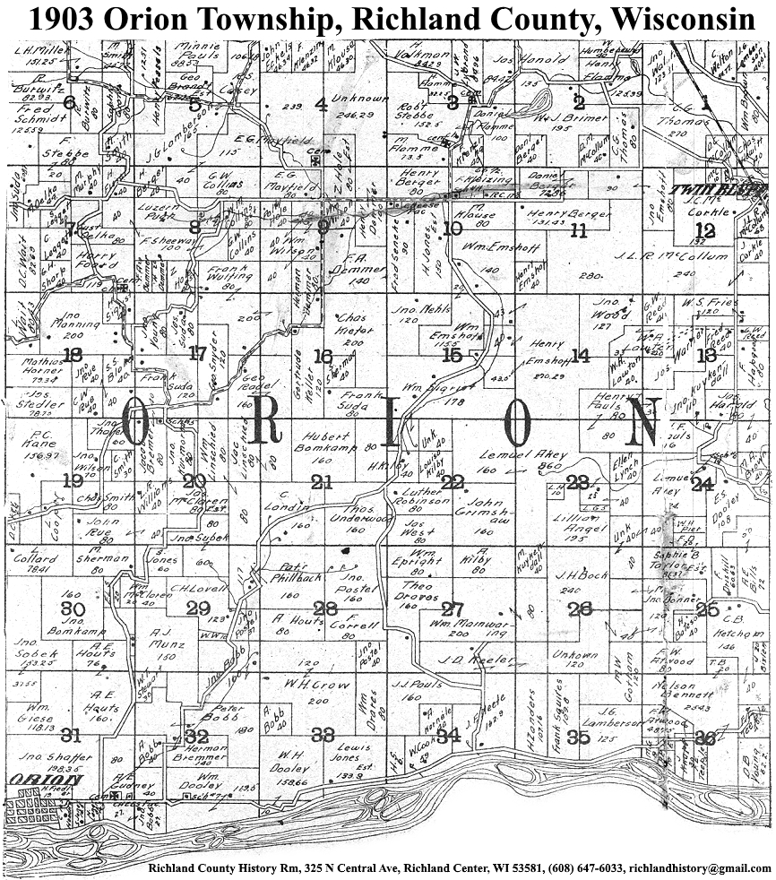
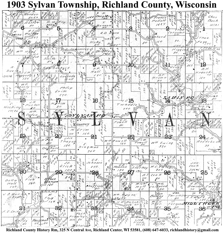
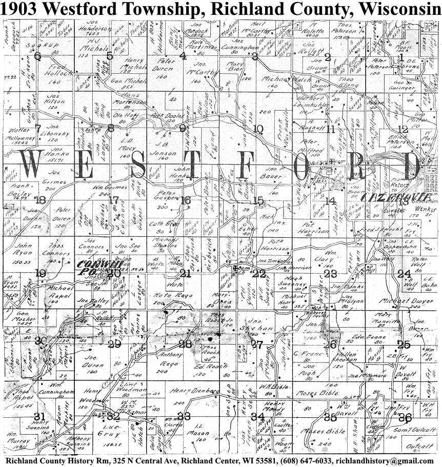
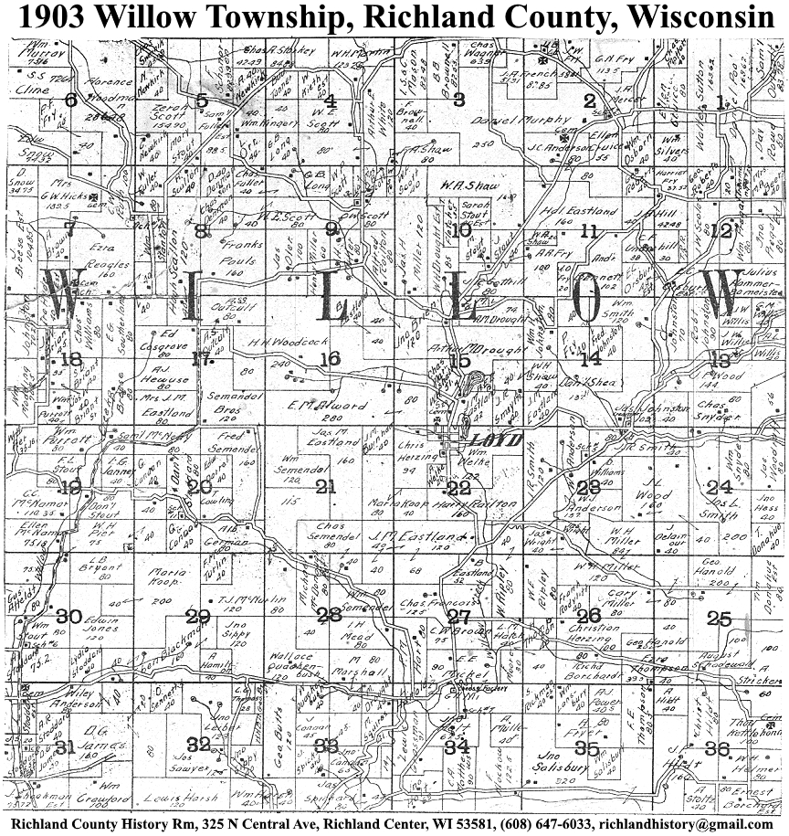
| 1903 | Akan | Bloom | Buena Vista | Dayton | Eagle | Forest | Henrietta | Ithaca | Marshall | Orion | Richland | Richwood | Rockbridge | Sylvan | Westford | Willow |
| 1913 | Akan | Bloom | Buena Vista | Dayton | Eagle | Forest | Henrietta | Ithaca | Marshall | Orion | Richland | Richwood | Rockbridge | Sylvan | Westford | Willow |
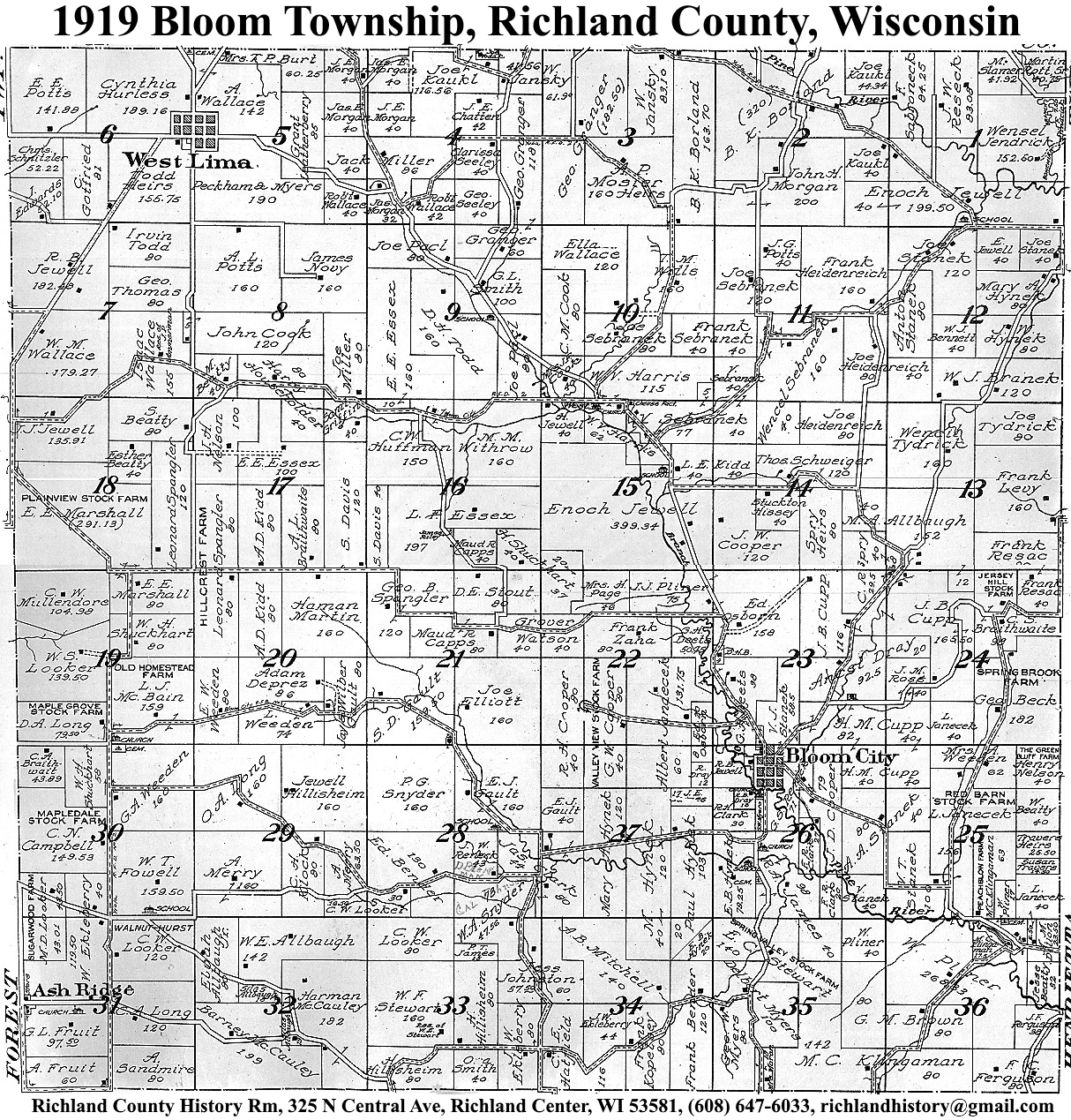
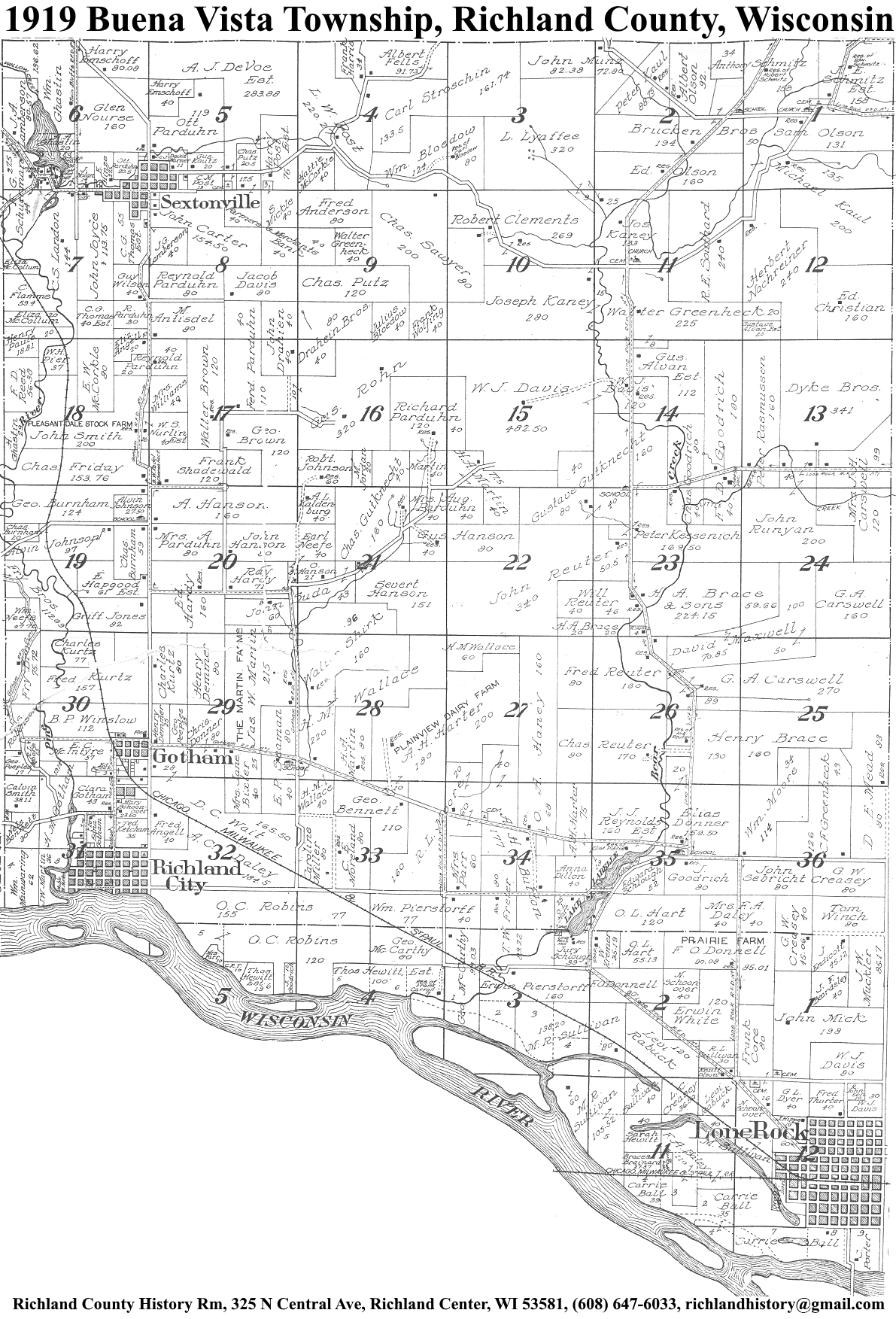
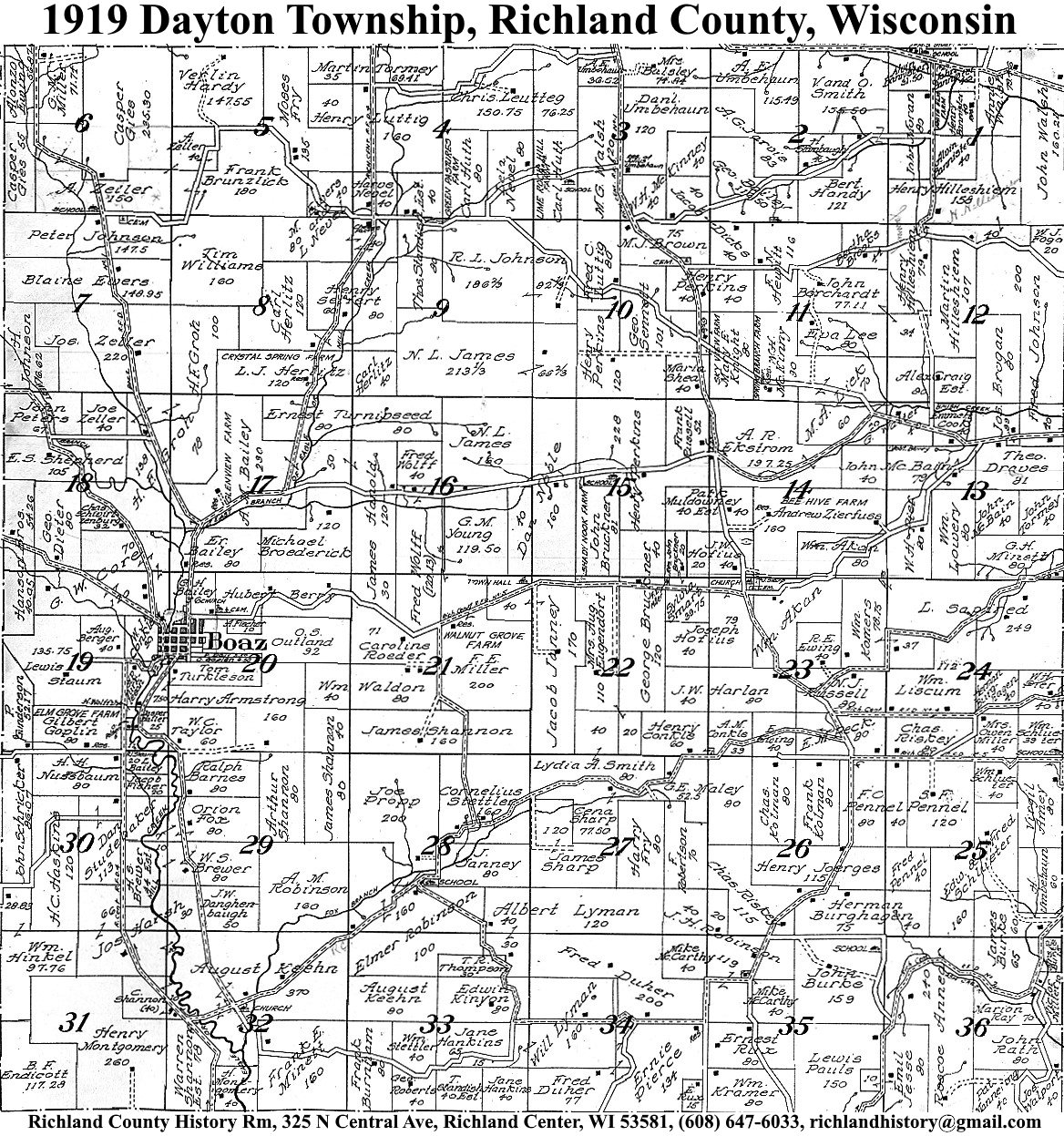
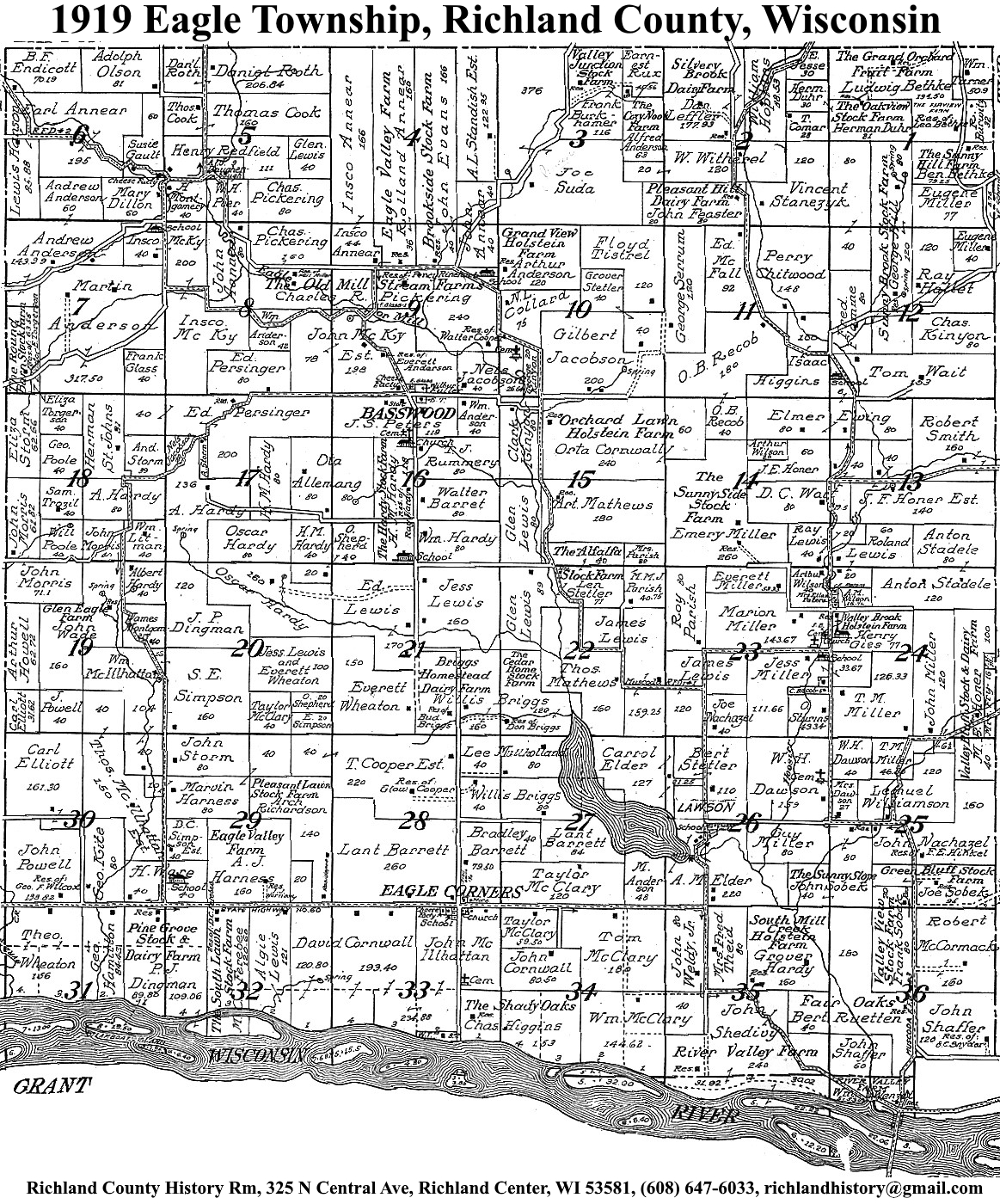
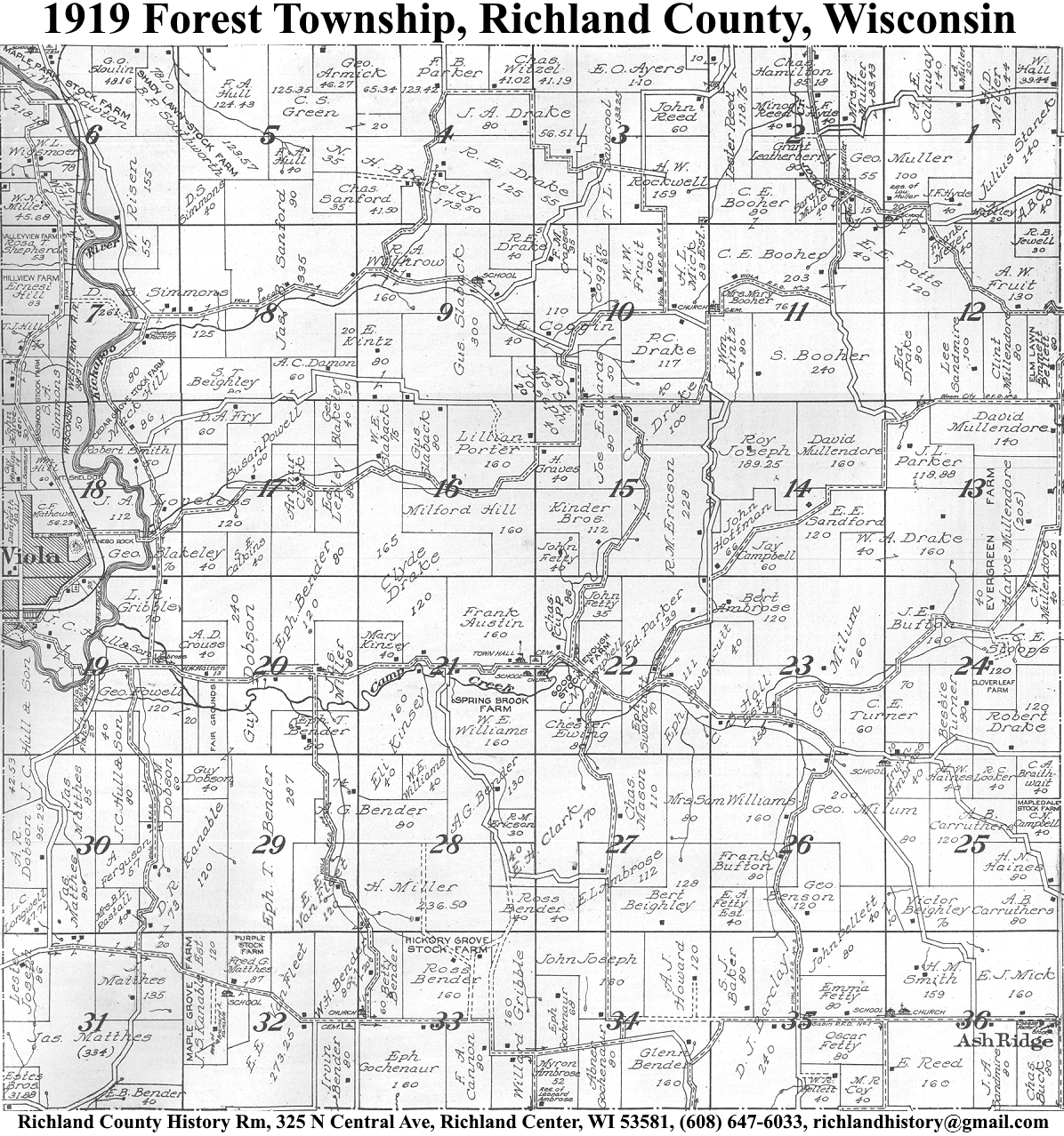
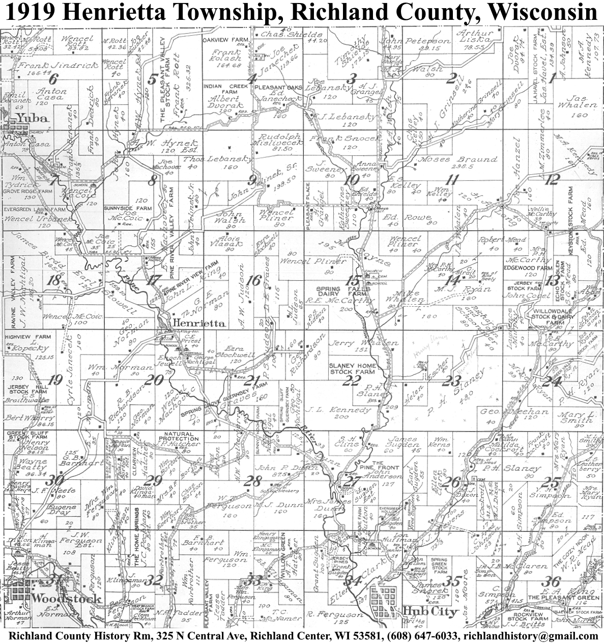
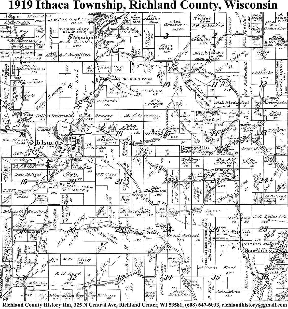
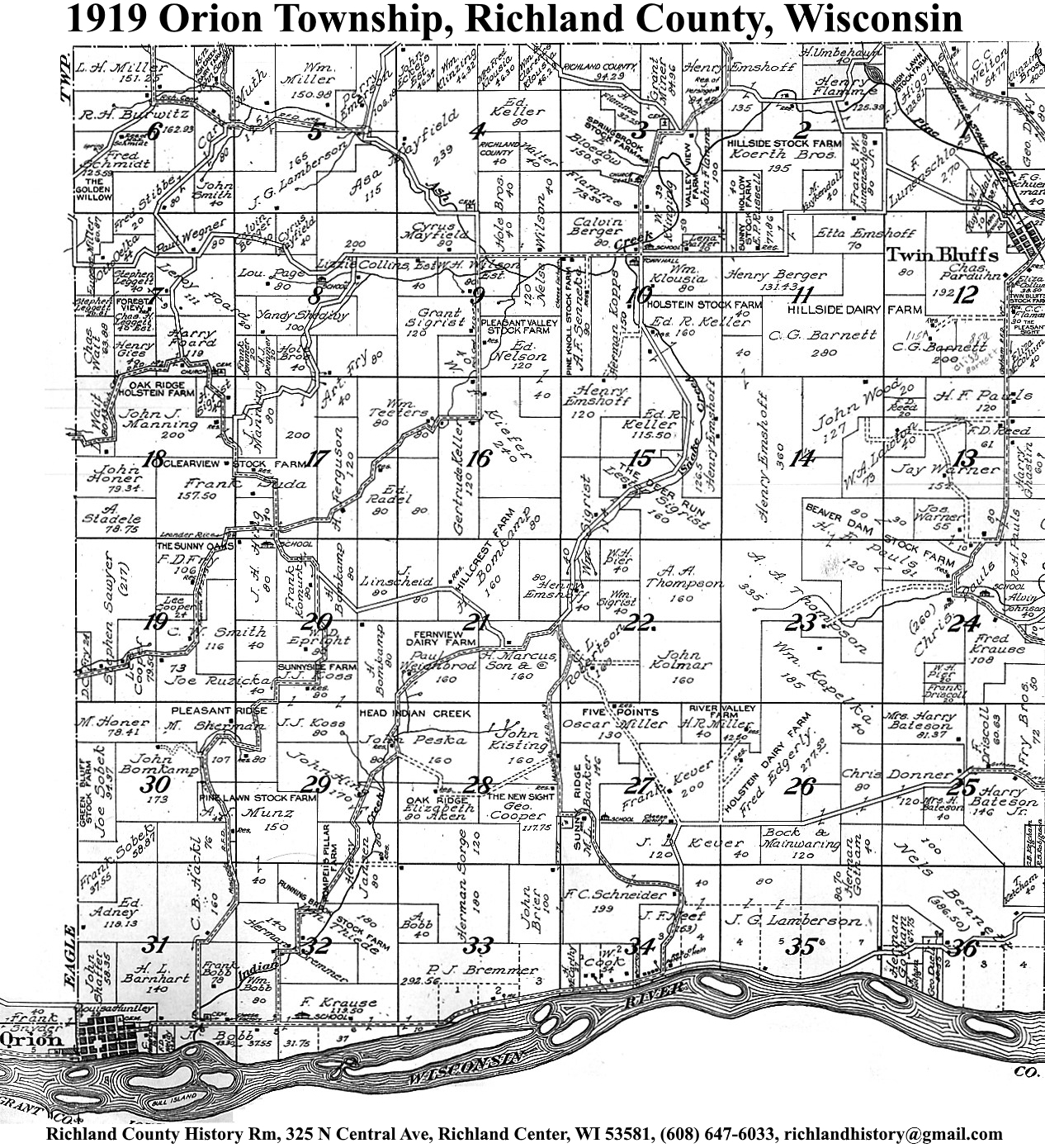
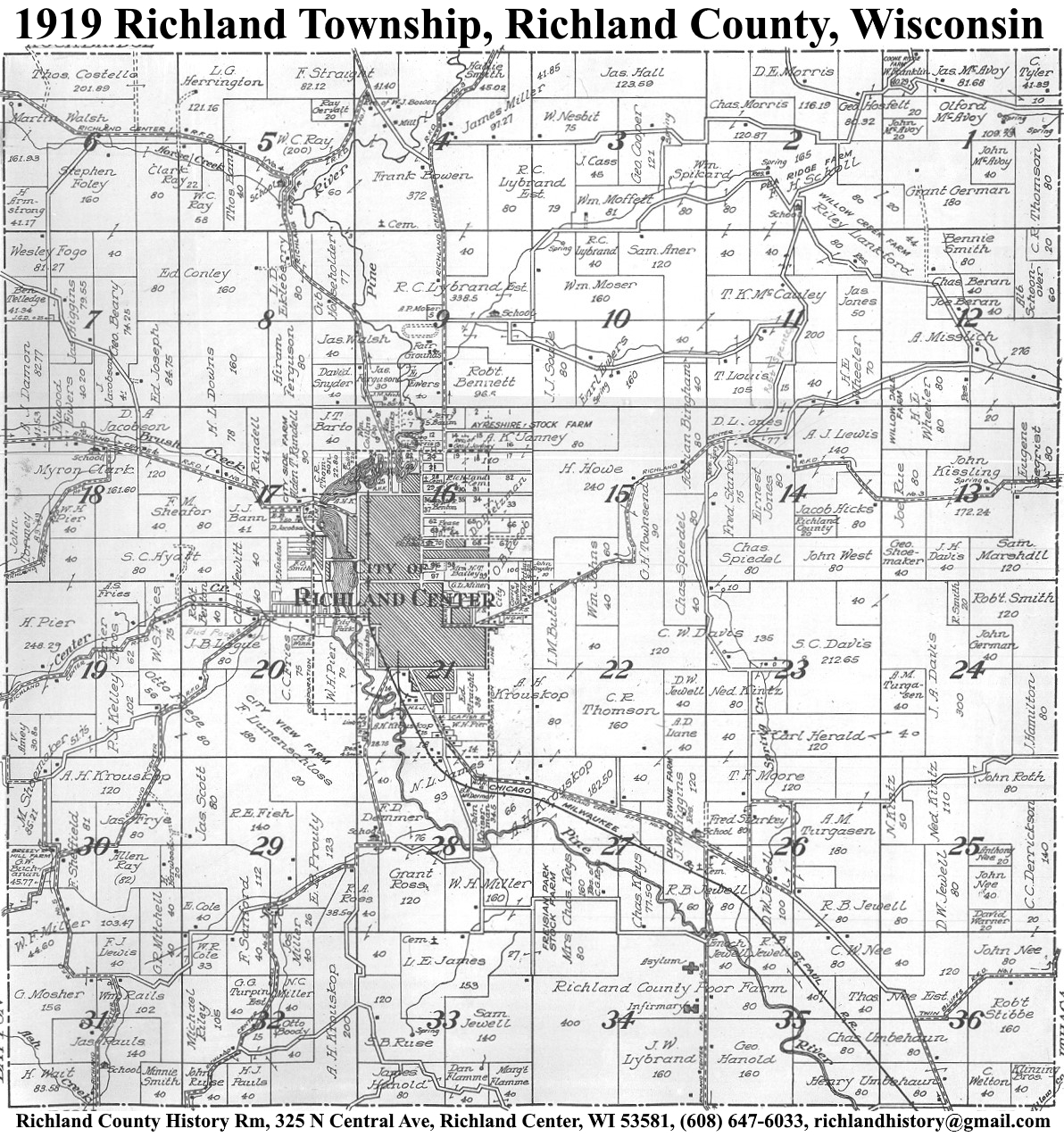
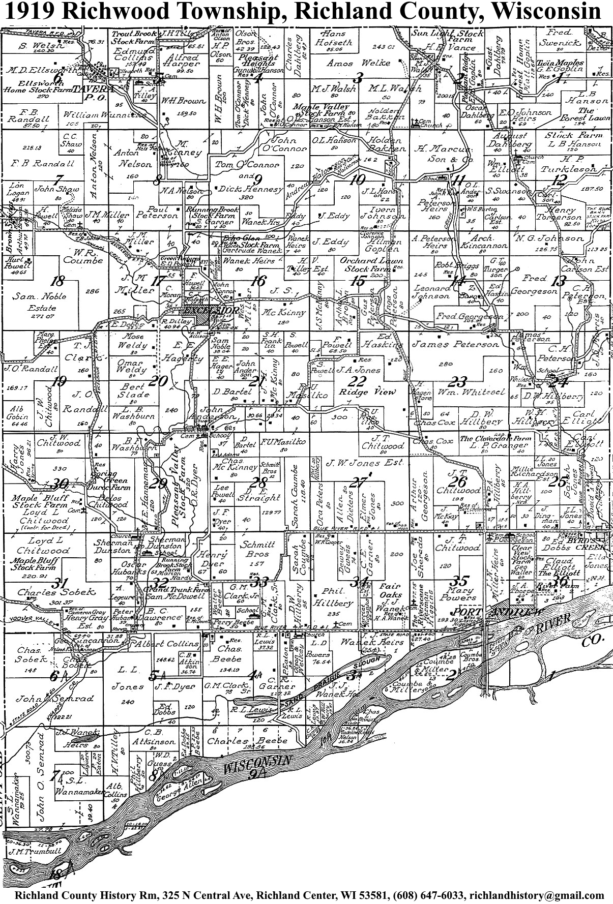
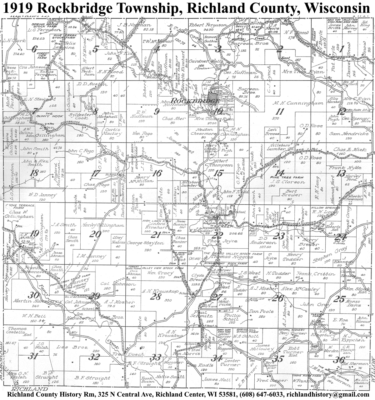
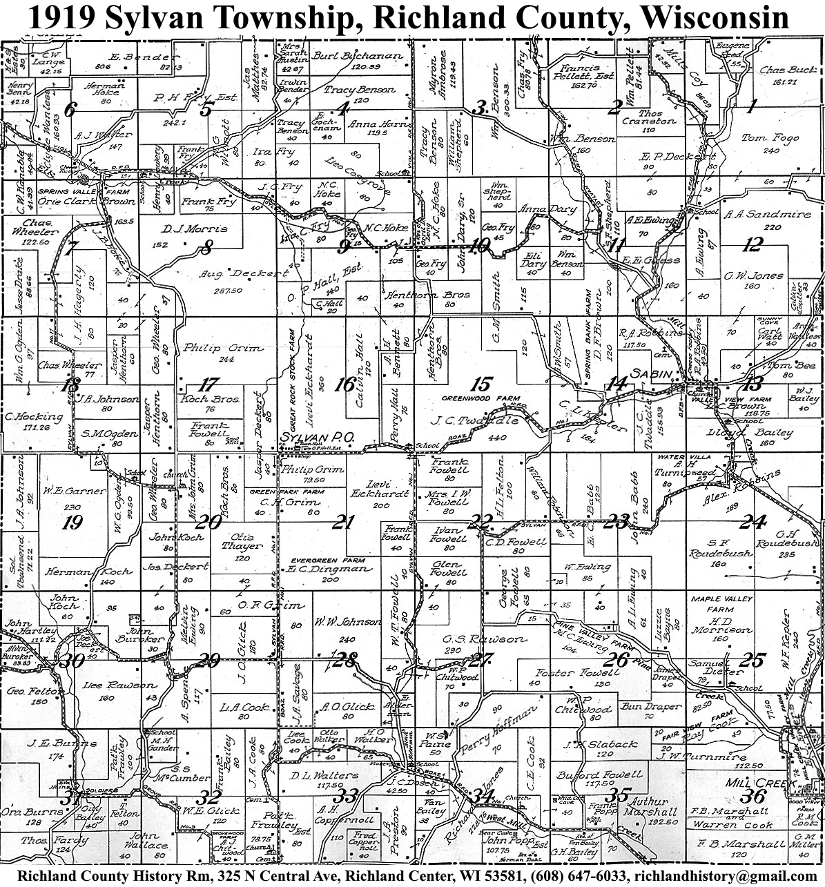
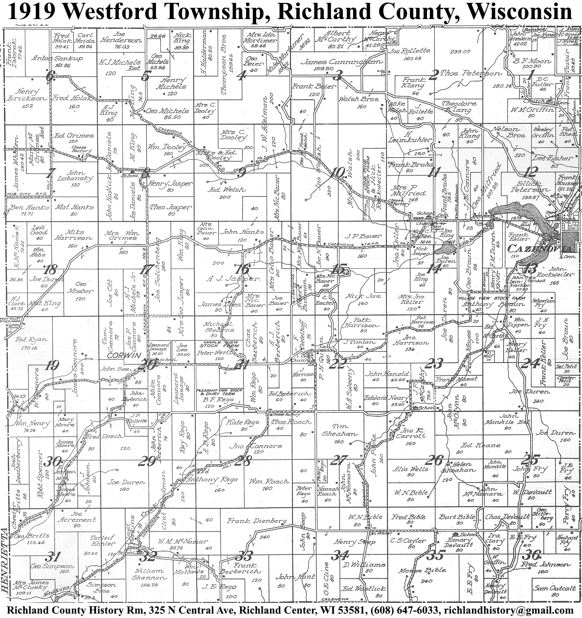
| 1919 | Akan | Bloom | Buena Vista | Dayton | Eagle | Forest | Henrietta | Ithaca | Marshall | Orion | Richland | Richwood | Rockbridge | Sylvan | Westford | Willow |
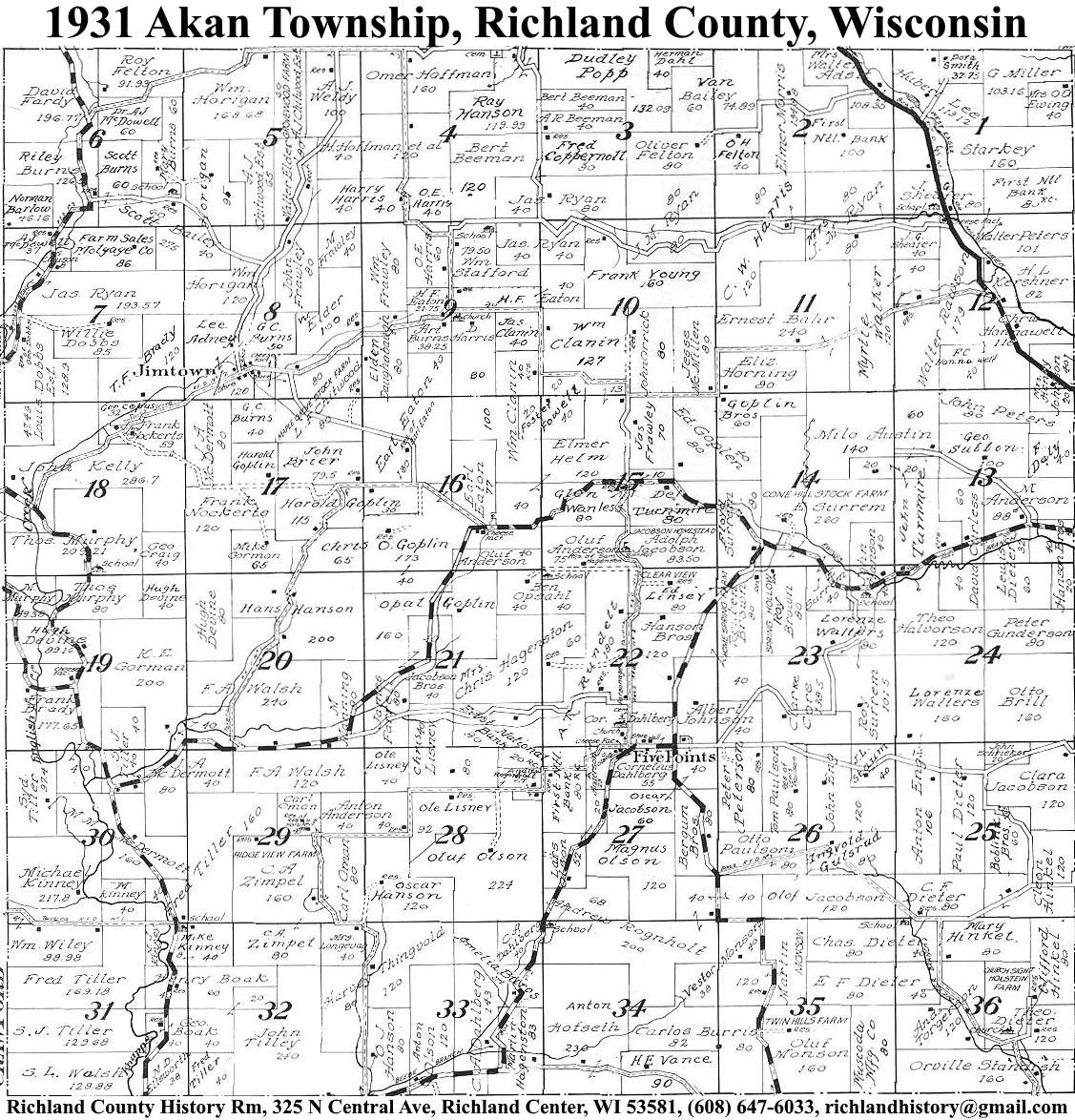
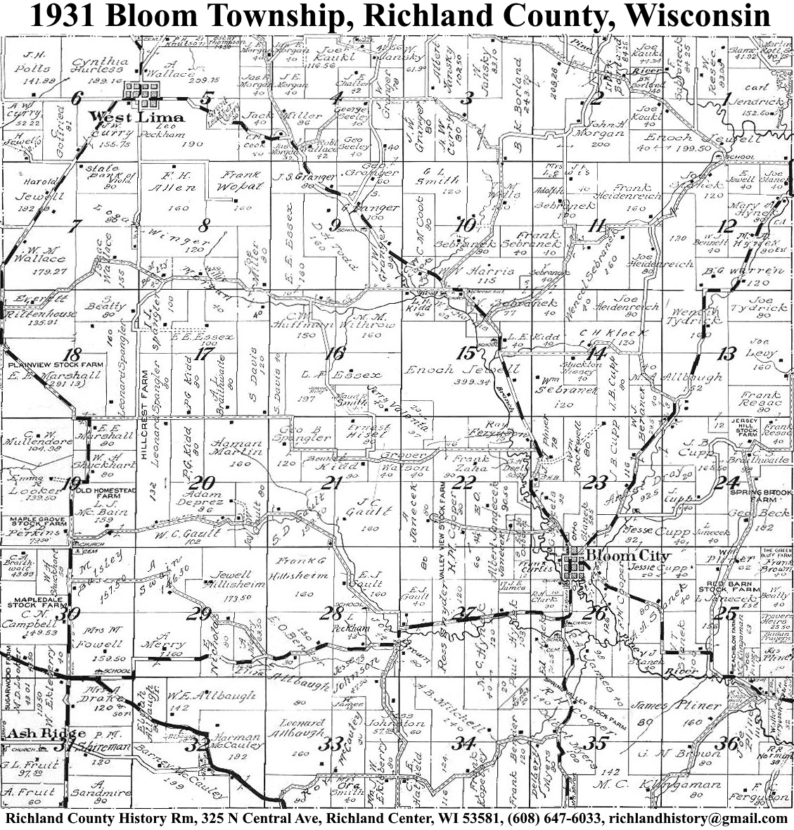
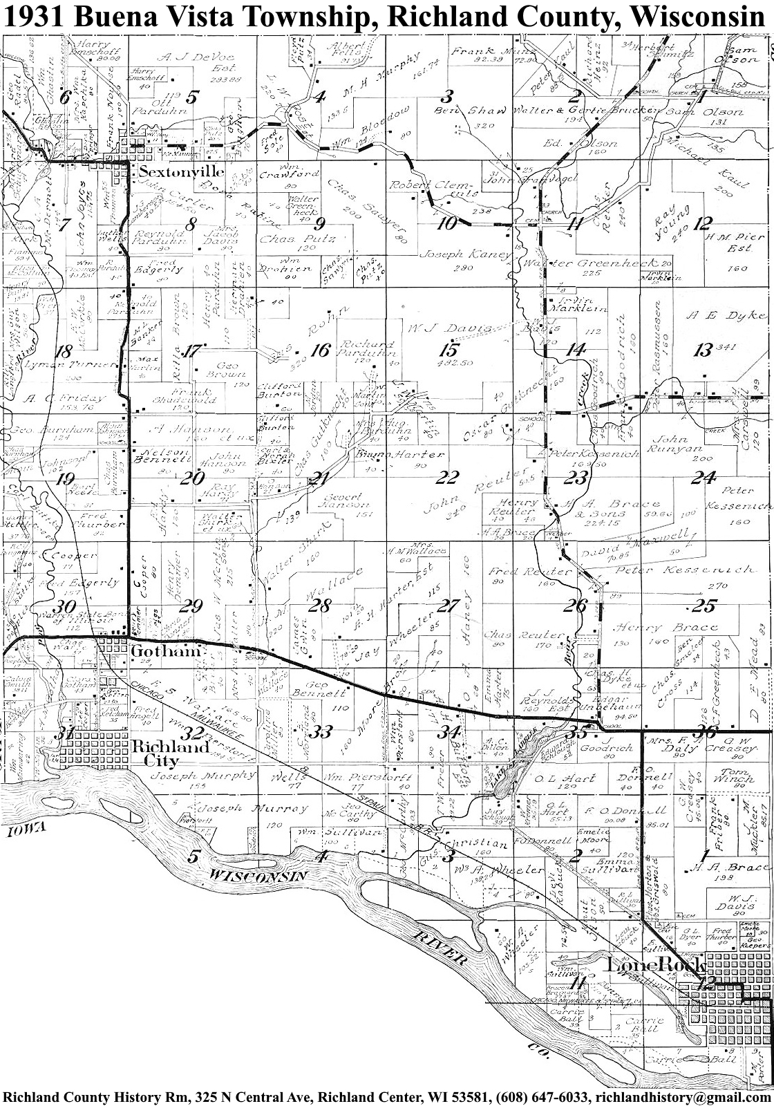
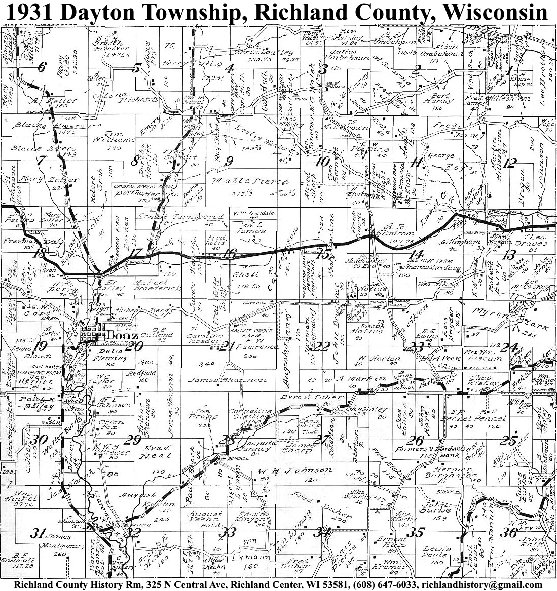
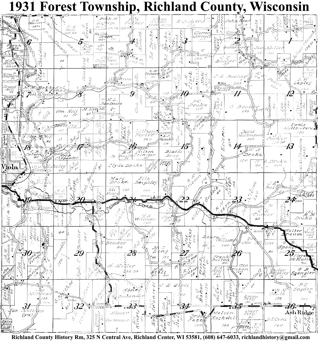
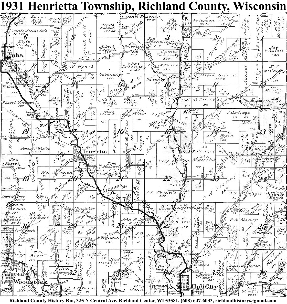
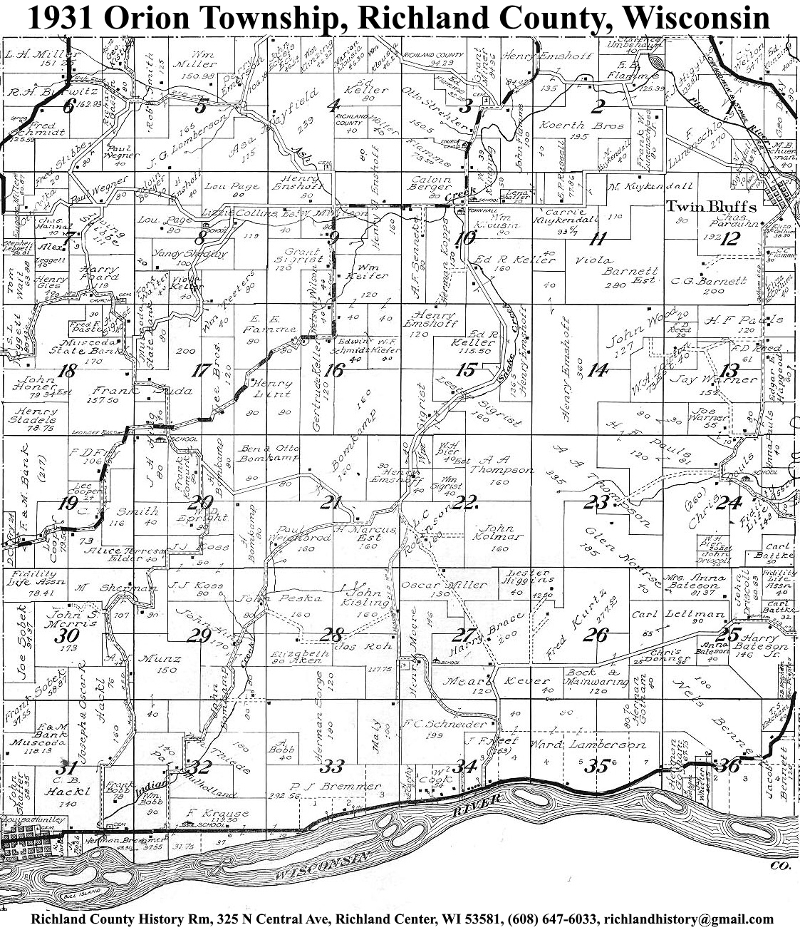
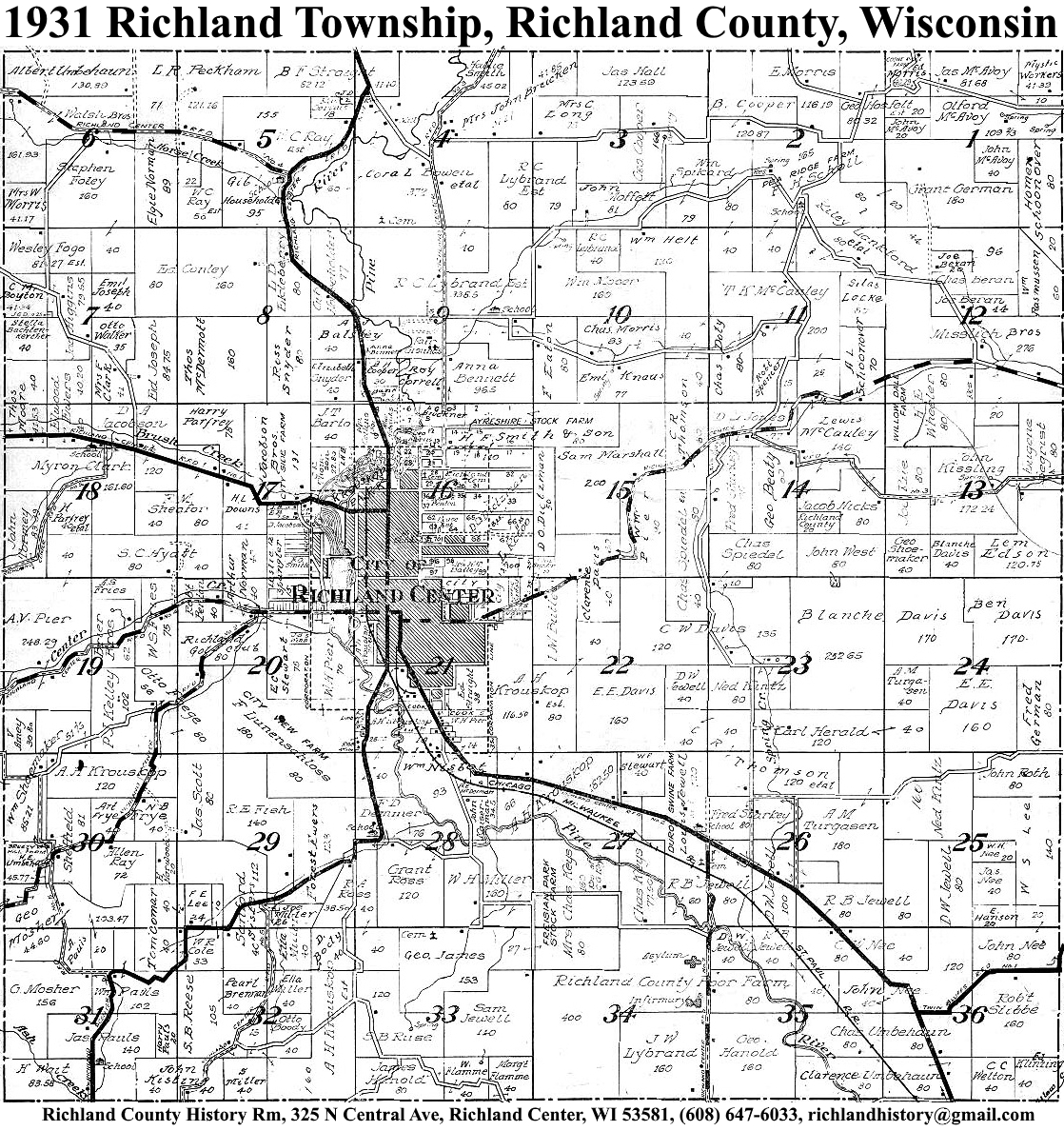
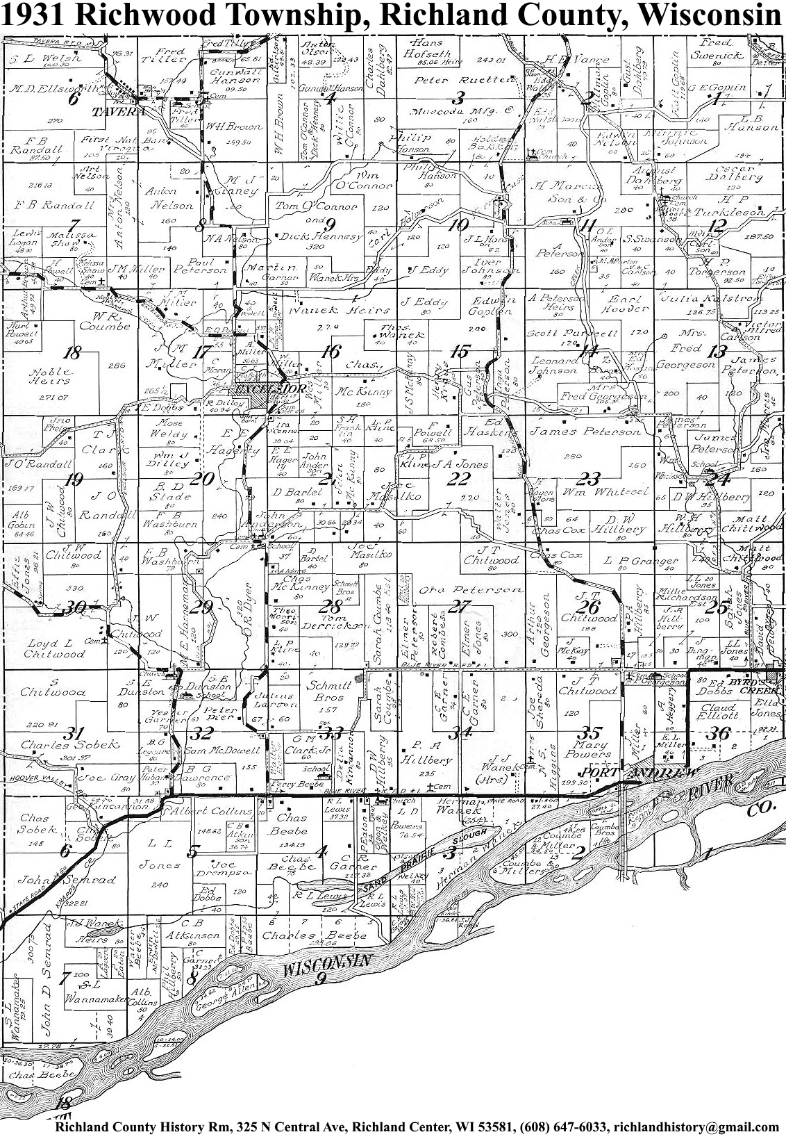
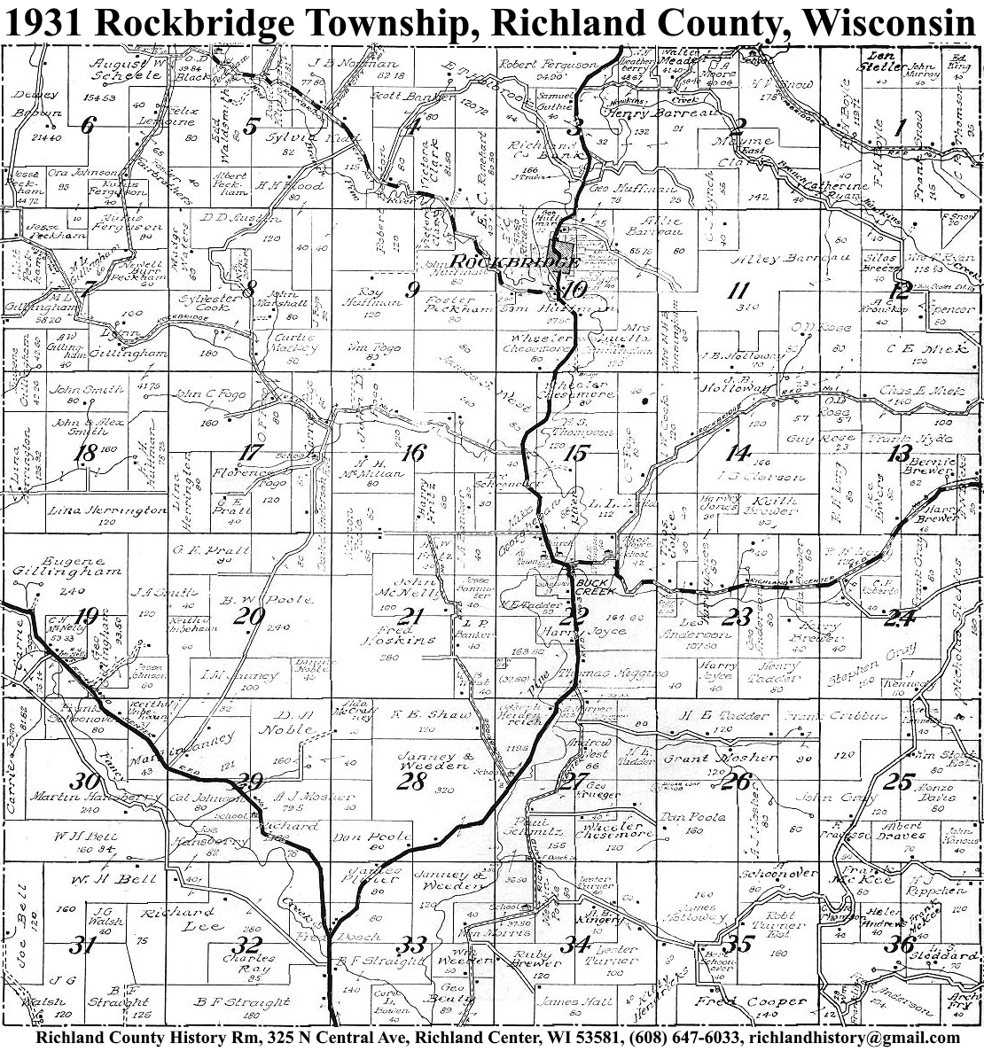
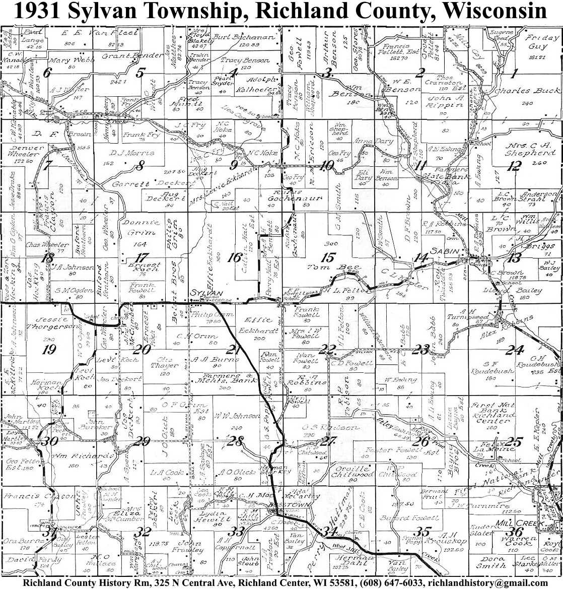
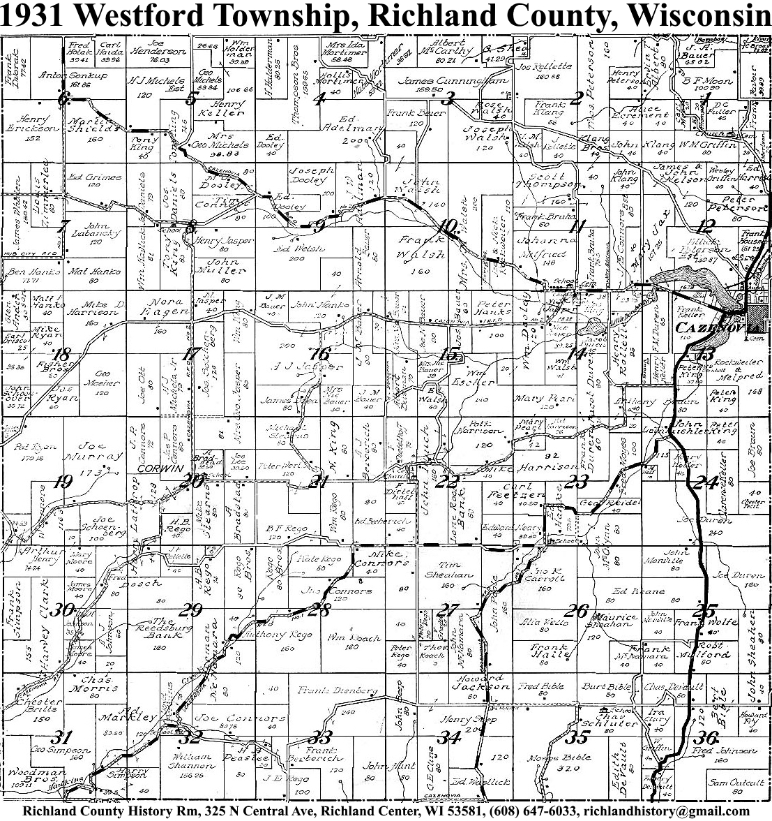
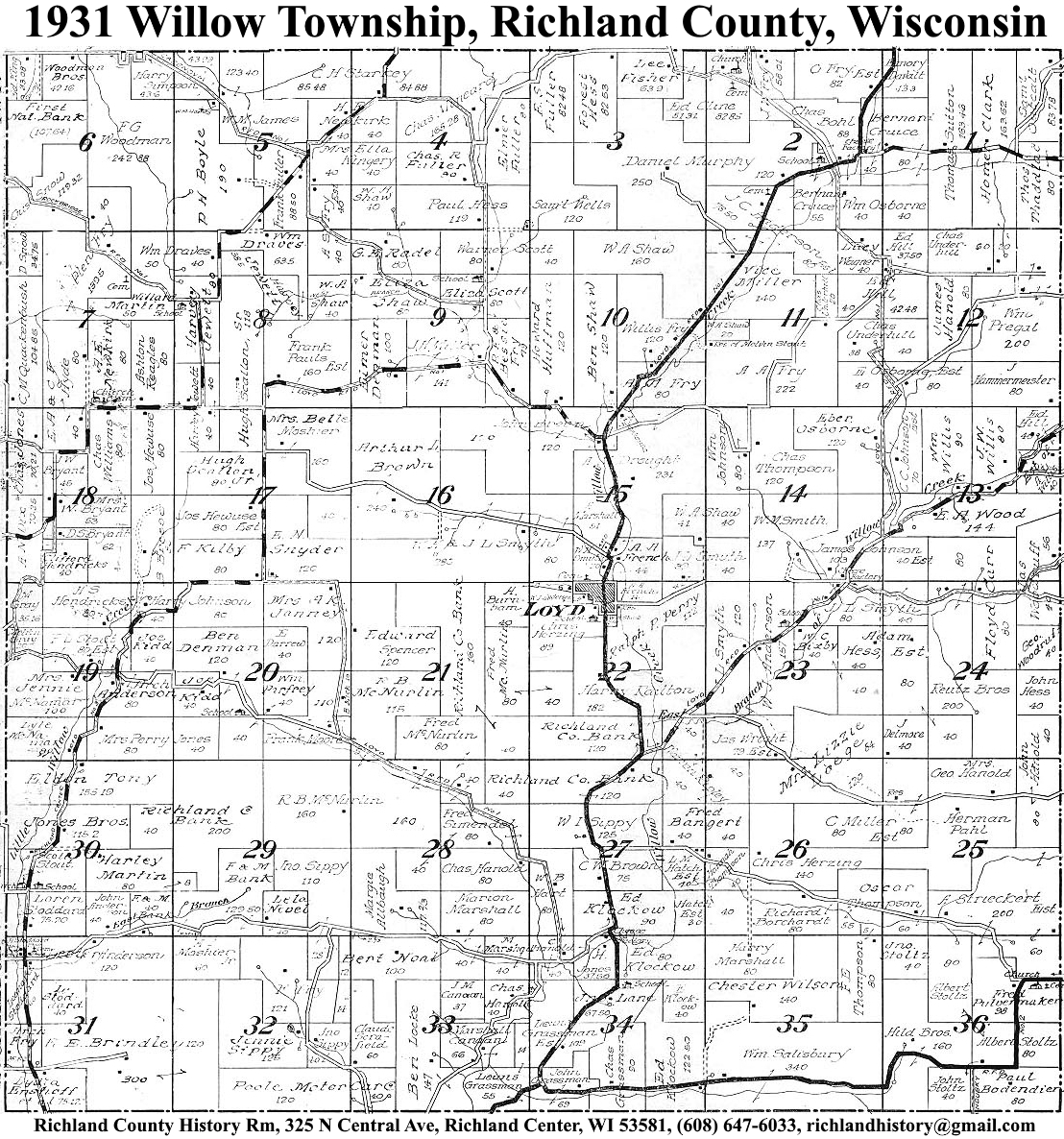
| 1931 | Akan | Bloom | Buena Vista | Dayton | Eagle | Forest | Henrietta | Ithaca | Marshall | Orion | Richland | Richwood | Rockbridge | Sylvan | Westford | Willow |
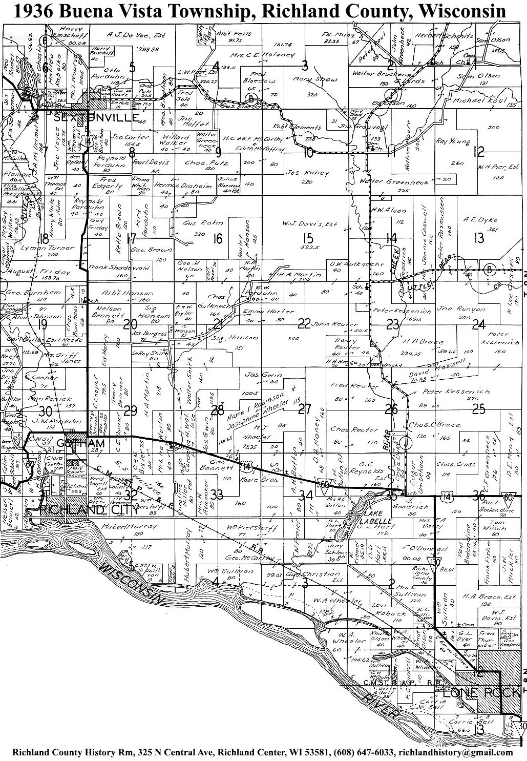
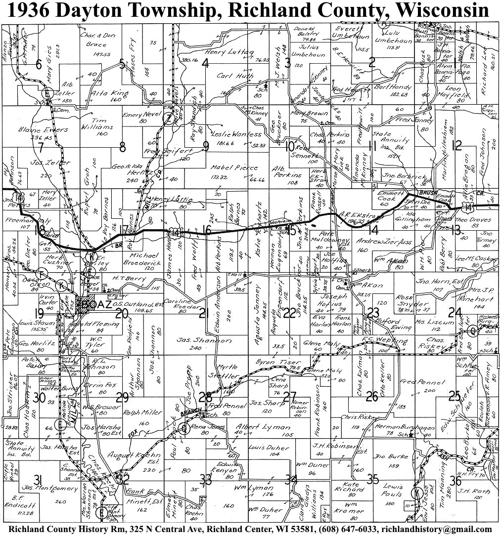
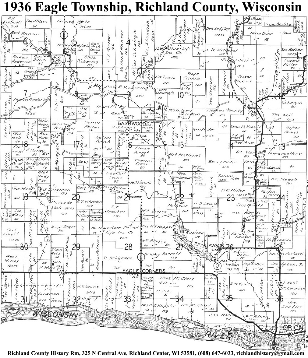
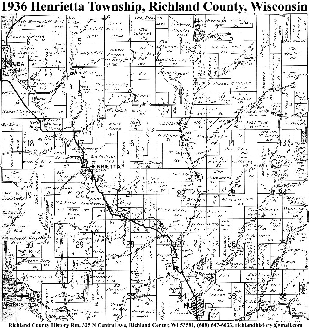
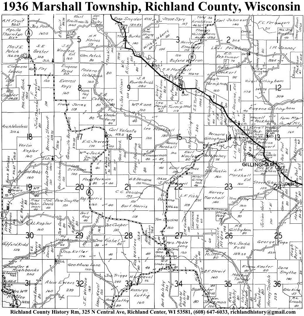
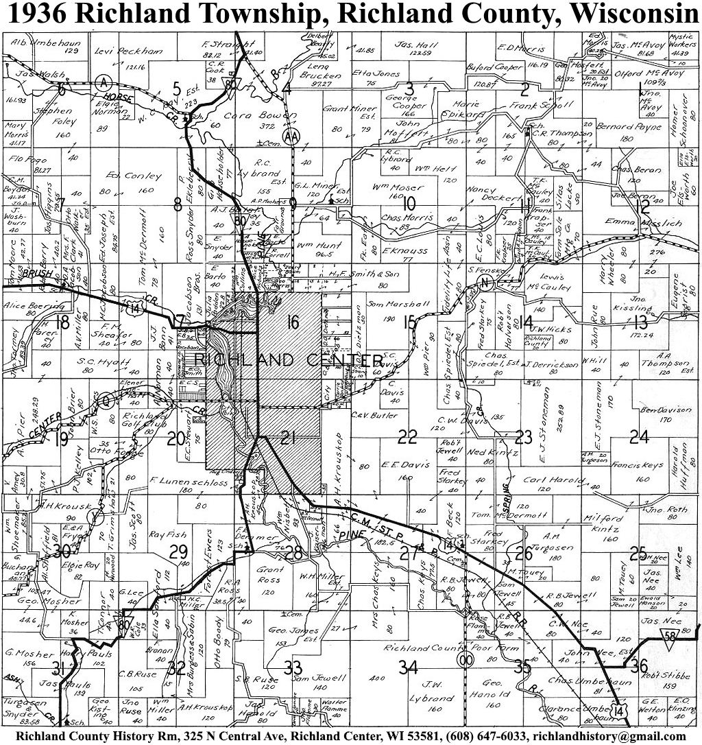
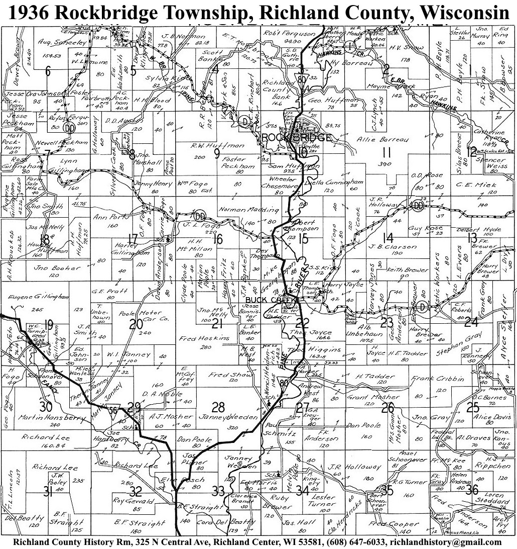
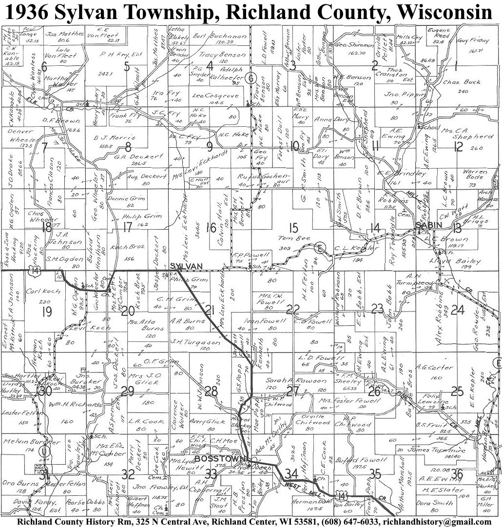
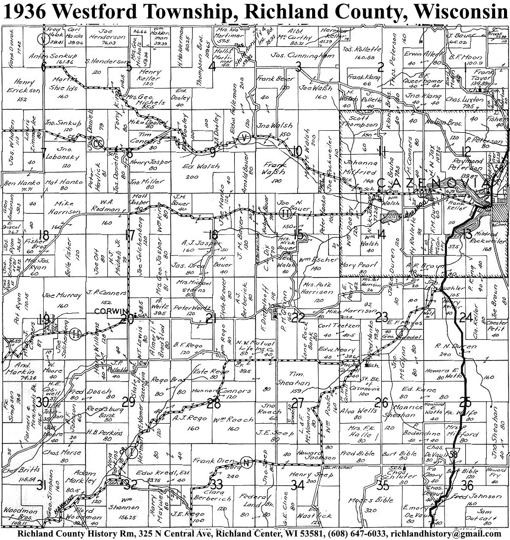
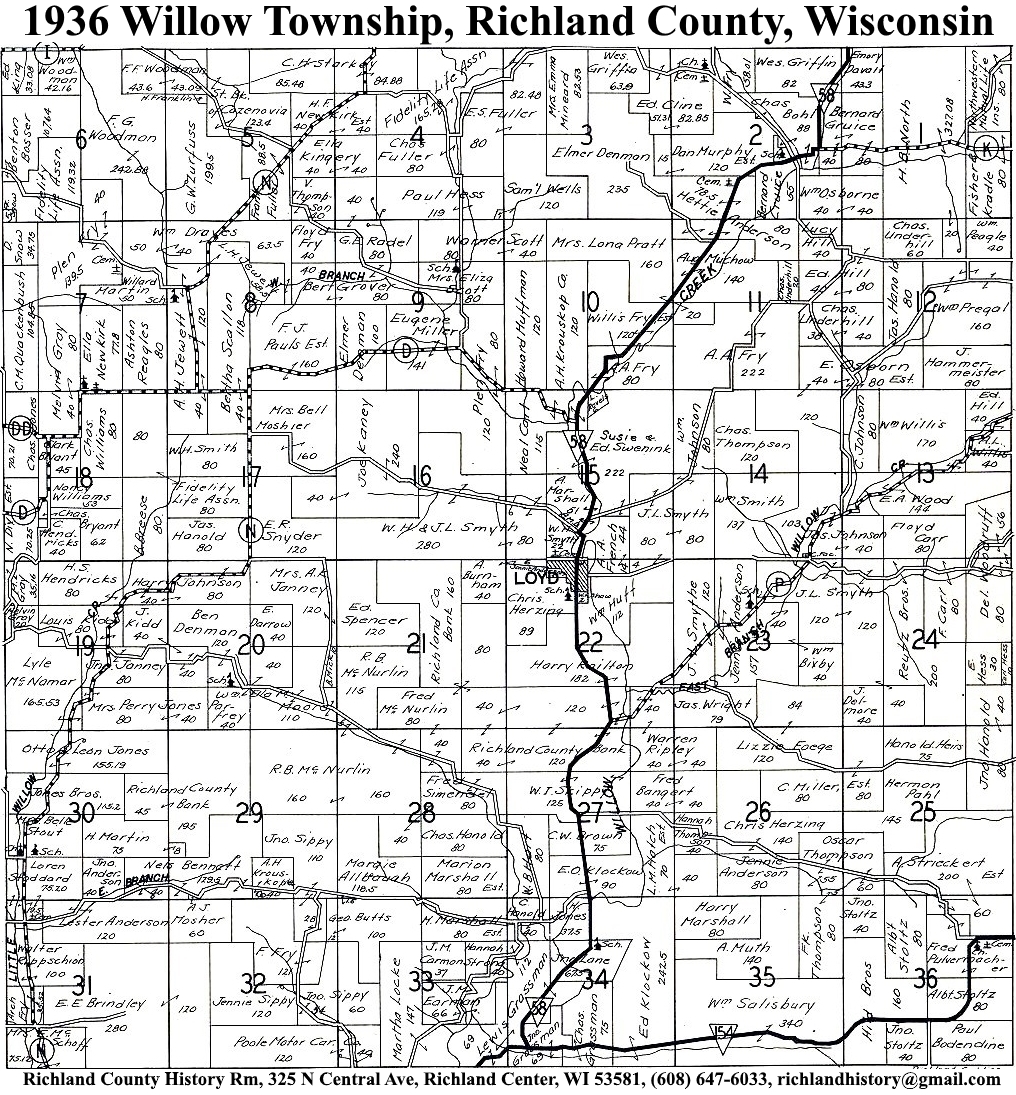
| 1936 | Akan | Bloom | Buena Vista | Dayton | Eagle | Forest | Henrietta | Ithaca | Marshall | Orion | Richland | Richwood | Rockbridge | Sylvan | Westford | Willow |
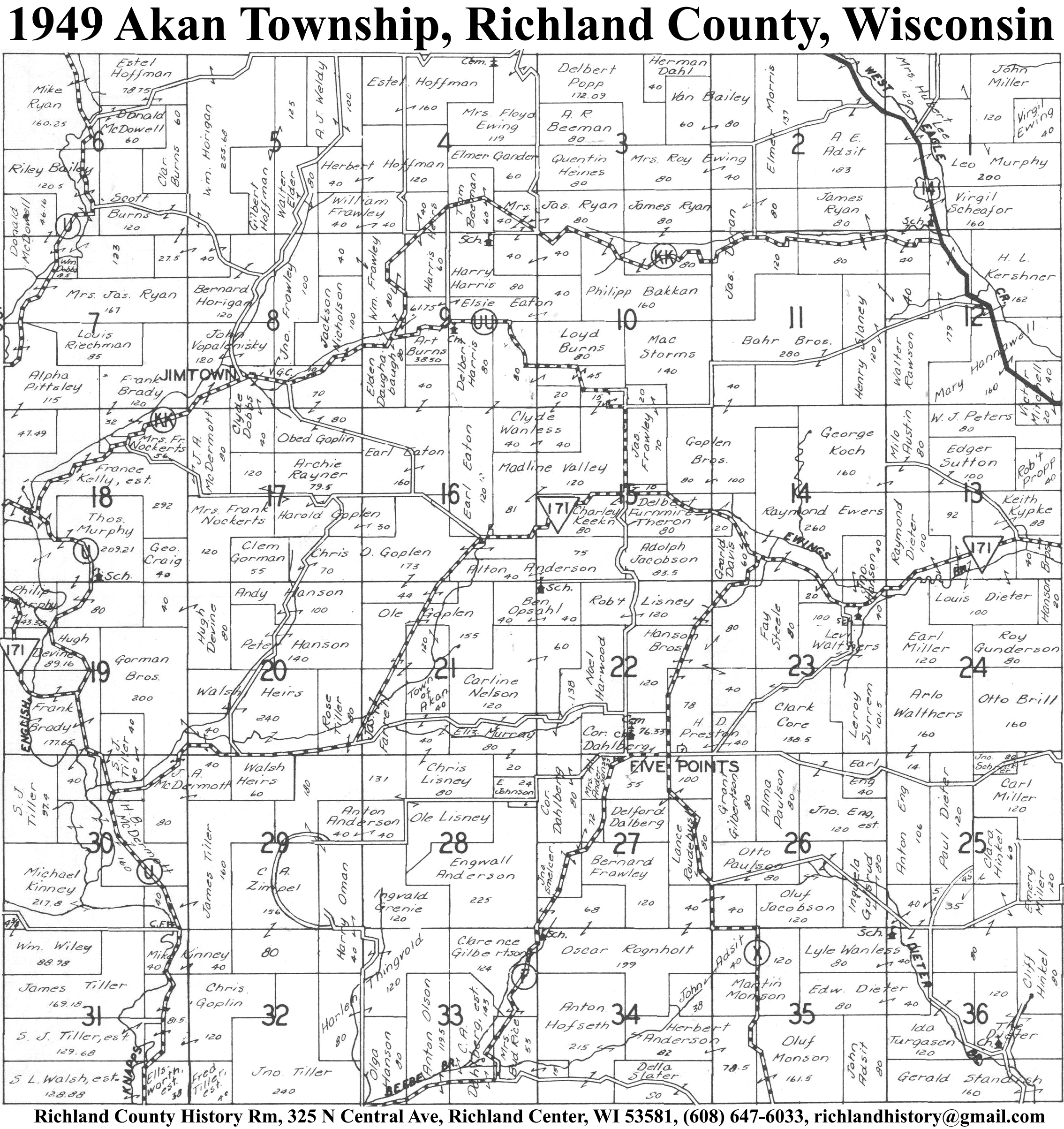
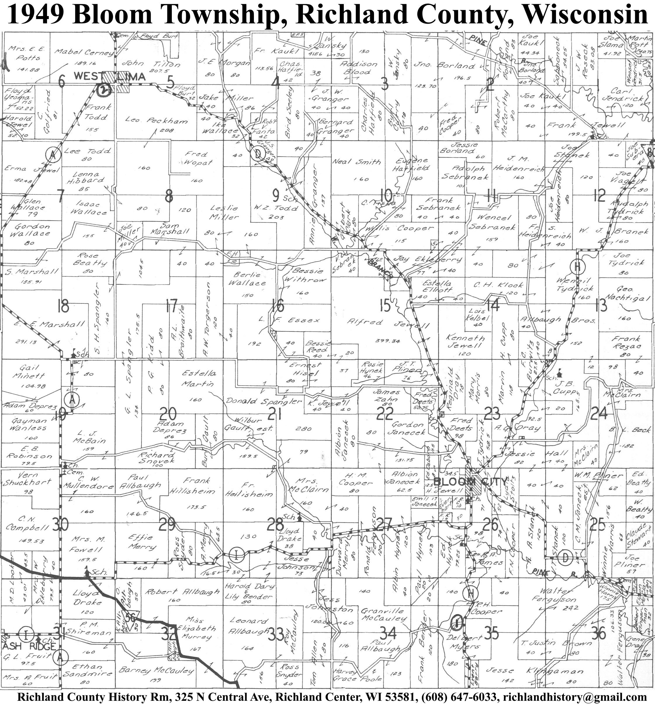
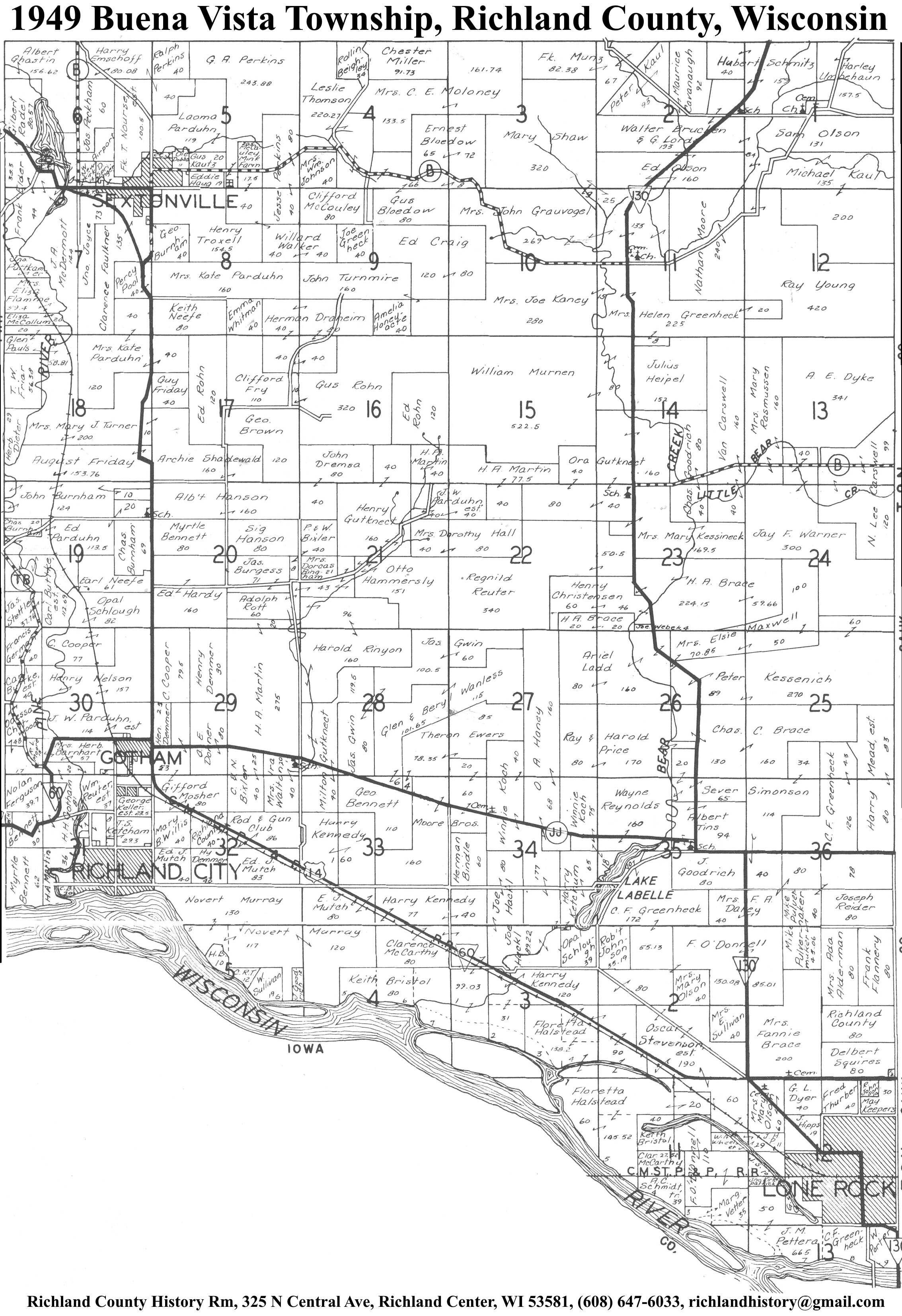
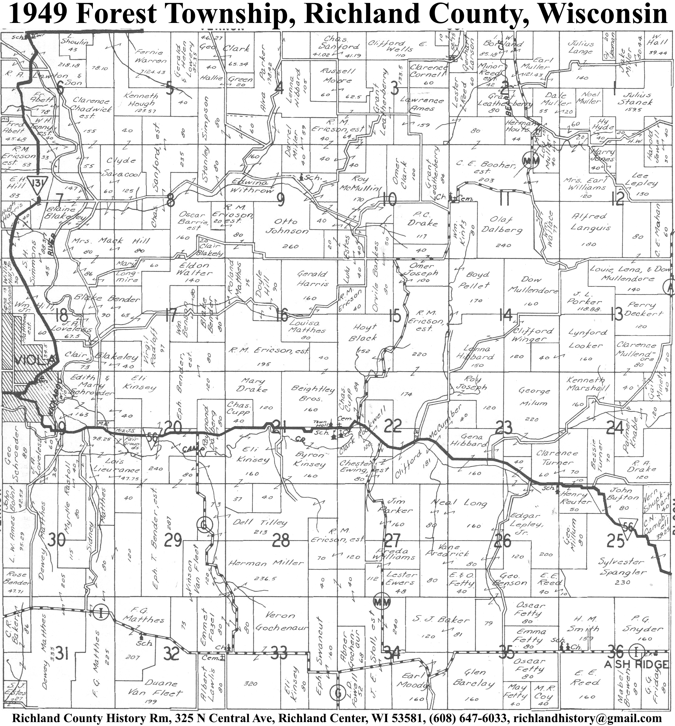
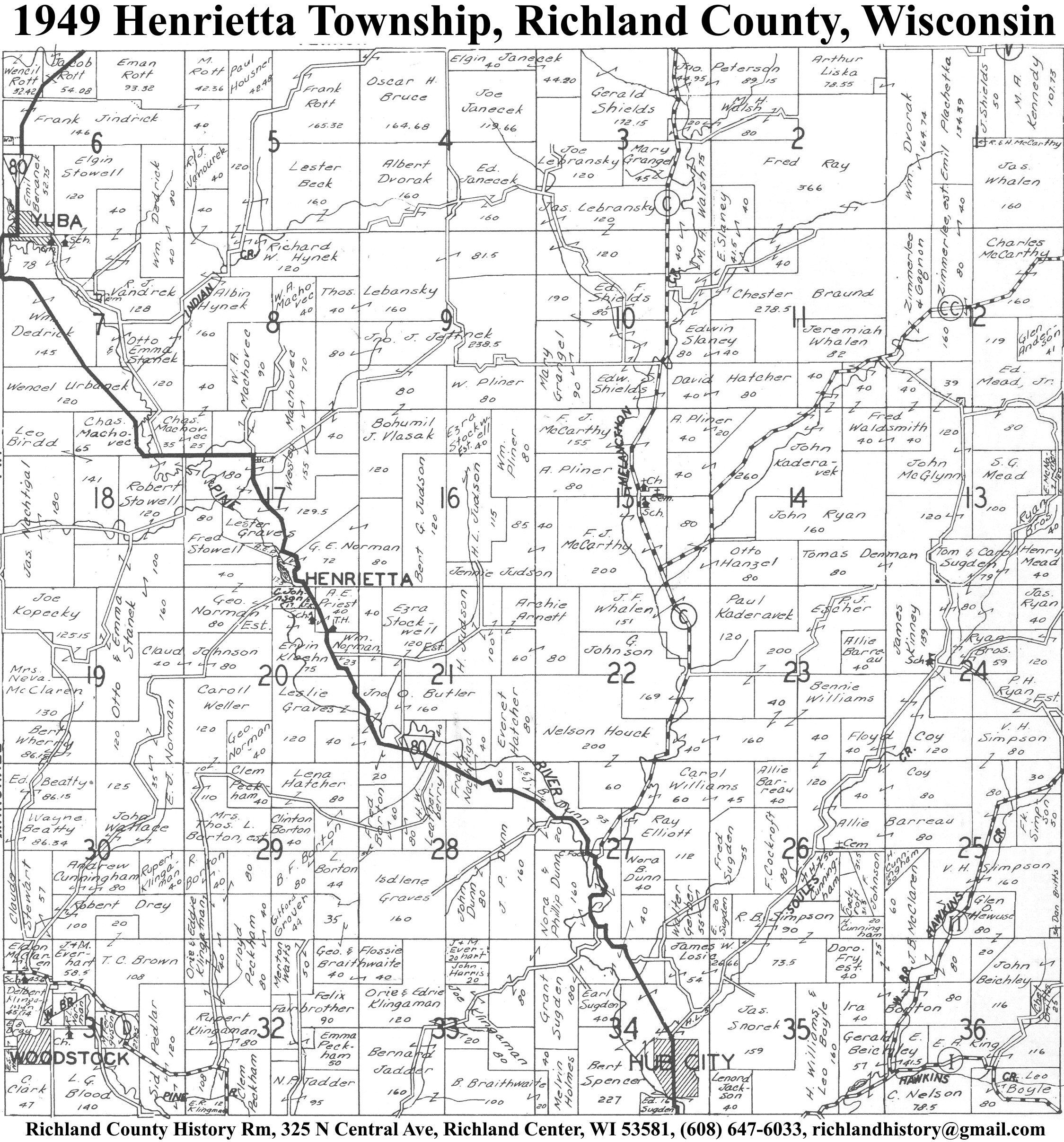
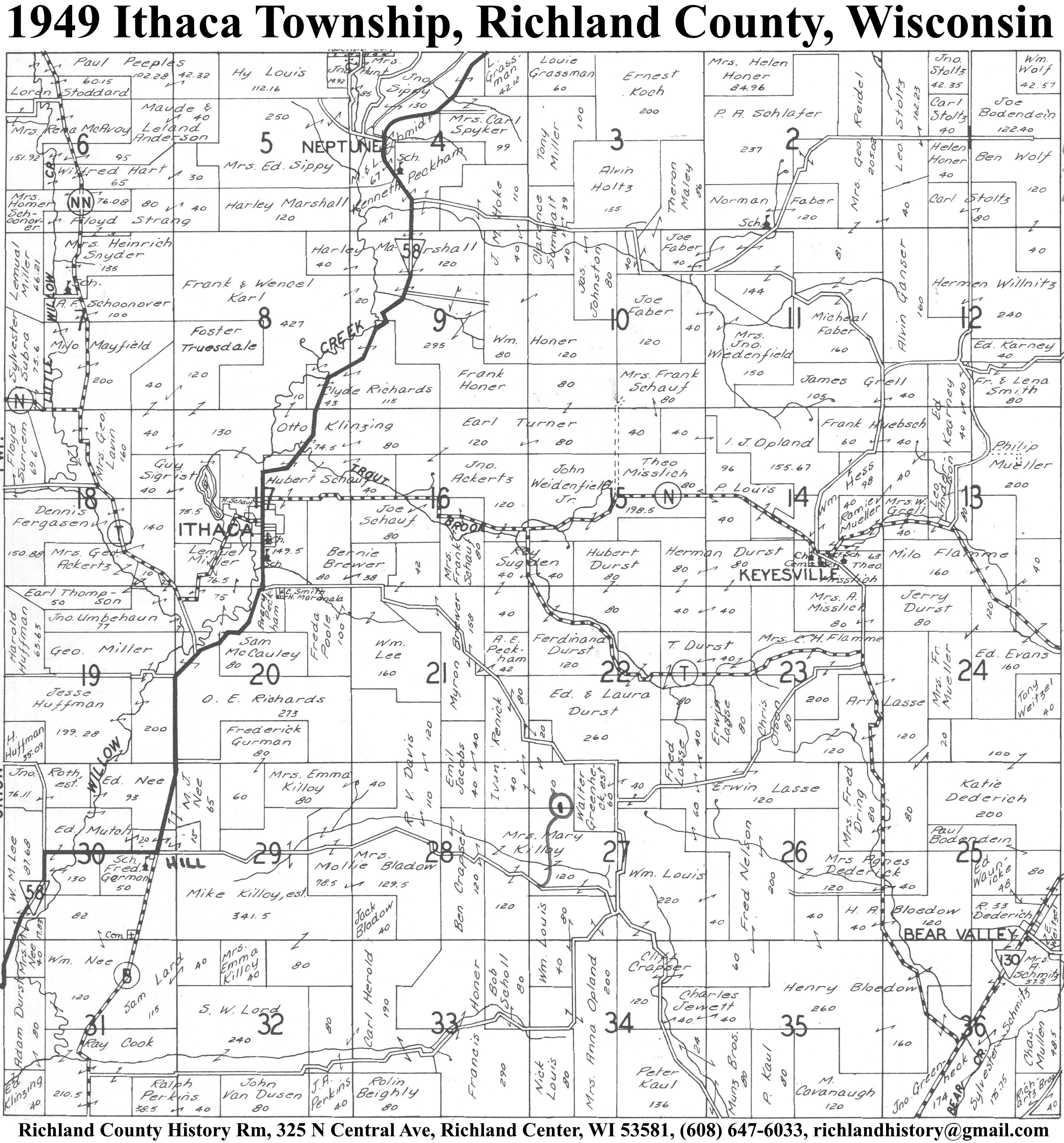
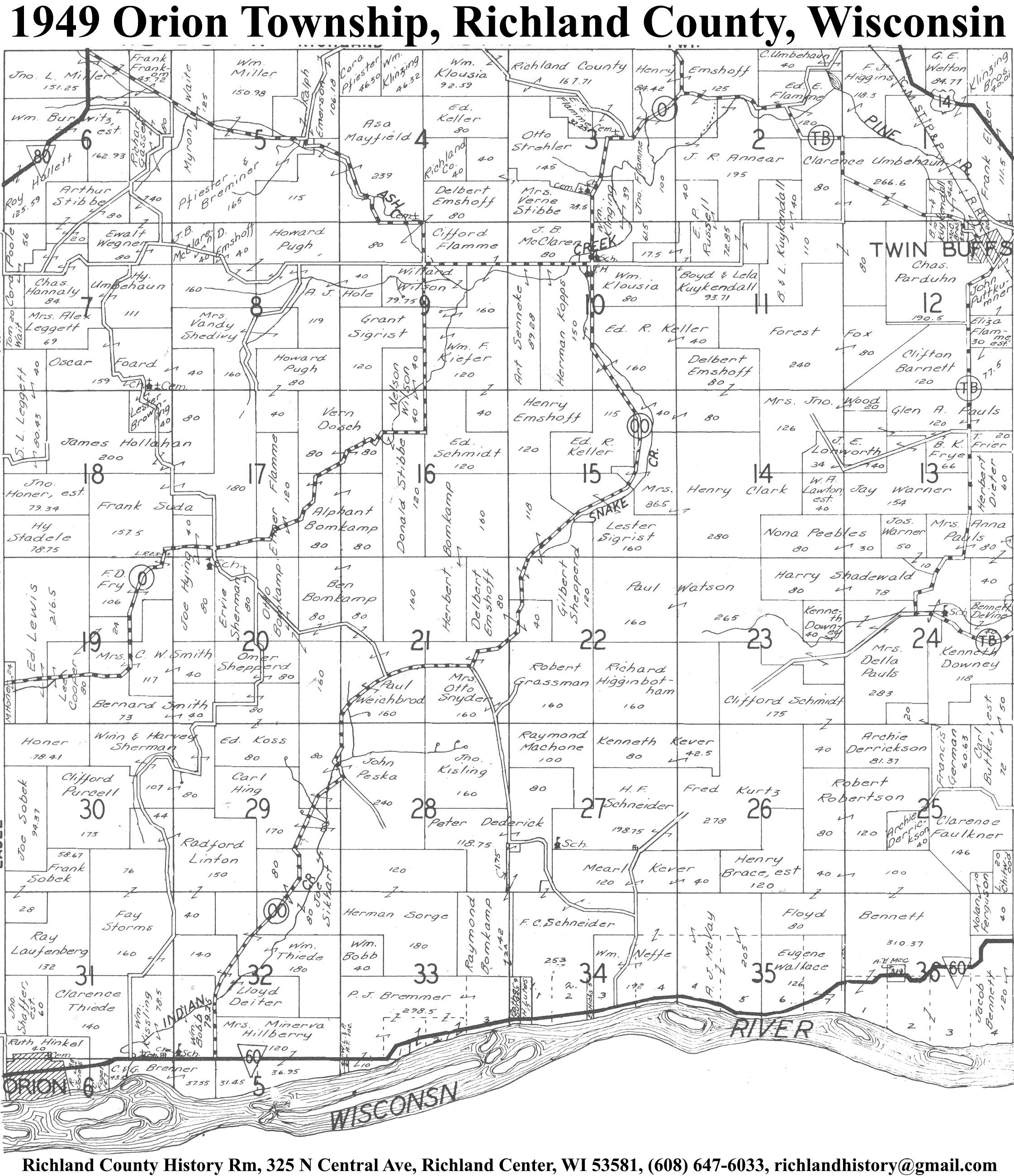
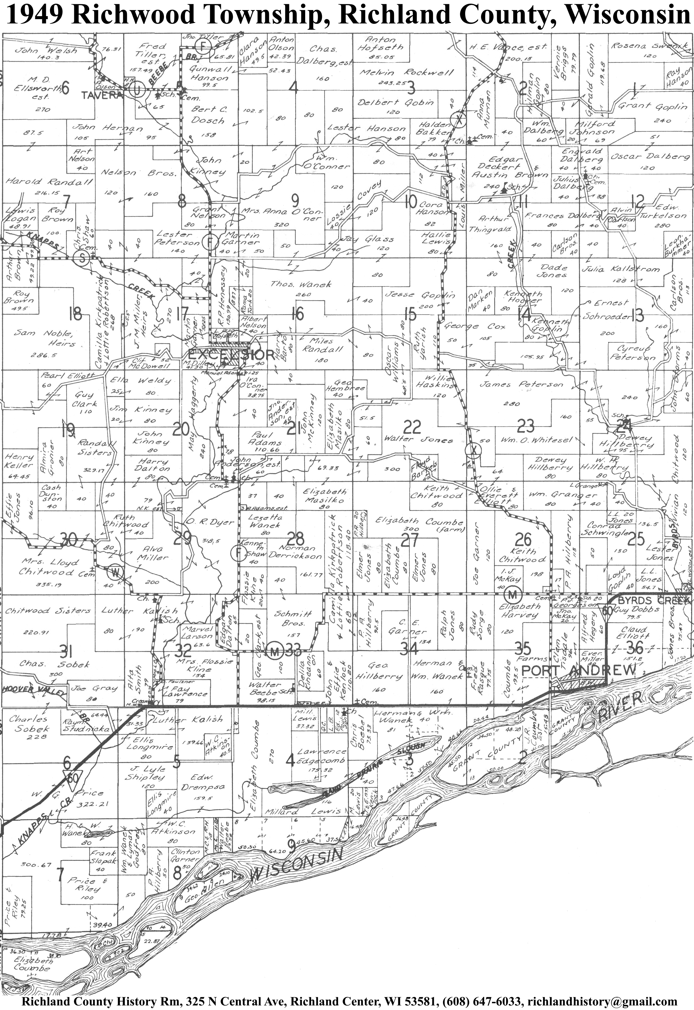
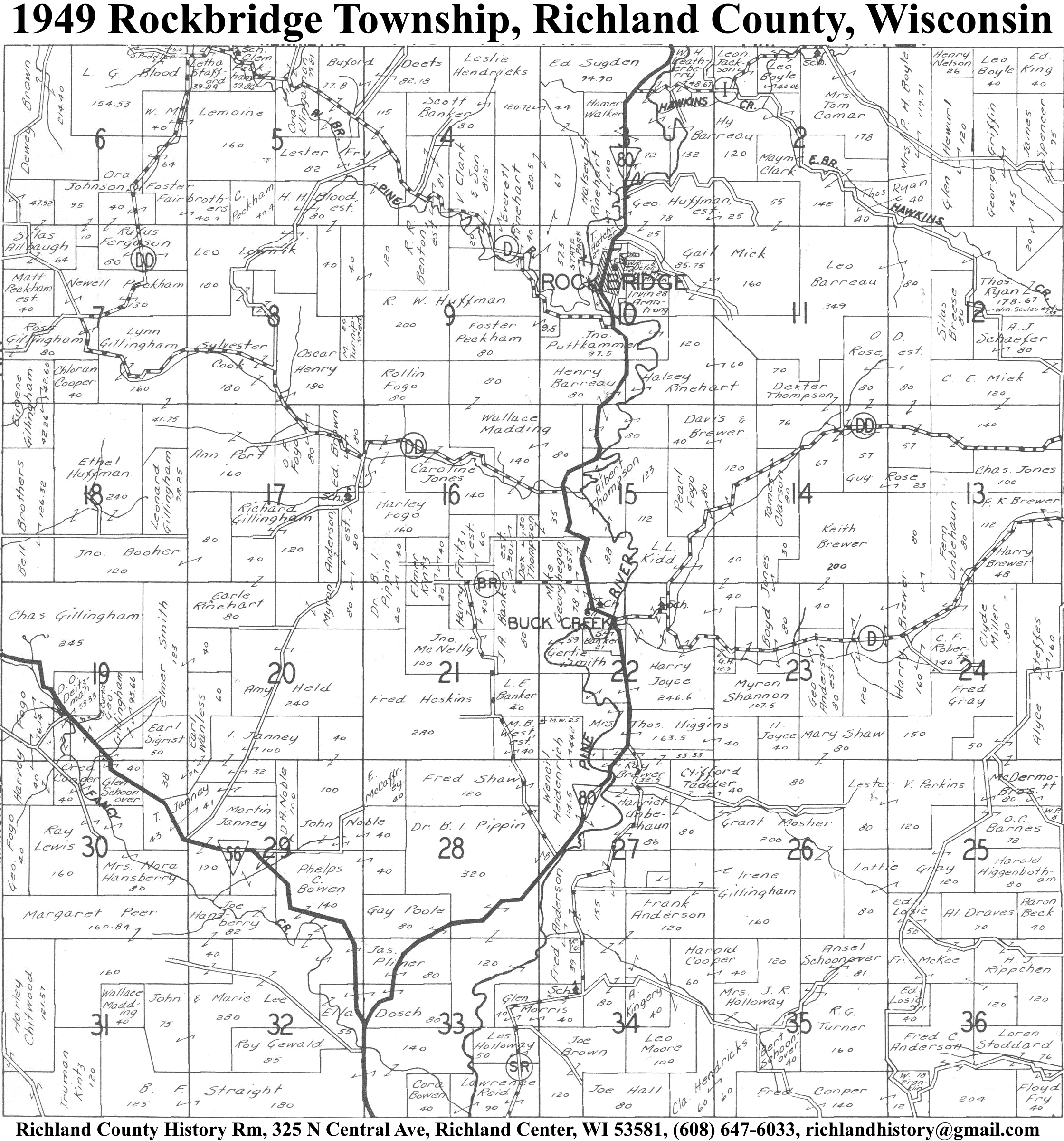
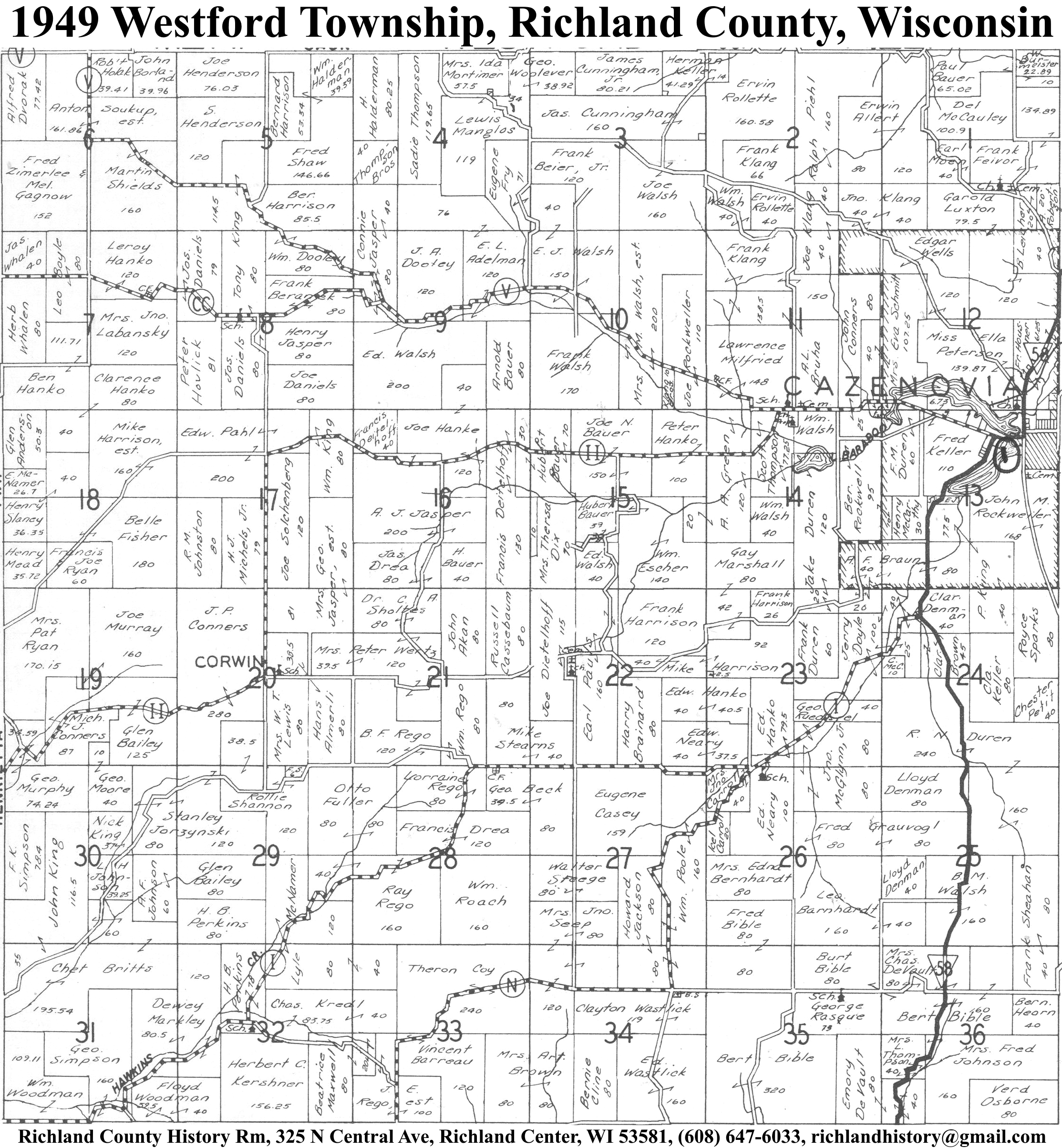
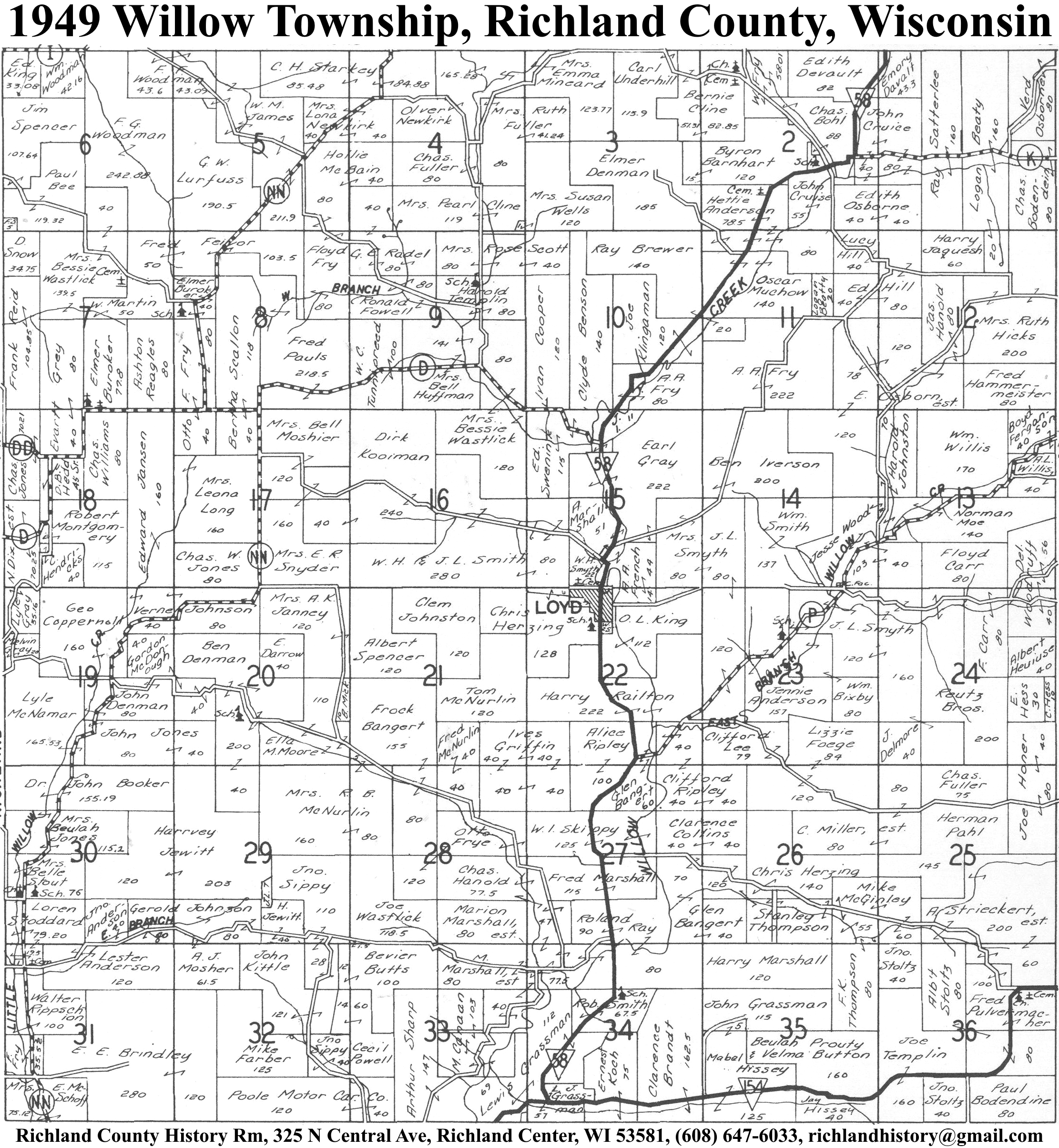
| 1949 | Akan | Bloom | Buena Vista | Dayton | Eagle | Forest | Henrietta | Ithaca | Marshall | Orion | Richland | Richwood | Rockbridge | Sylvan | Westford | Willow |
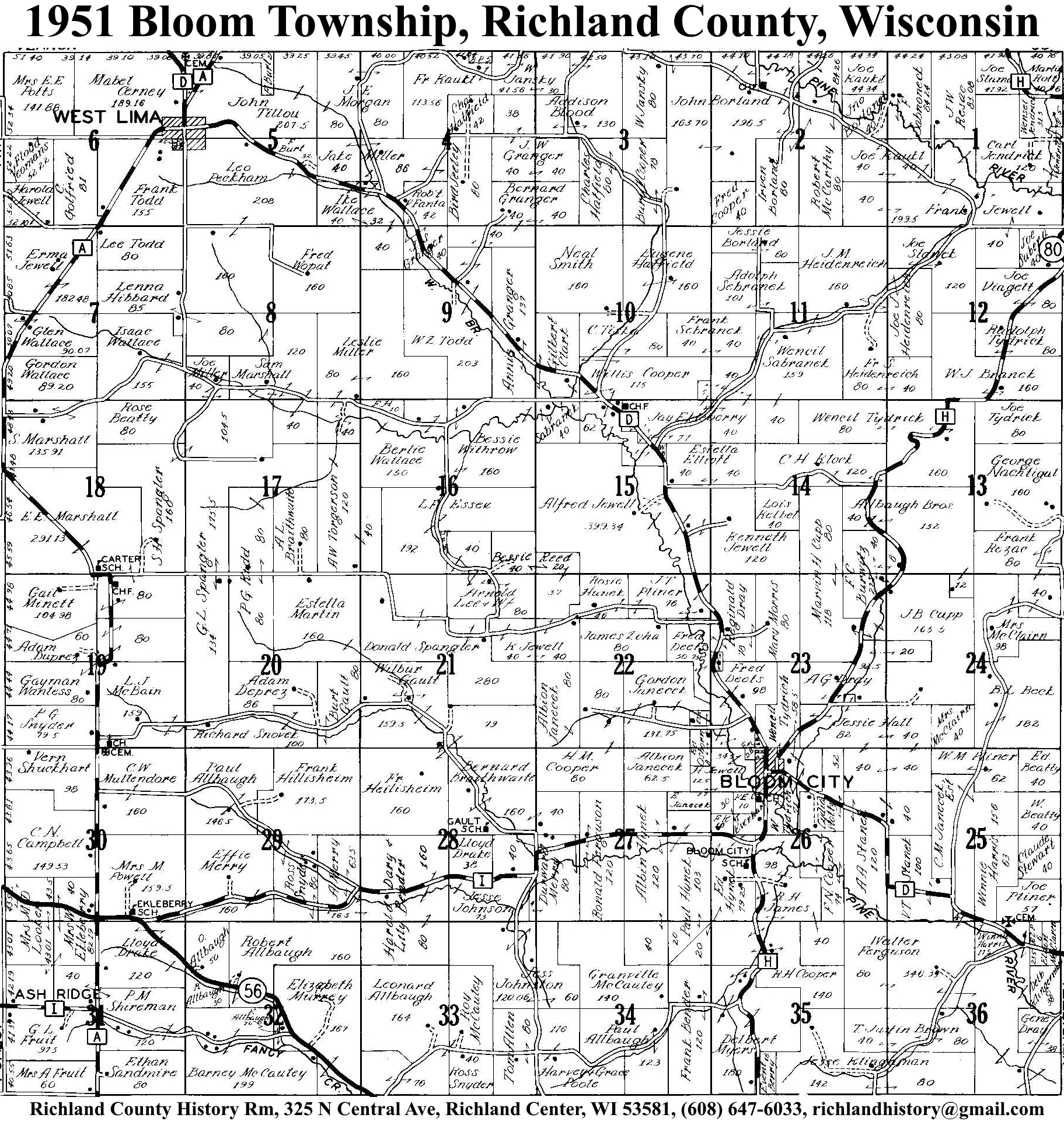
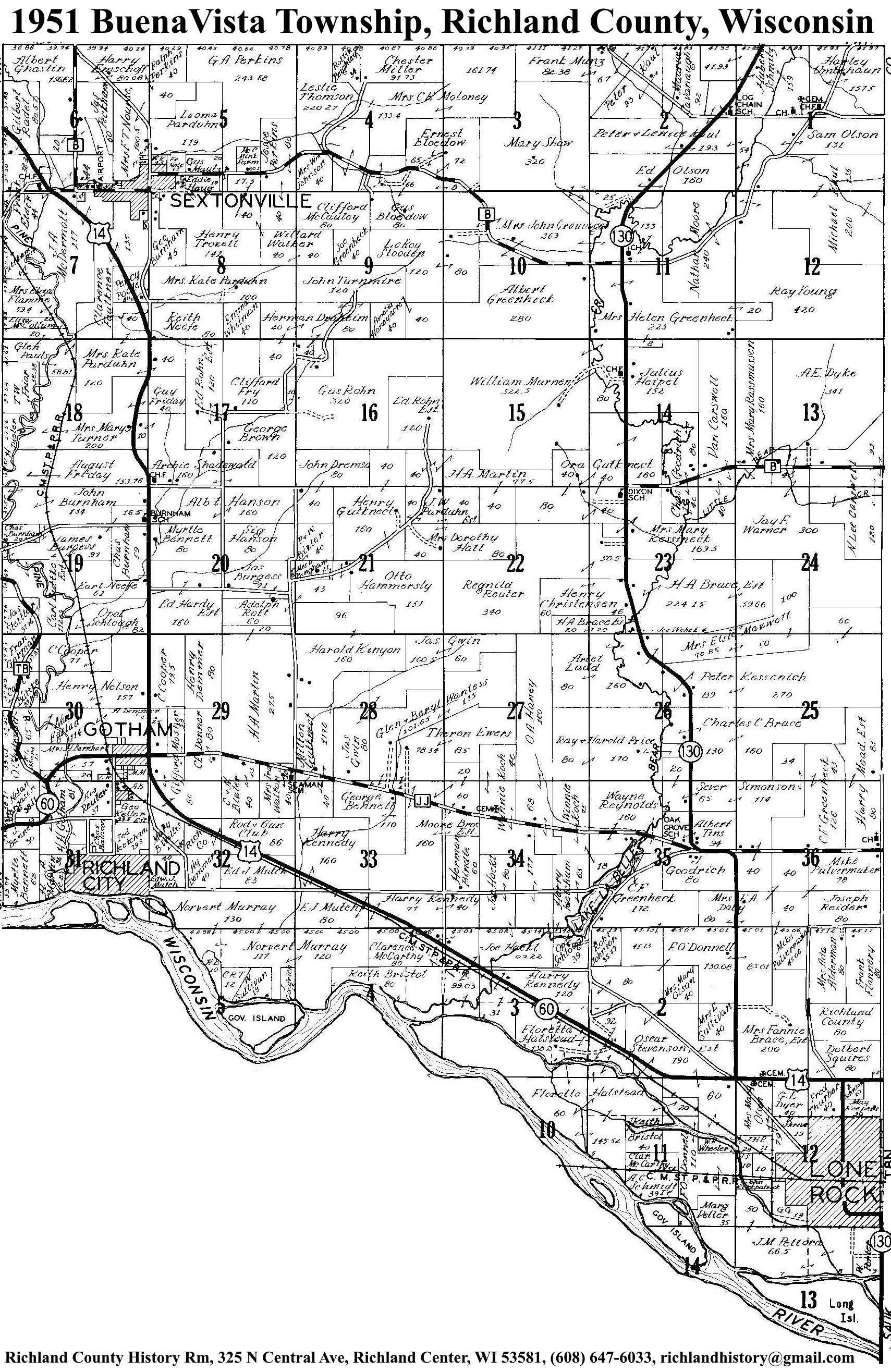
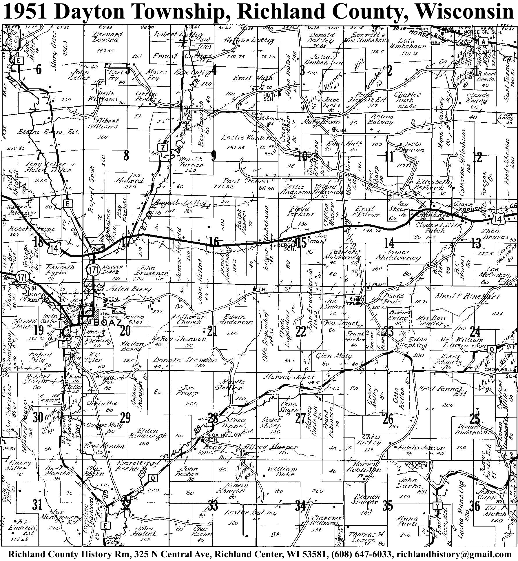
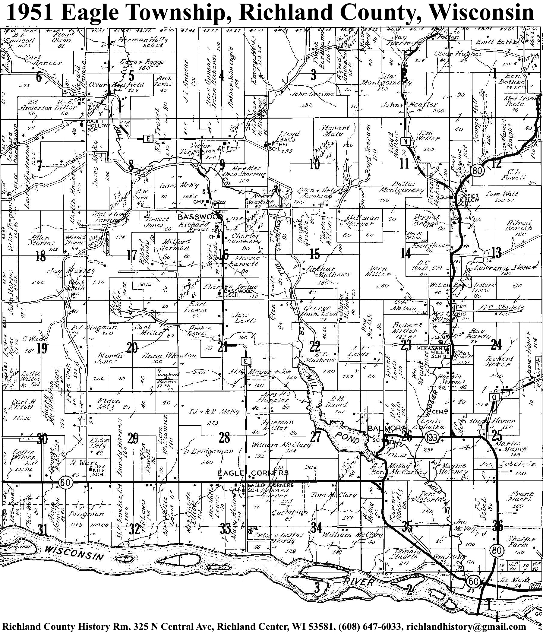
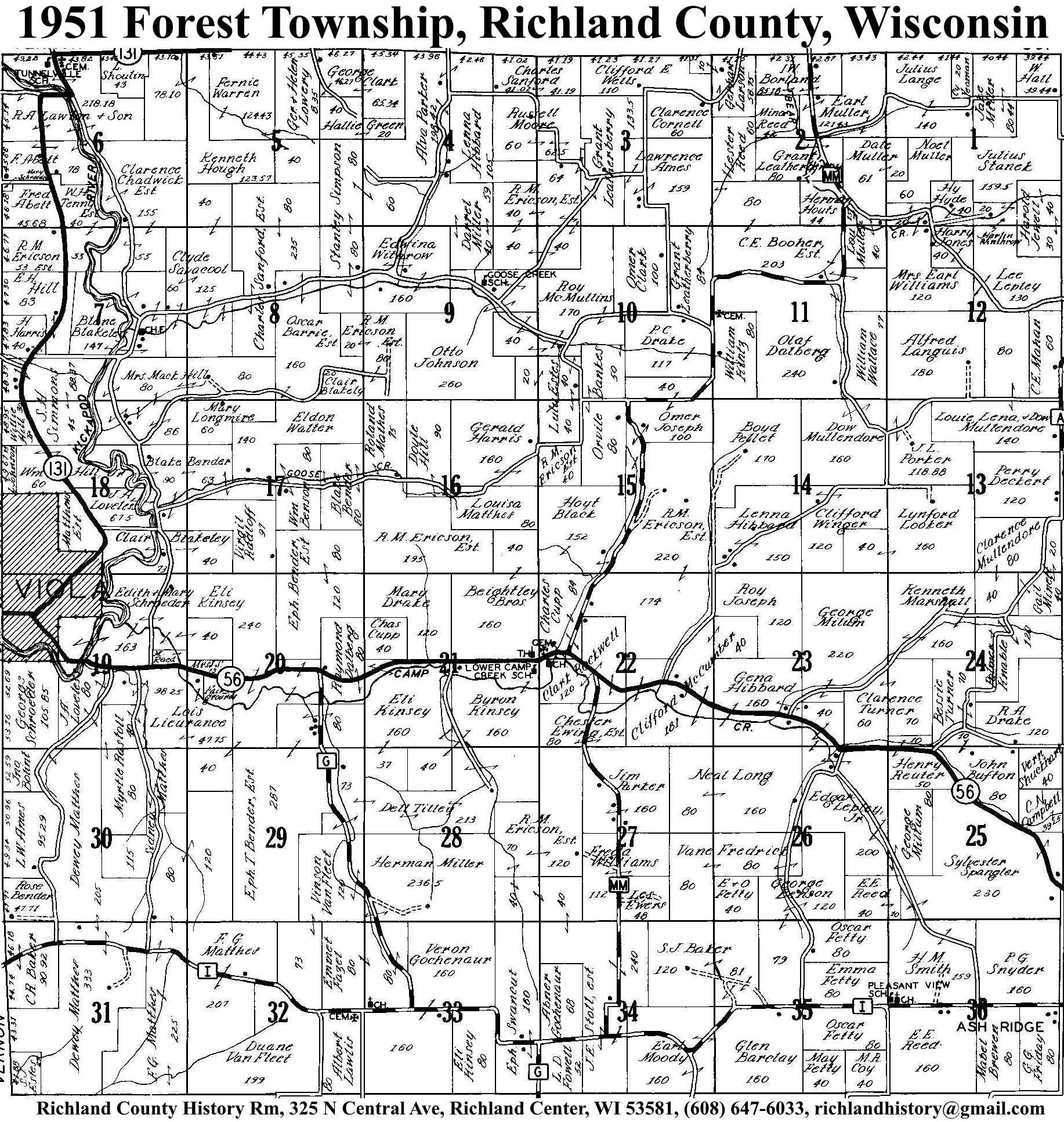
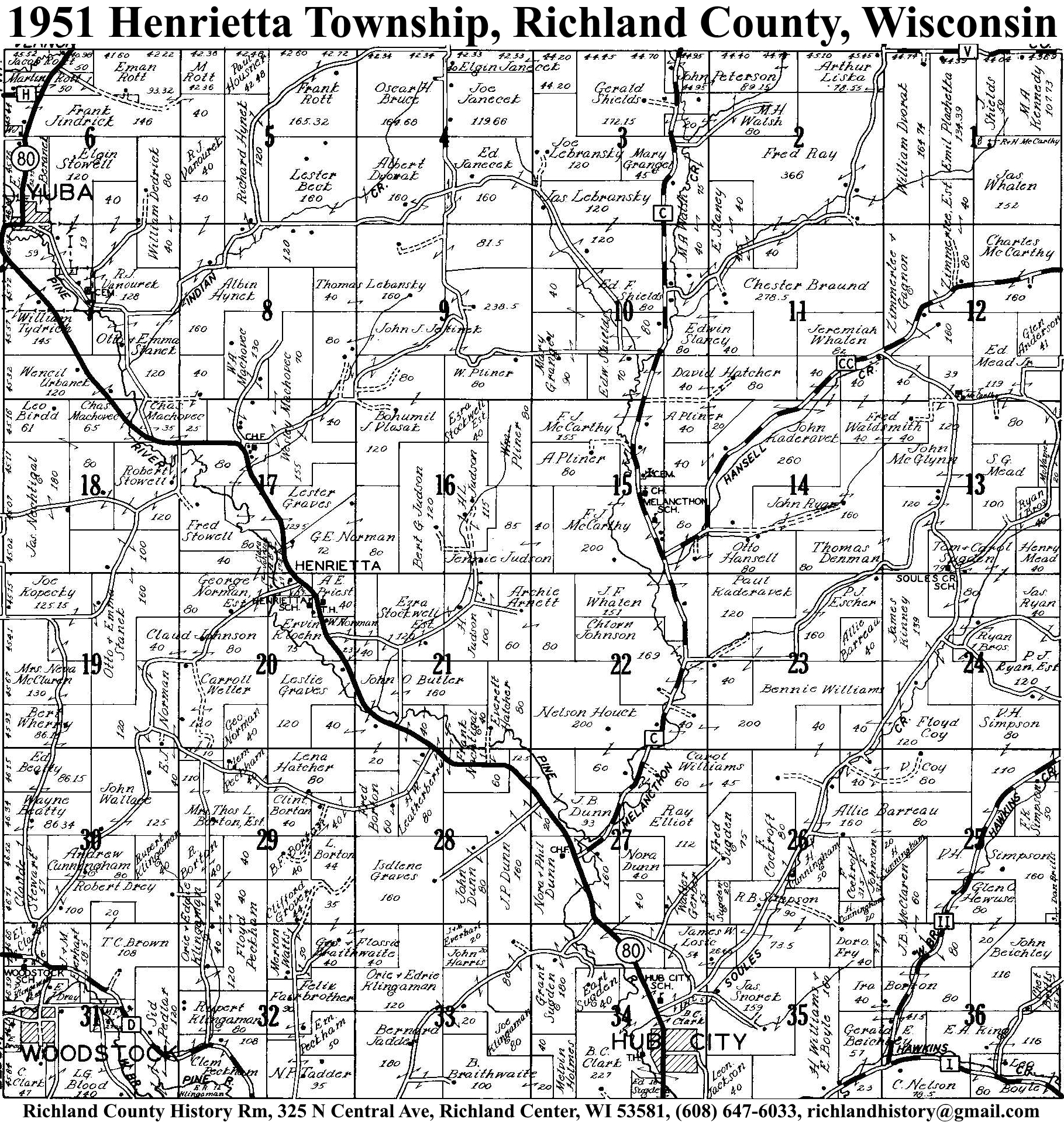
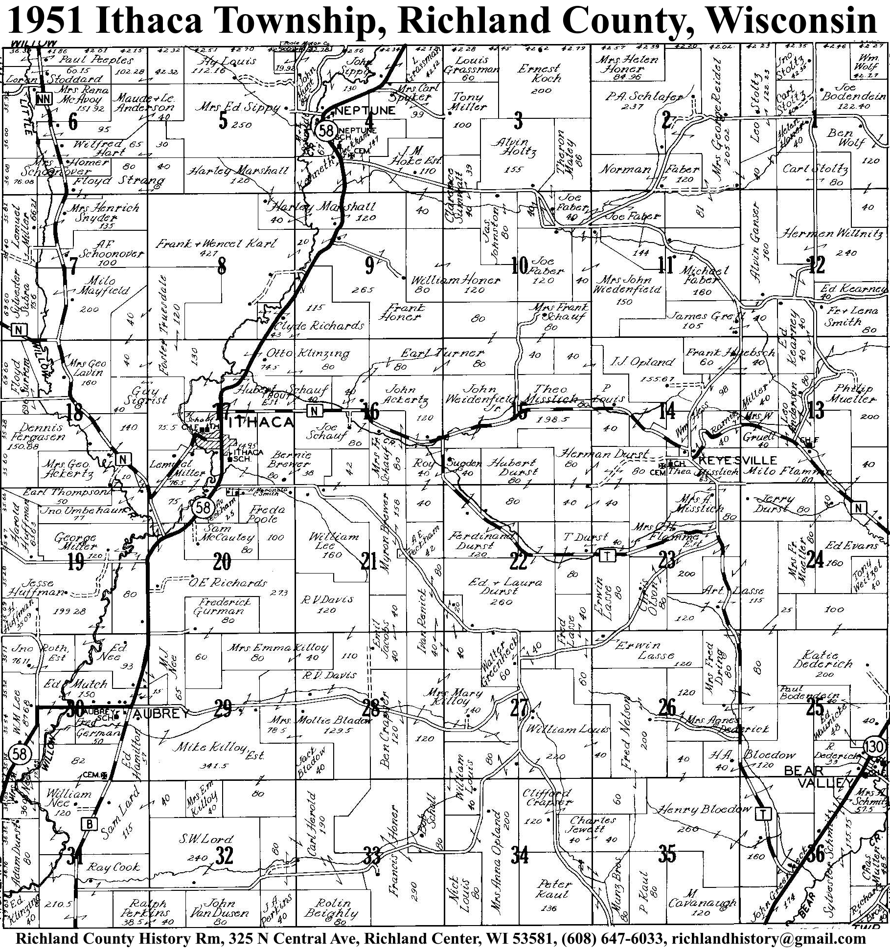
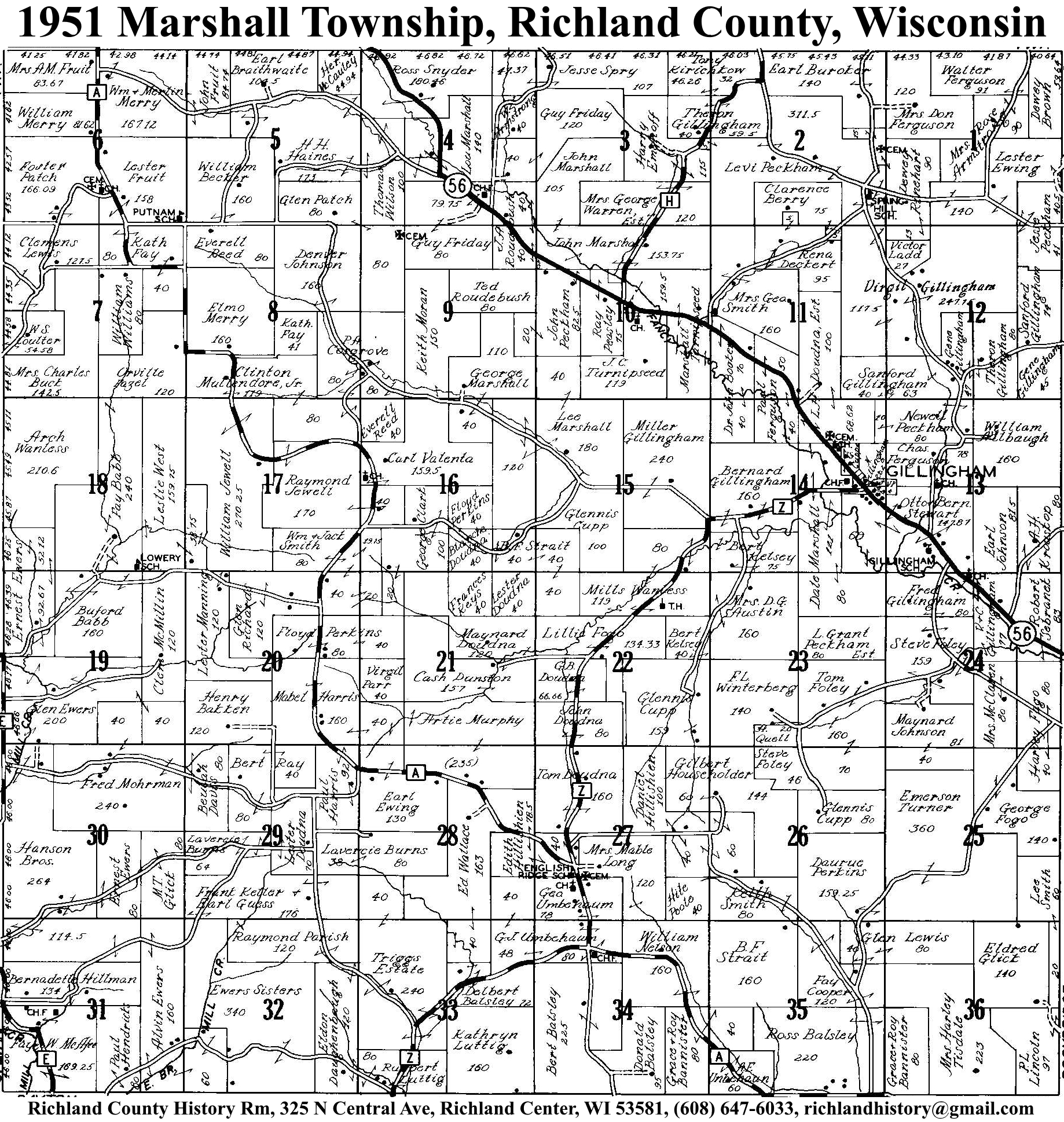
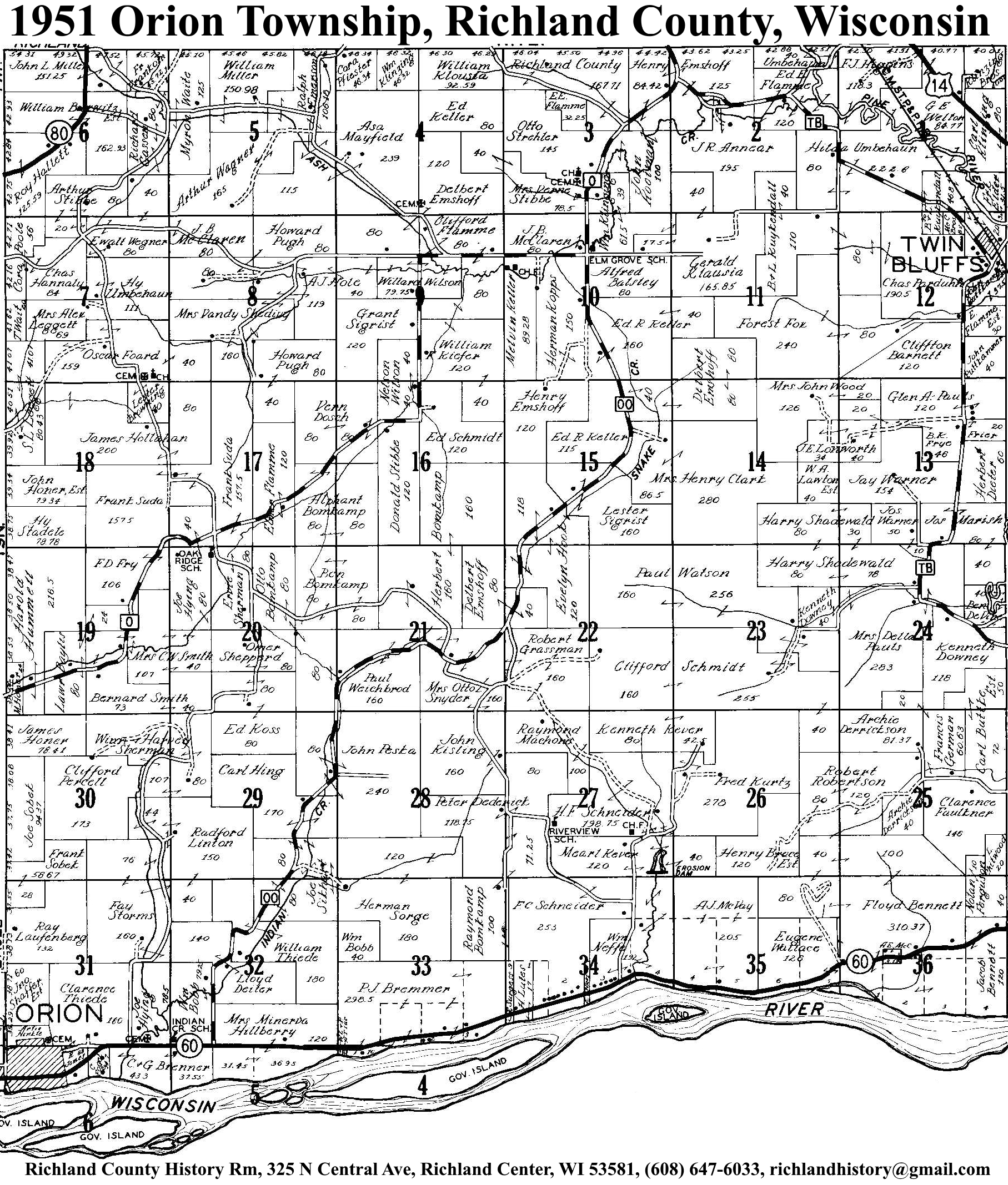
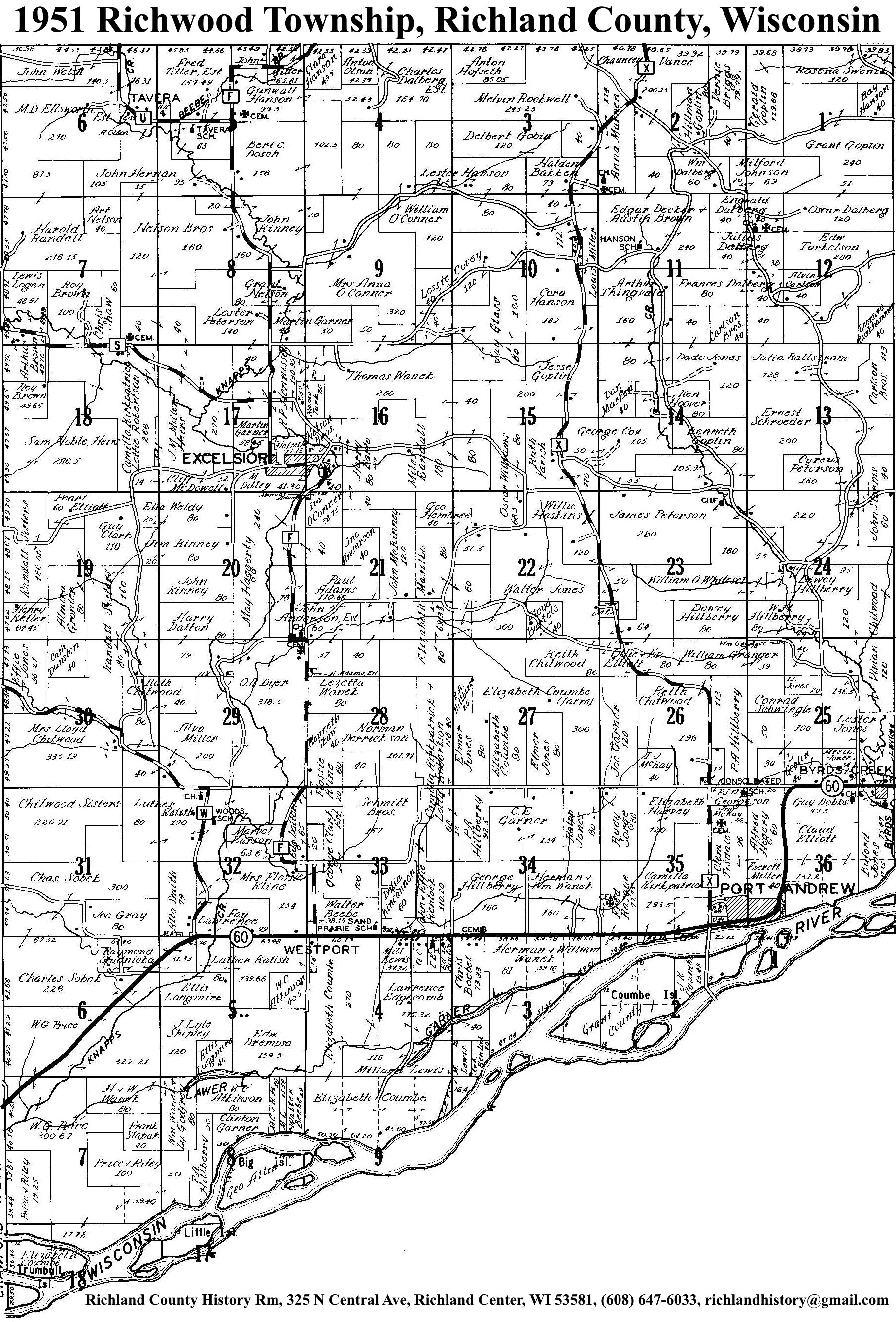
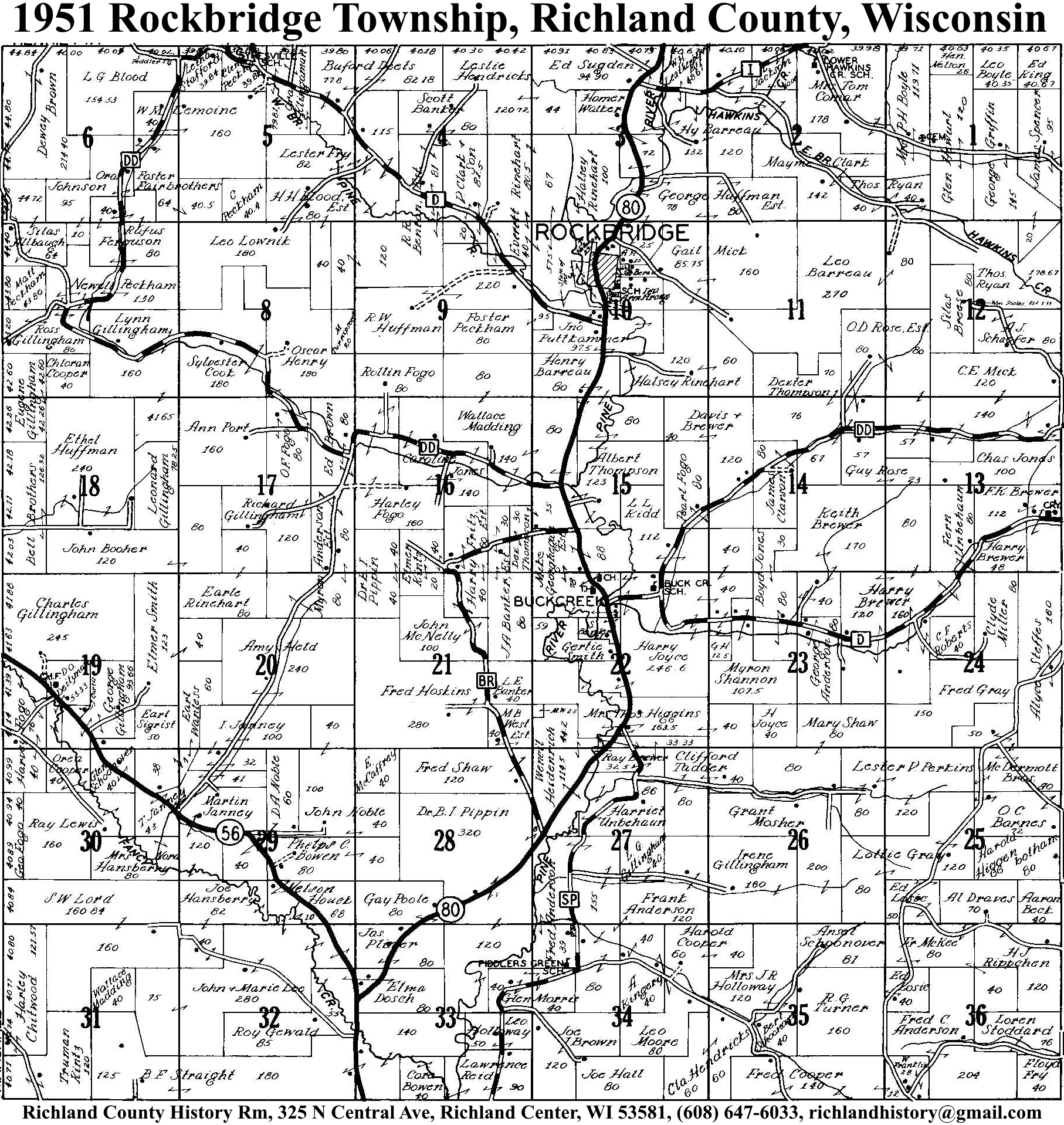
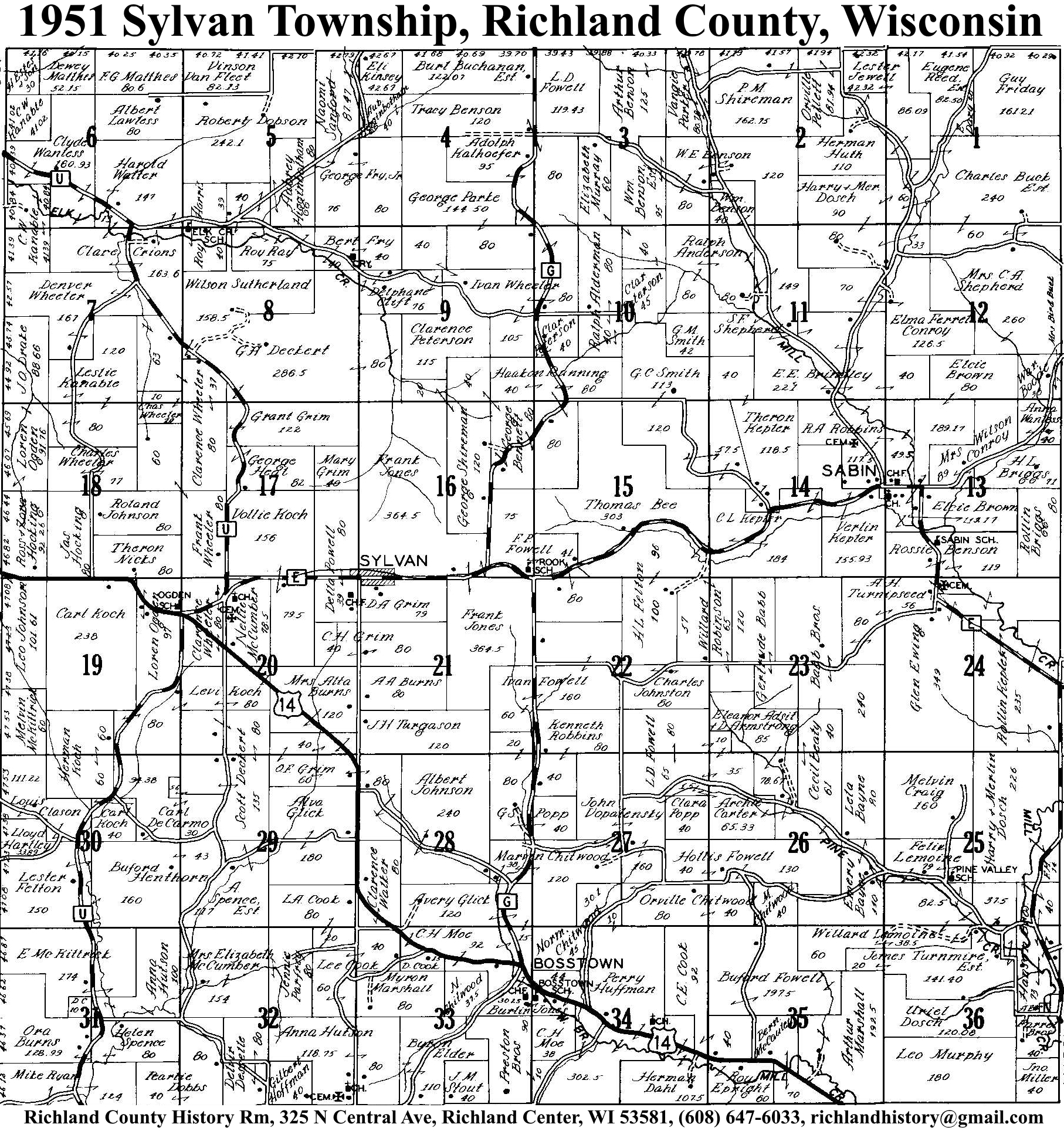
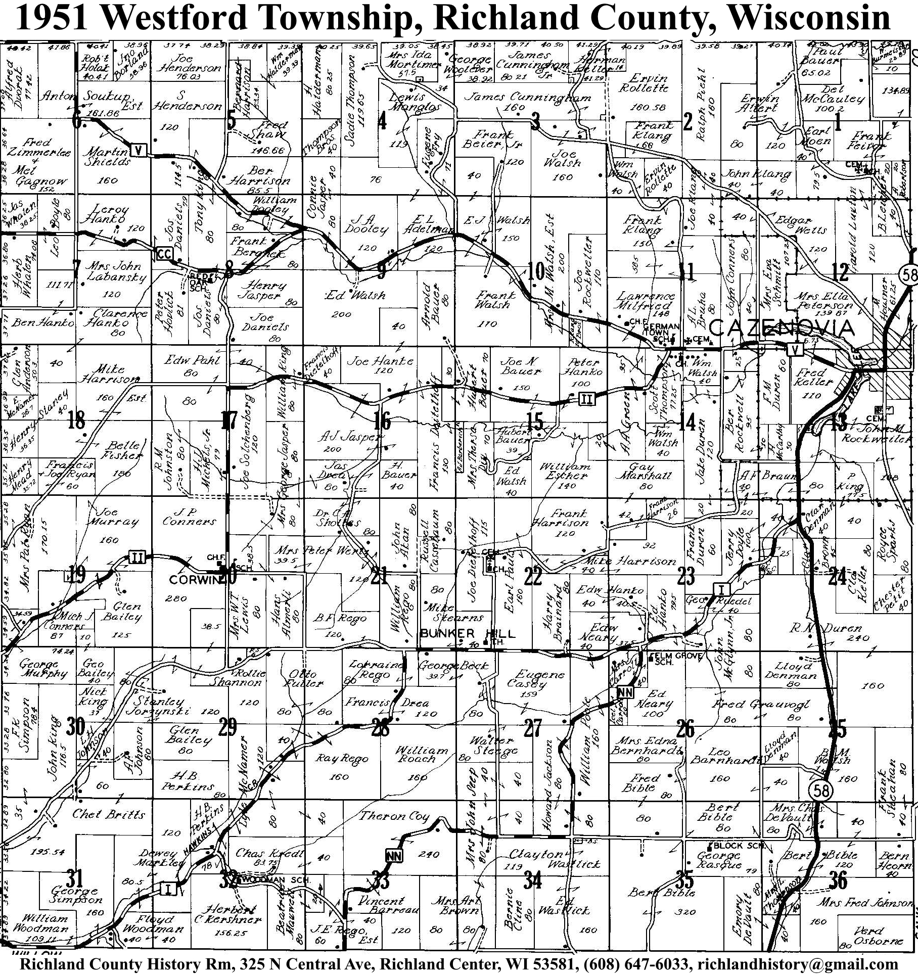
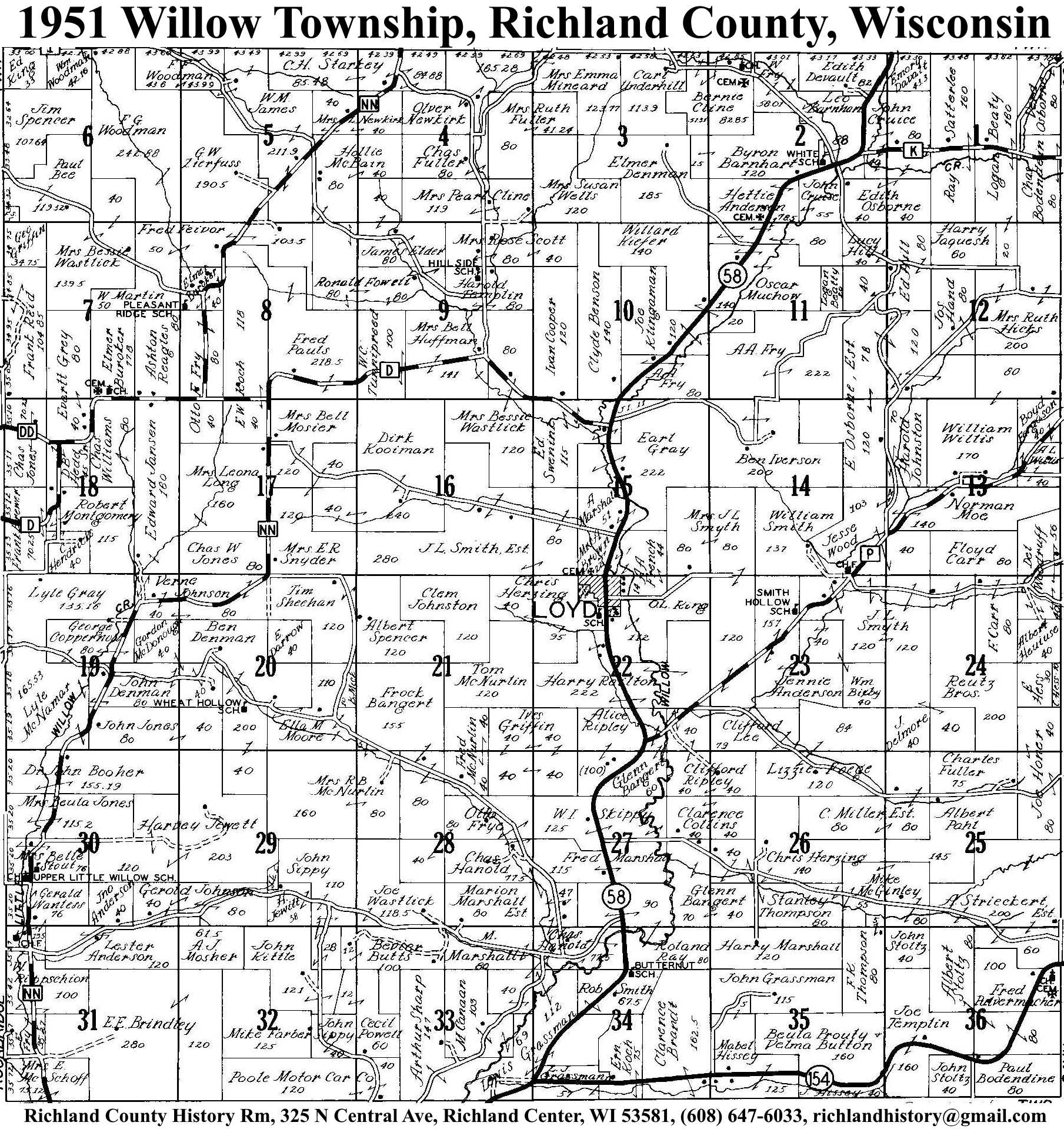
| 1951 | Akan | Bloom | Buena Vista | Dayton | Eagle | Forest | Henrietta | Ithaca | Marshall | Orion | Richland | Richwood | Rockbridge | Sylvan | Westford | Willow |
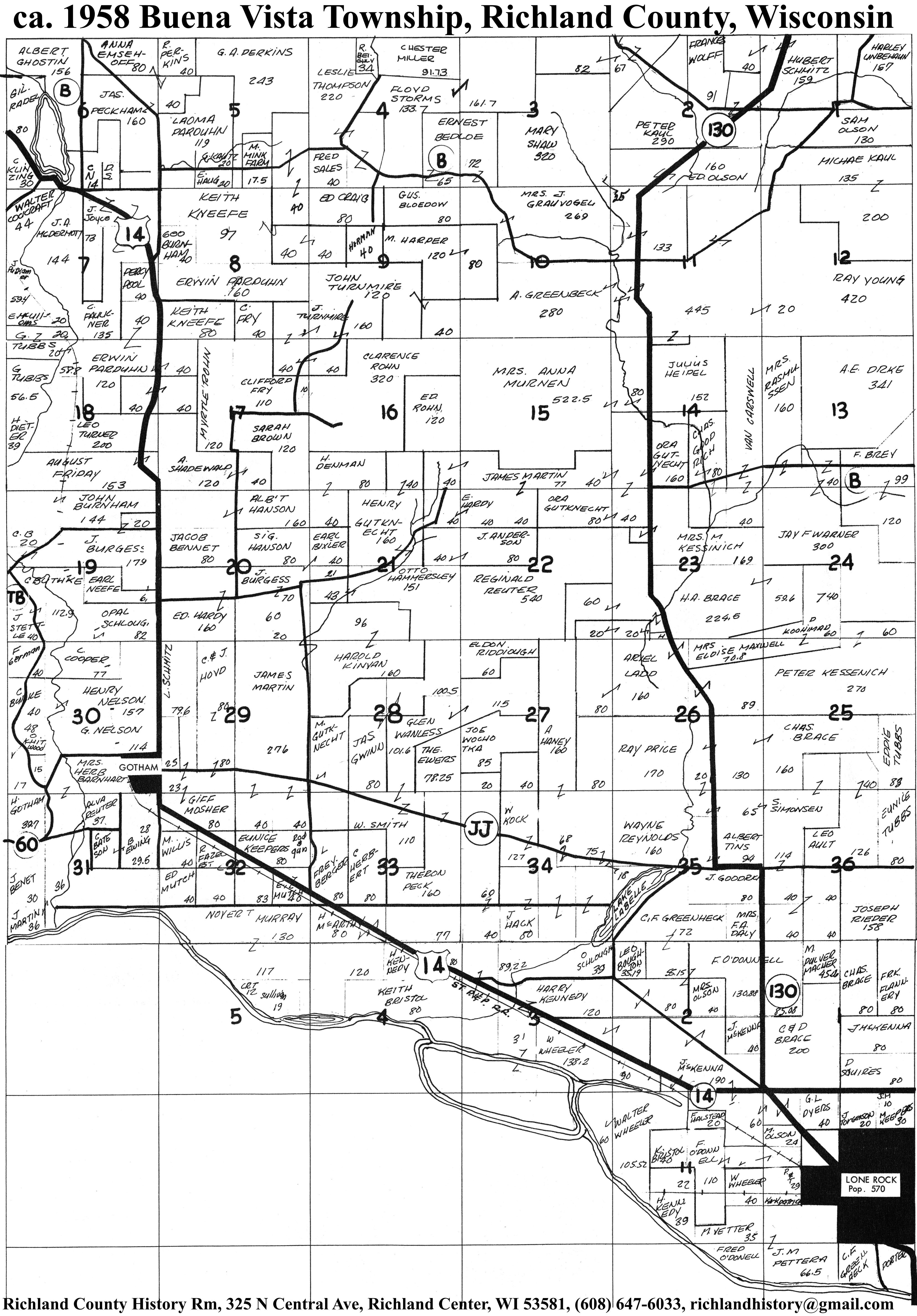
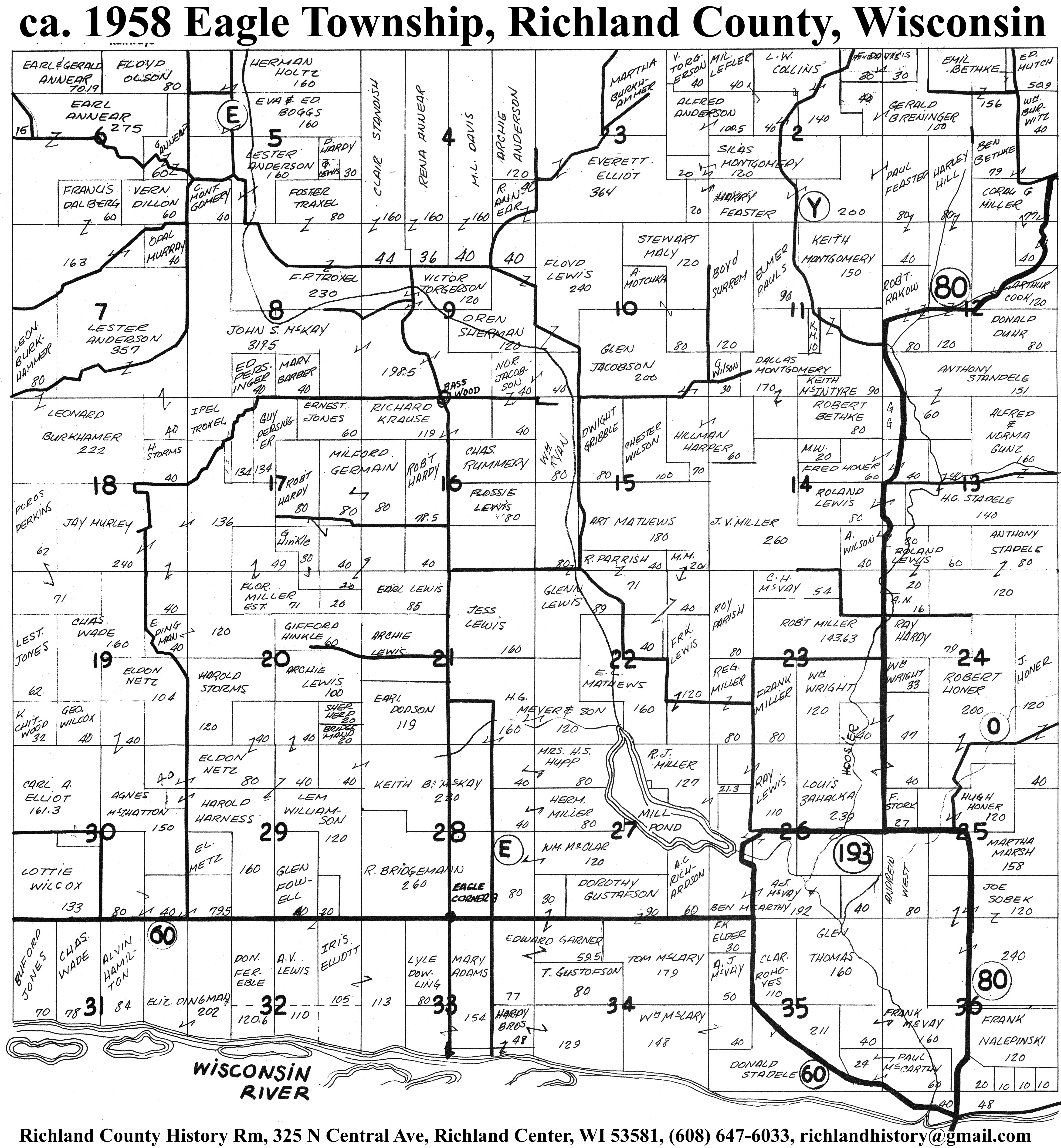
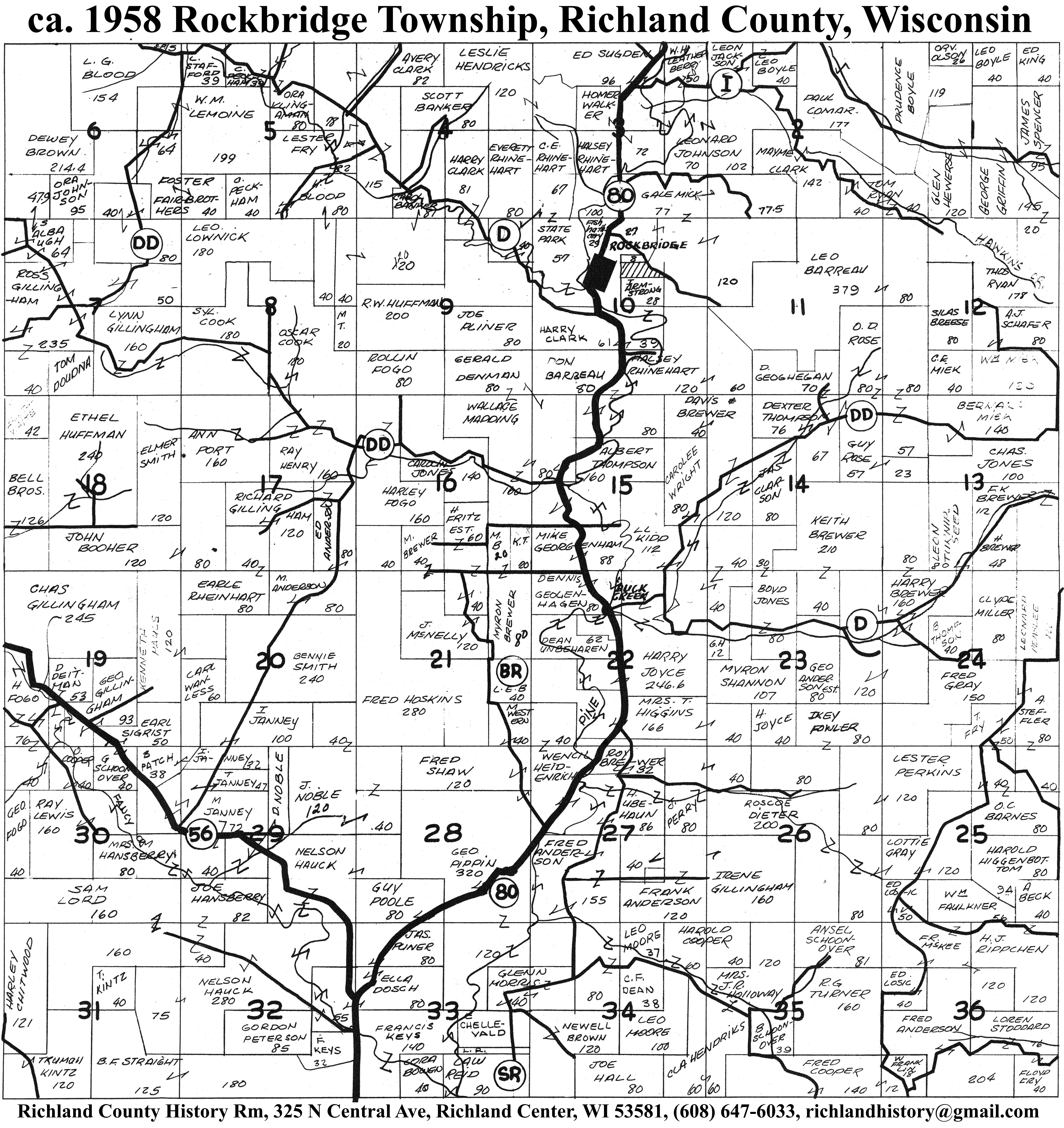
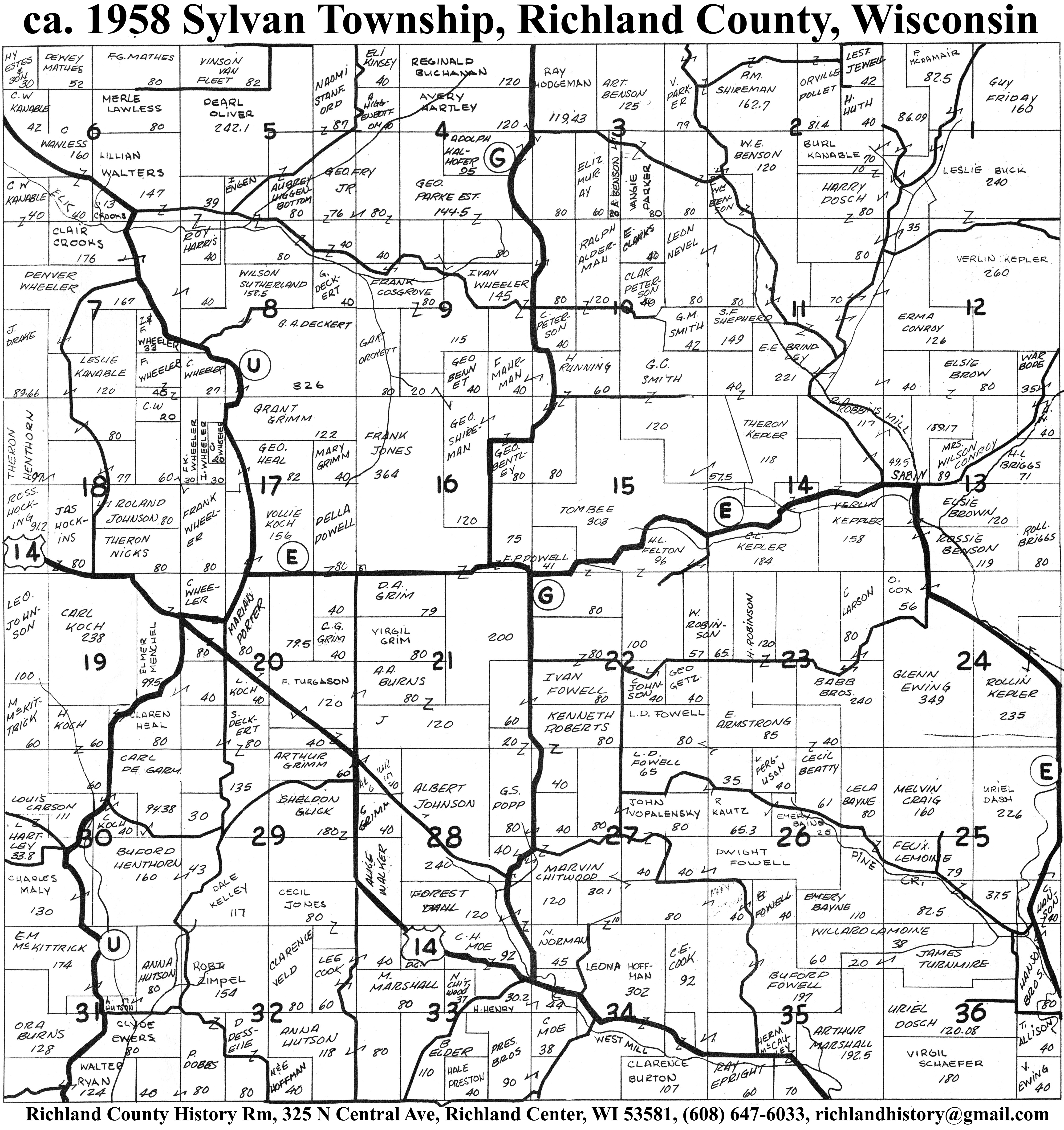
| 1958 | Akan | Bloom | Buena Vista | Dayton | Eagle | Forest | Henrietta | Ithaca | Marshall | Orion | Richland | Richwood | Rockbridge | Sylvan | Westford | Willow |
| 1961 | ||||||||||||||||
| 1965 | Unavailable online due to copyright | |||||||||||||||
| 1968 | ||||||||||||||||
| 1972 | ||||||||||||||||
| 1983 | ||||||||||||||||
| 1987 | ||||||||||||||||
| 1989 | ||||||||||||||||
| 1991 | ||||||||||||||||
| 1994 | ||||||||||||||||
| 1997 | ||||||||||||||||
| 1999 | ||||||||||||||||
| 2003 | ||||||||||||||||
| 2005 | ||||||||||||||||
| 2007 | ||||||||||||||||
| 2009 | ||||||||||||||||
| Village Maps | ||||
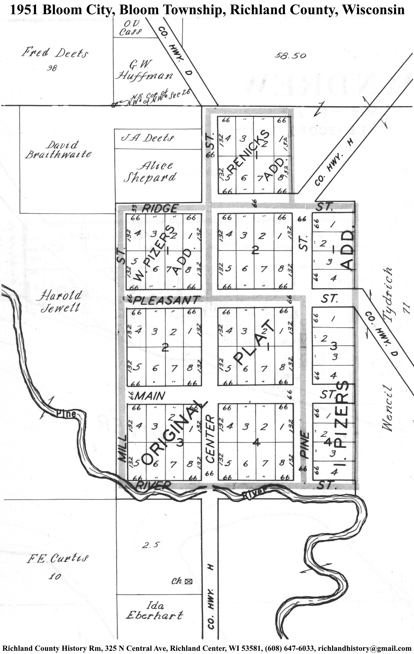
| Bloom City | 1895 | 1919 | 1951 | |
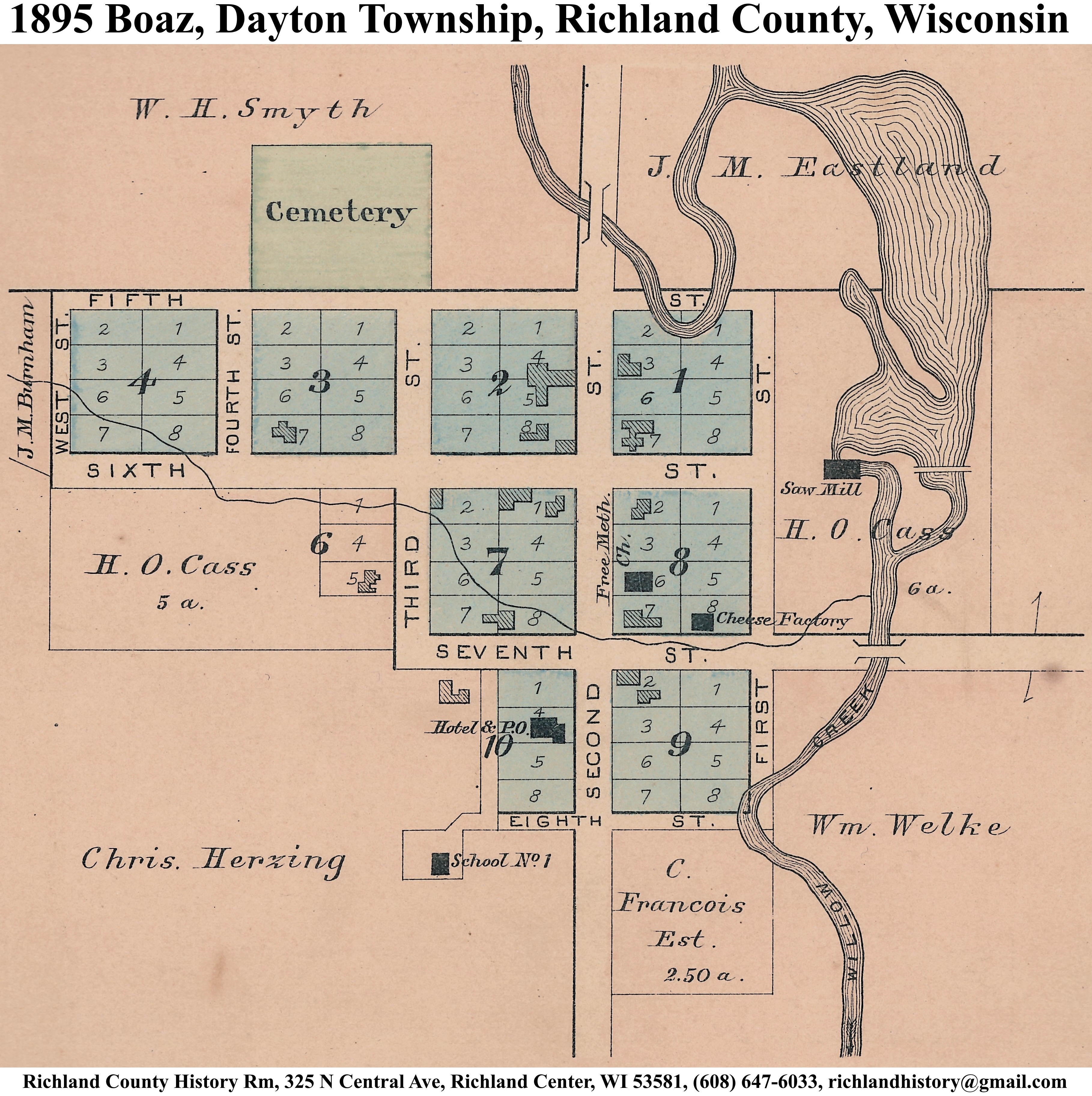
| Boaz | 1895 | 1919 | 1951 | |
| Buck Creek | 1895 | |||
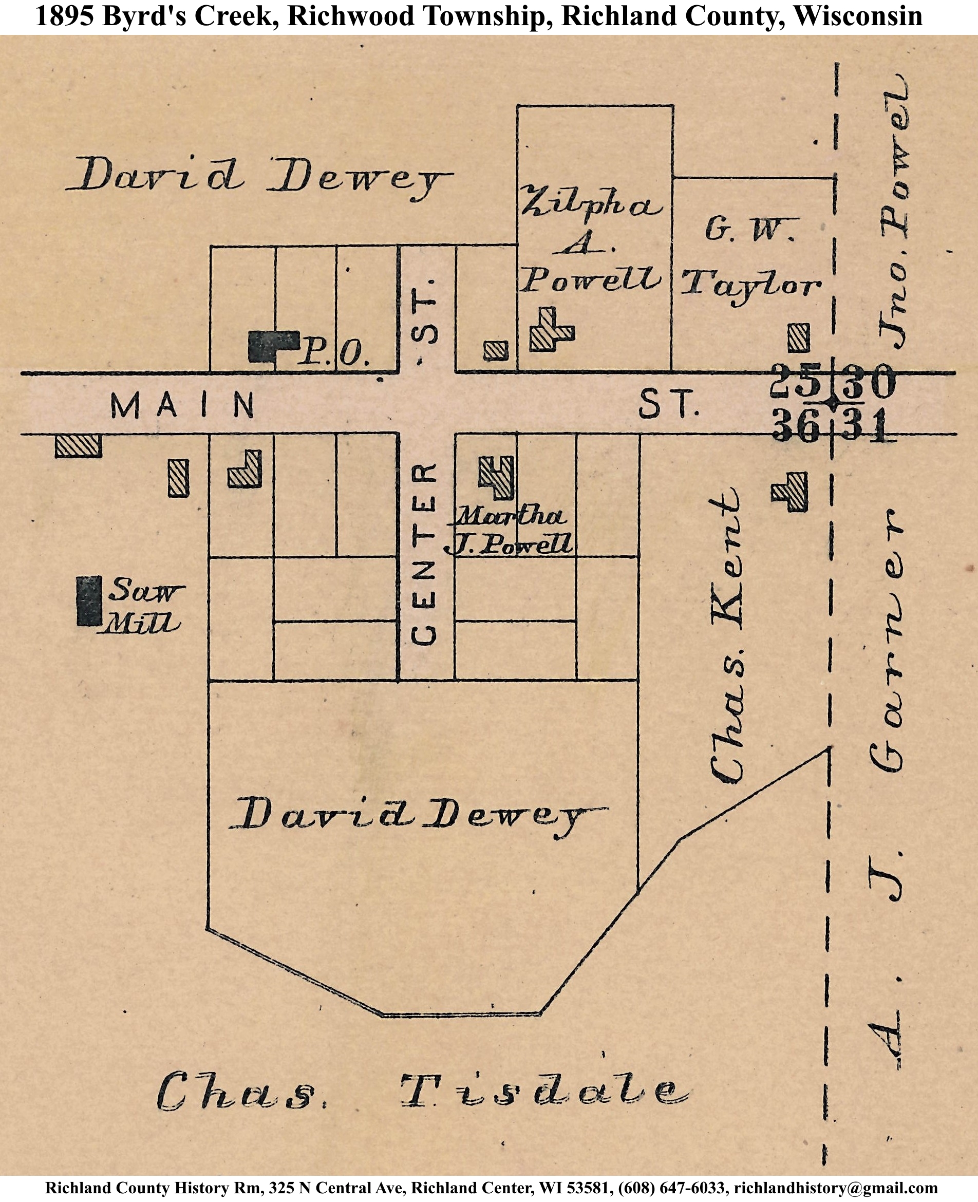
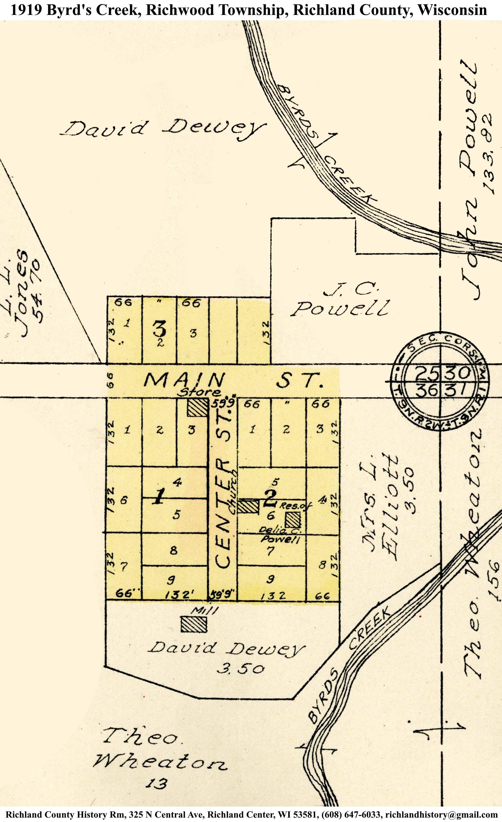
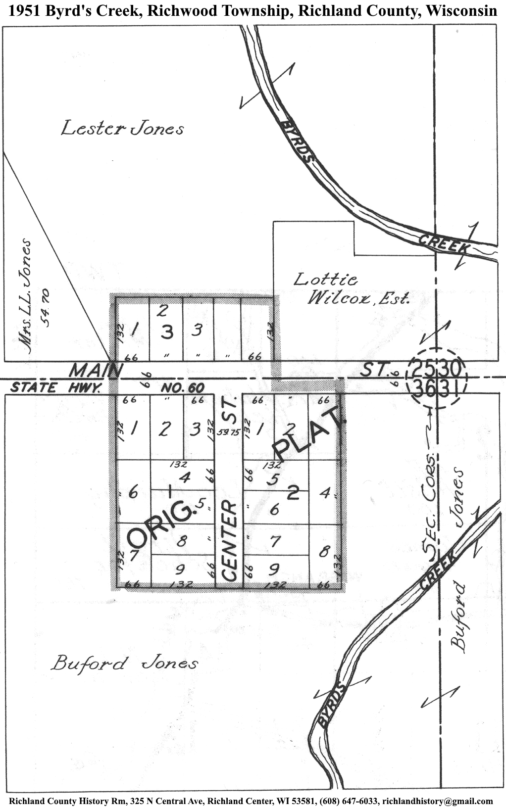
| Byrd's Creek | 1895 | 1919 | 1951 | |
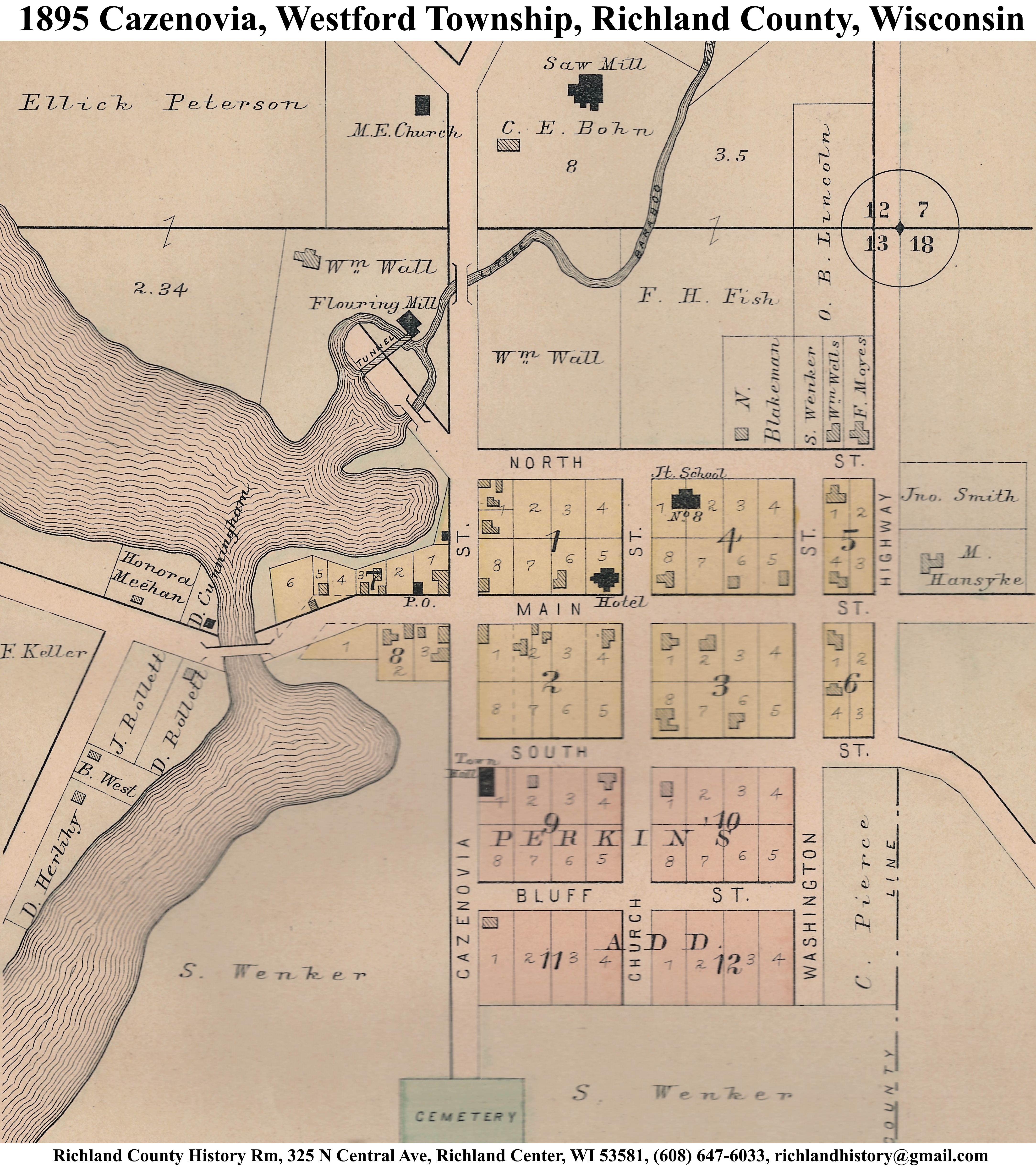
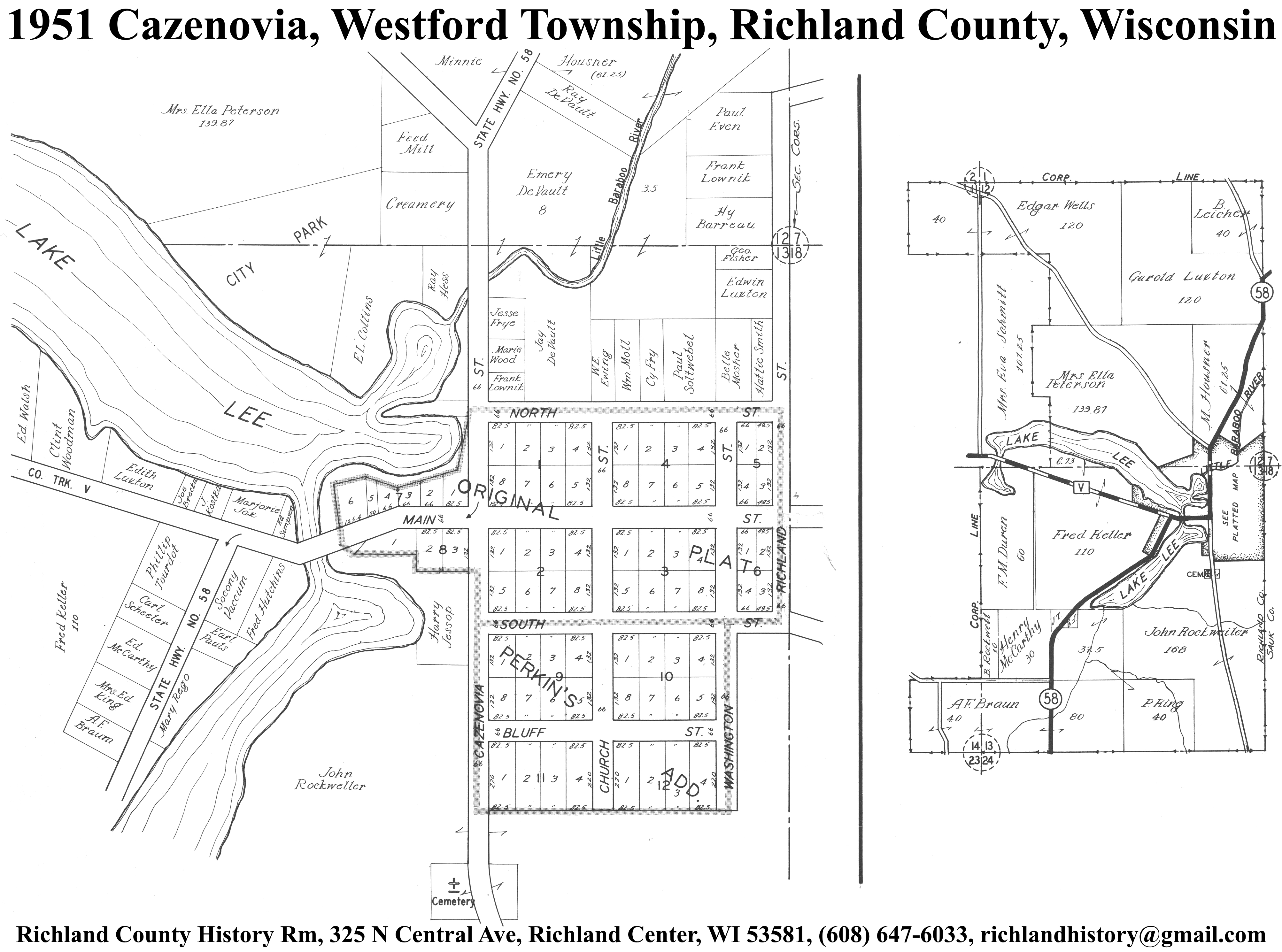
| Cazenovia | 1895 | 1919 | 1951 | |
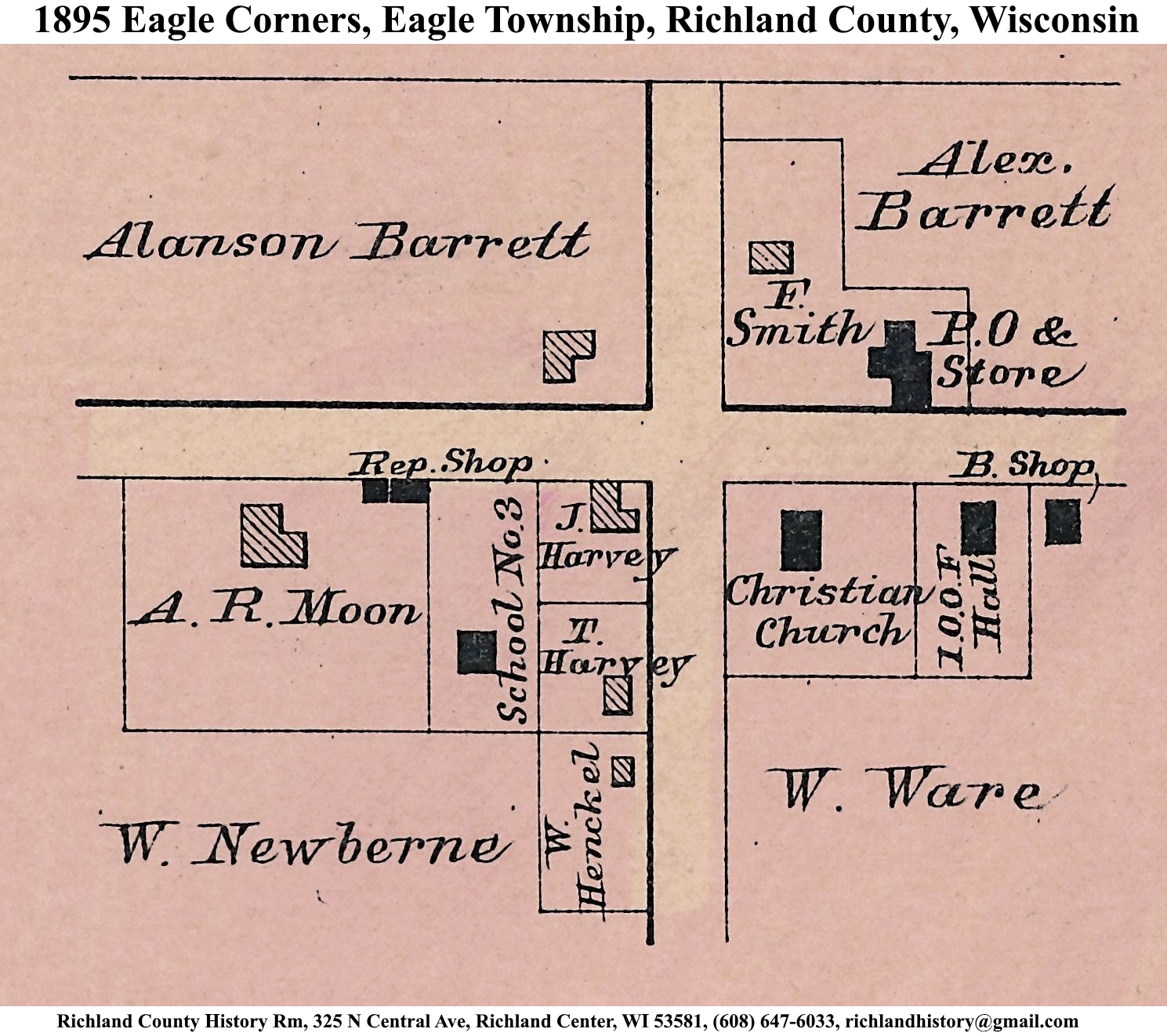
| Eagle Corners | 1895 | |||
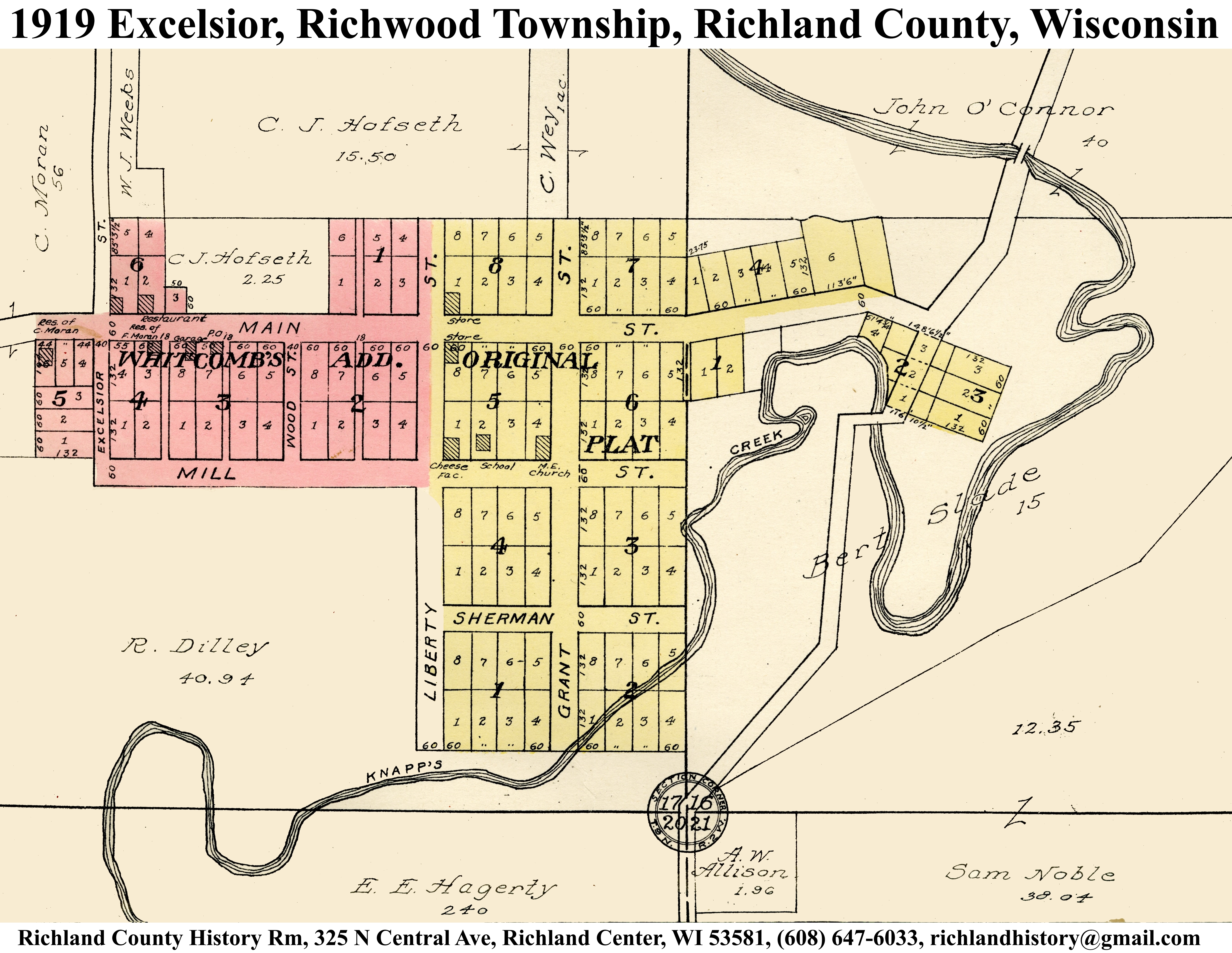
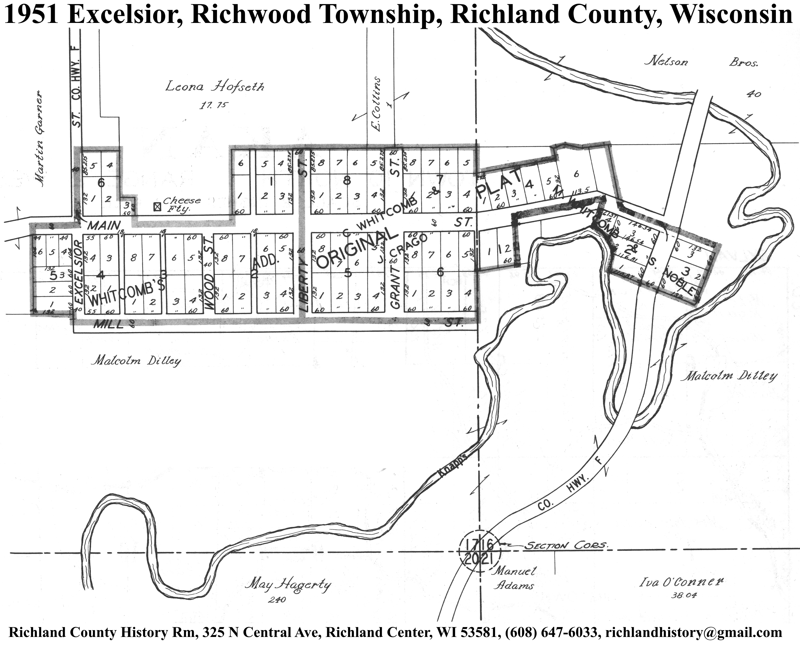
| Excelsior | 1895 | 1919 | 1951 | |
| Gotham | 1895 | 1919 | 1951 | |
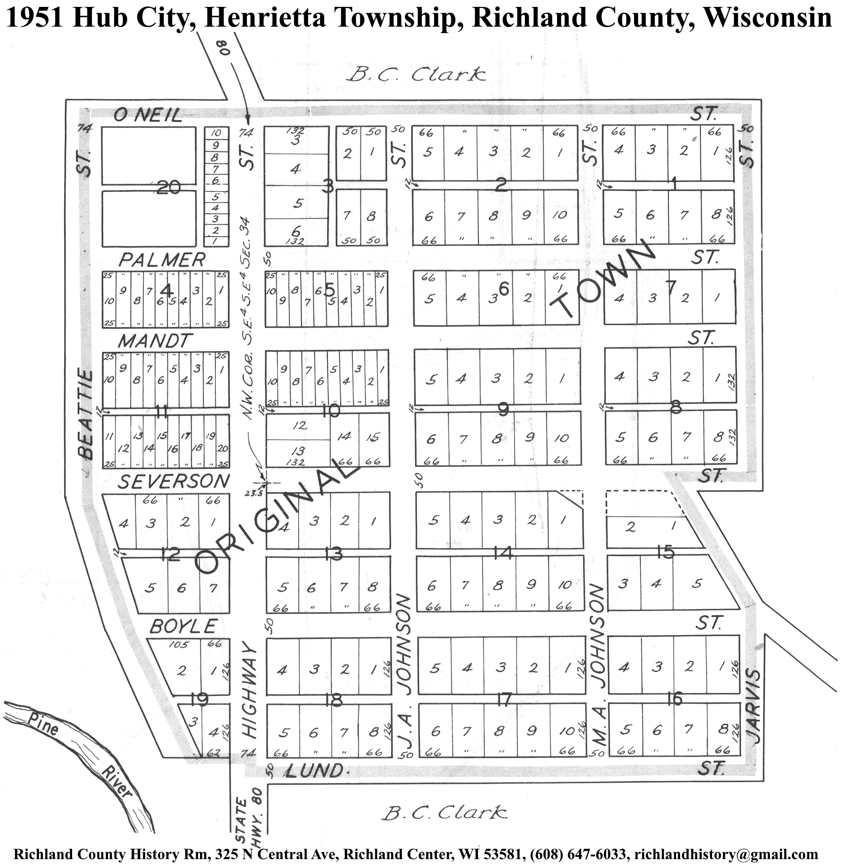
| Hub City | 1895 | 1919 | 1951 | |
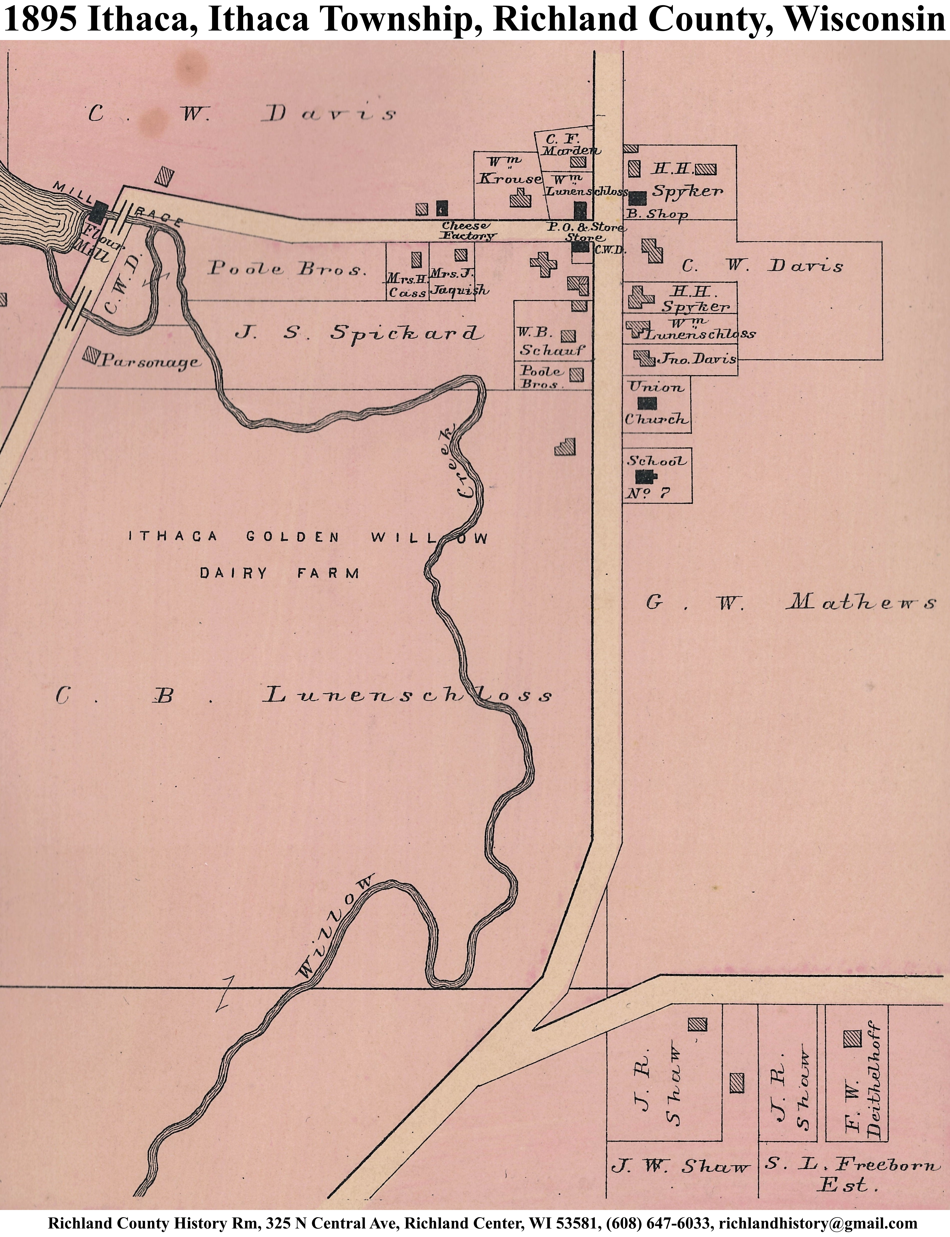
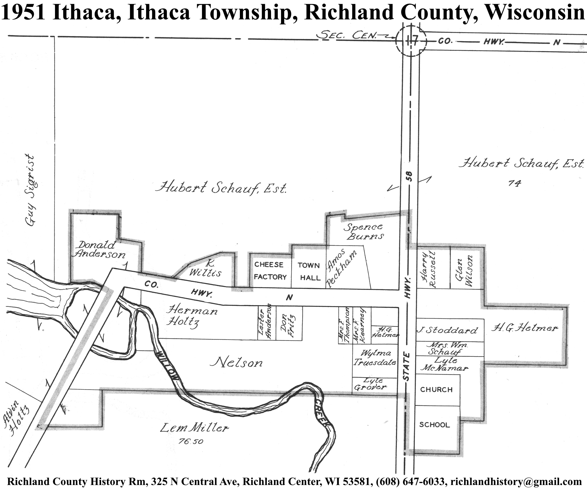
| Ithaca | 1895 | 1919 | 1951 | |
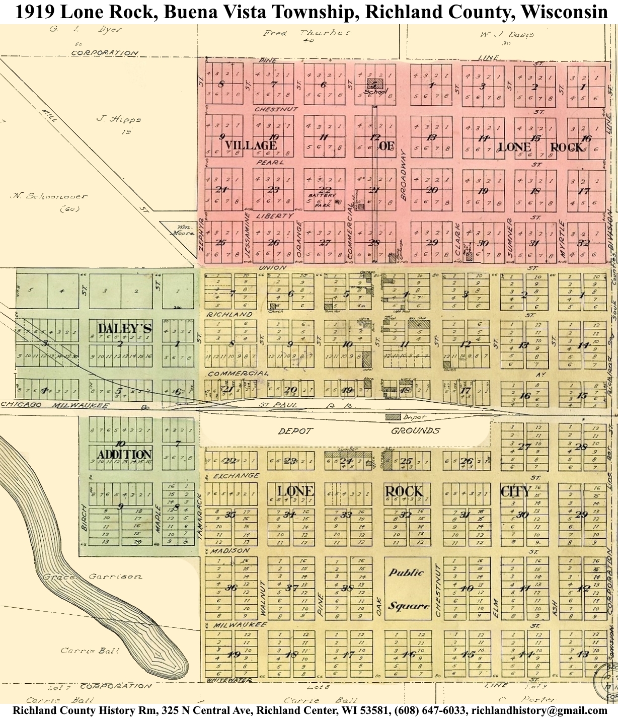
| Lone Rock | 1895 | 1919 | 1951 | |
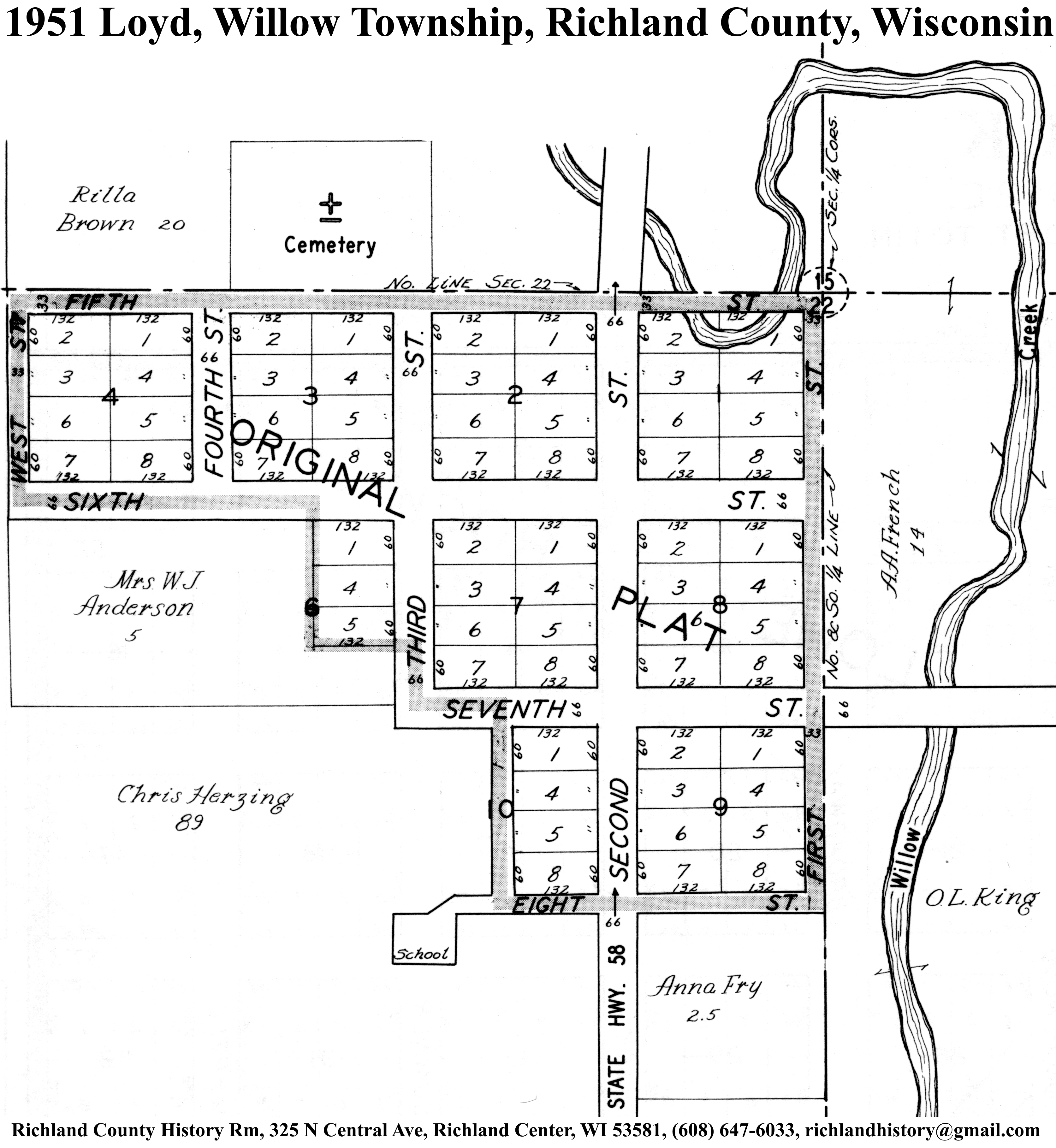
| Loyd | 1895 | 1919 | 1951 | |
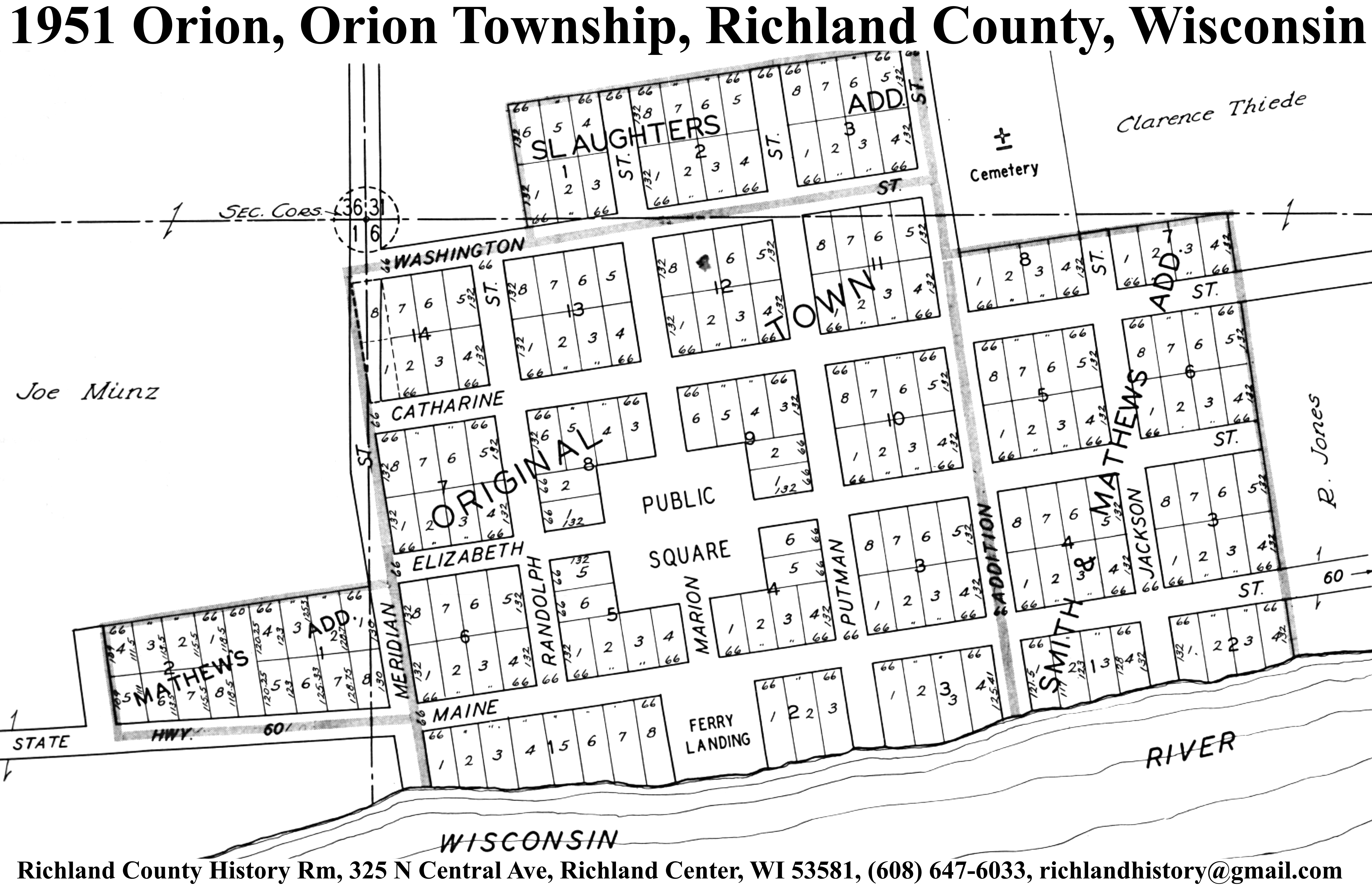
| Orion/Richmond | 1851 | 1895 | 1919 | 1951 |
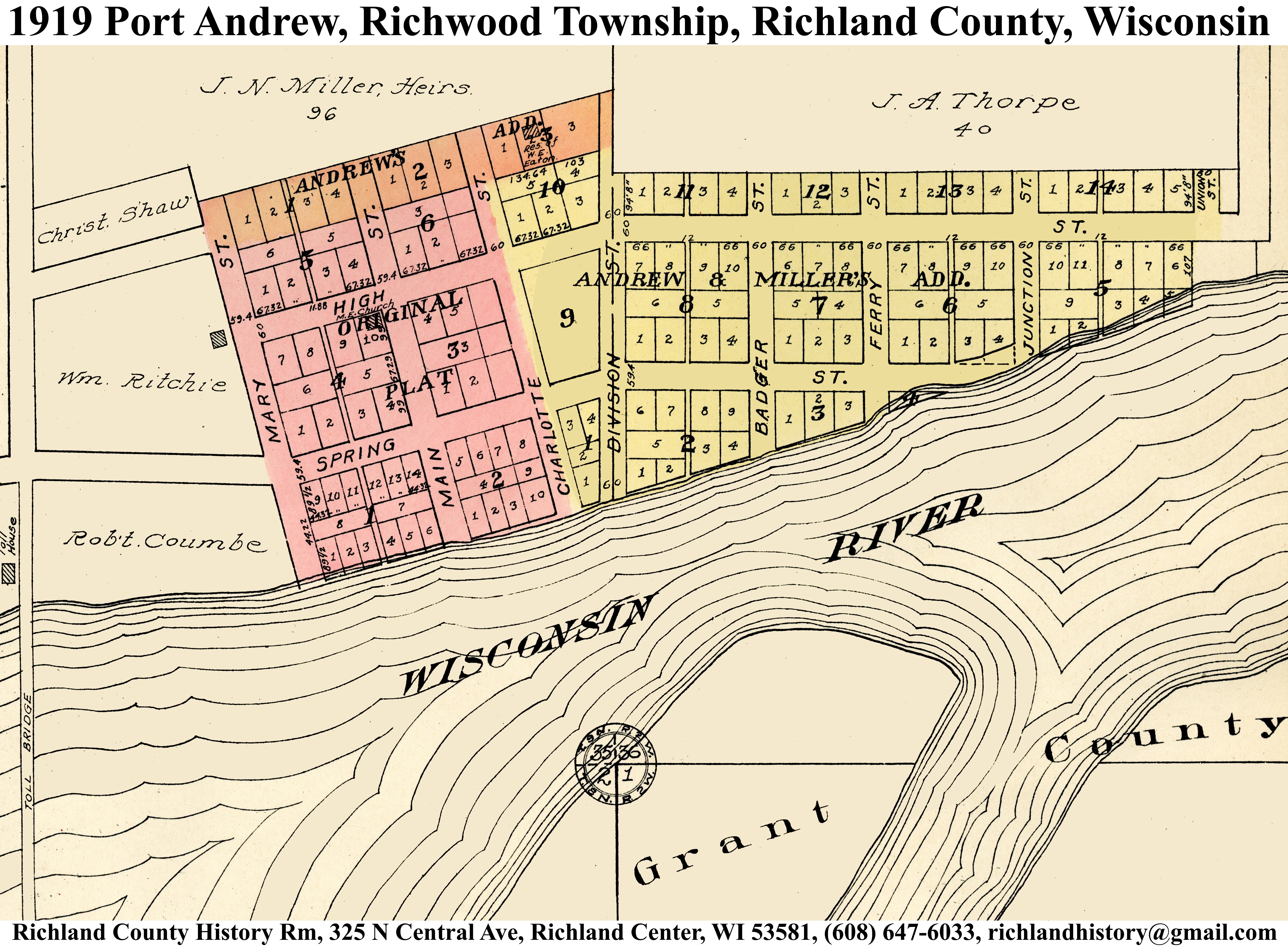
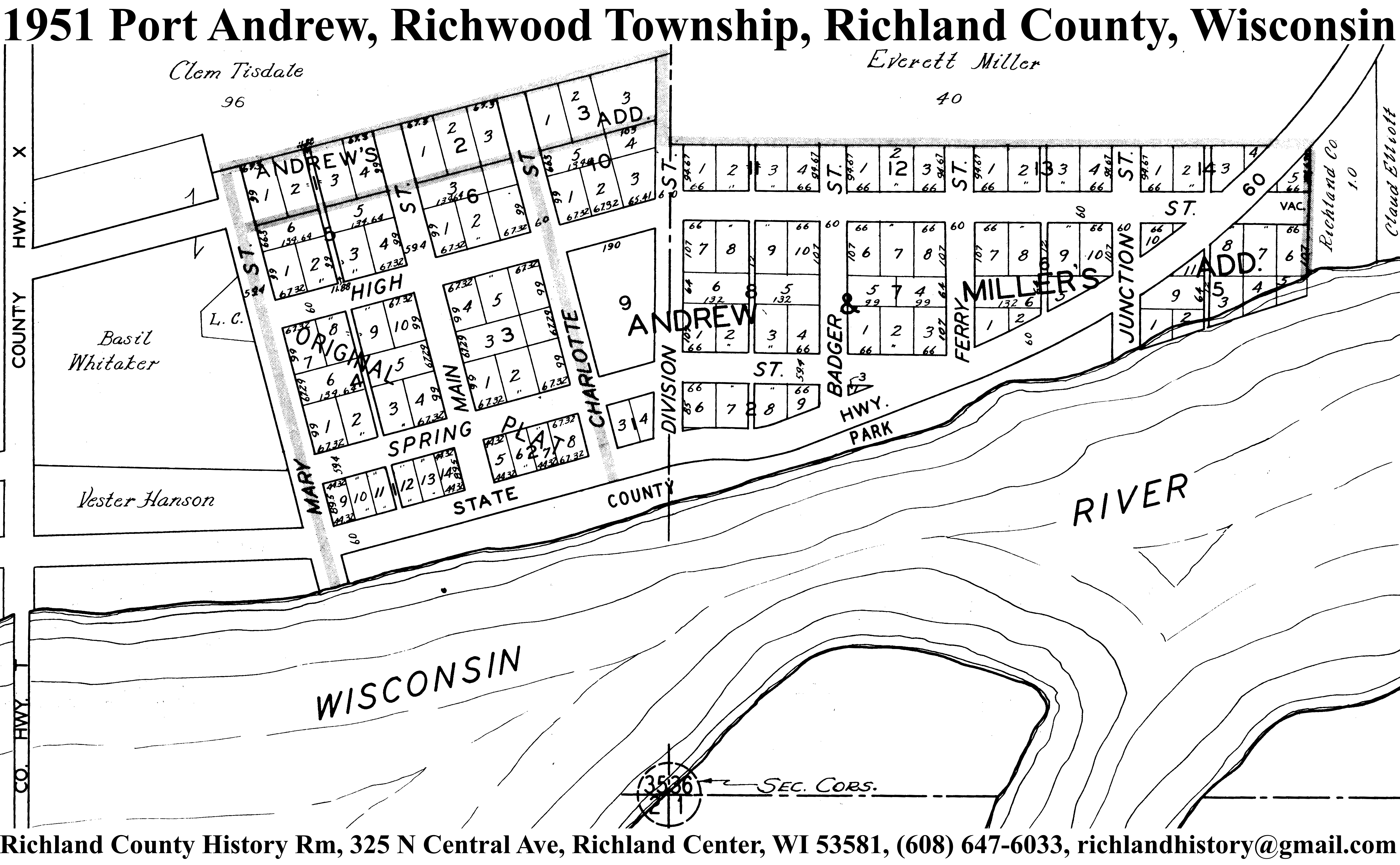
| Port Andrew | 1895 | 1919 | 1951 | |
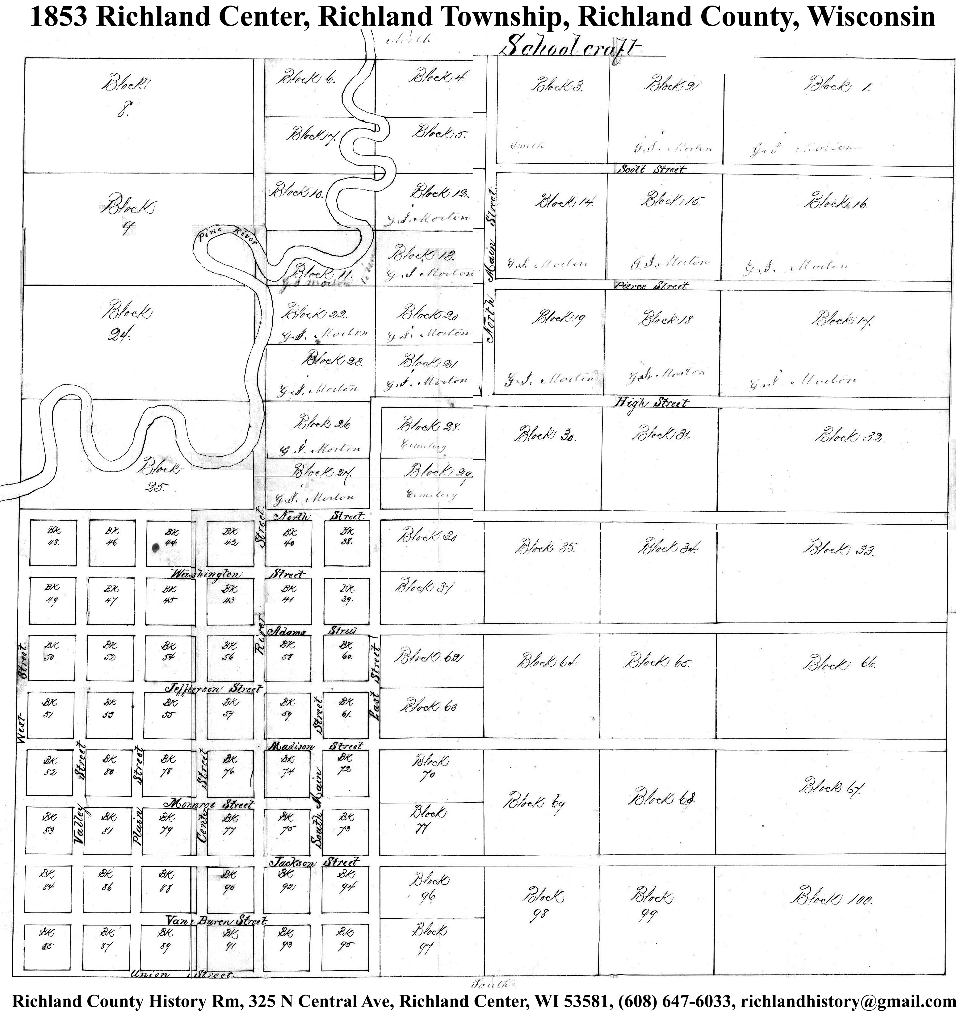
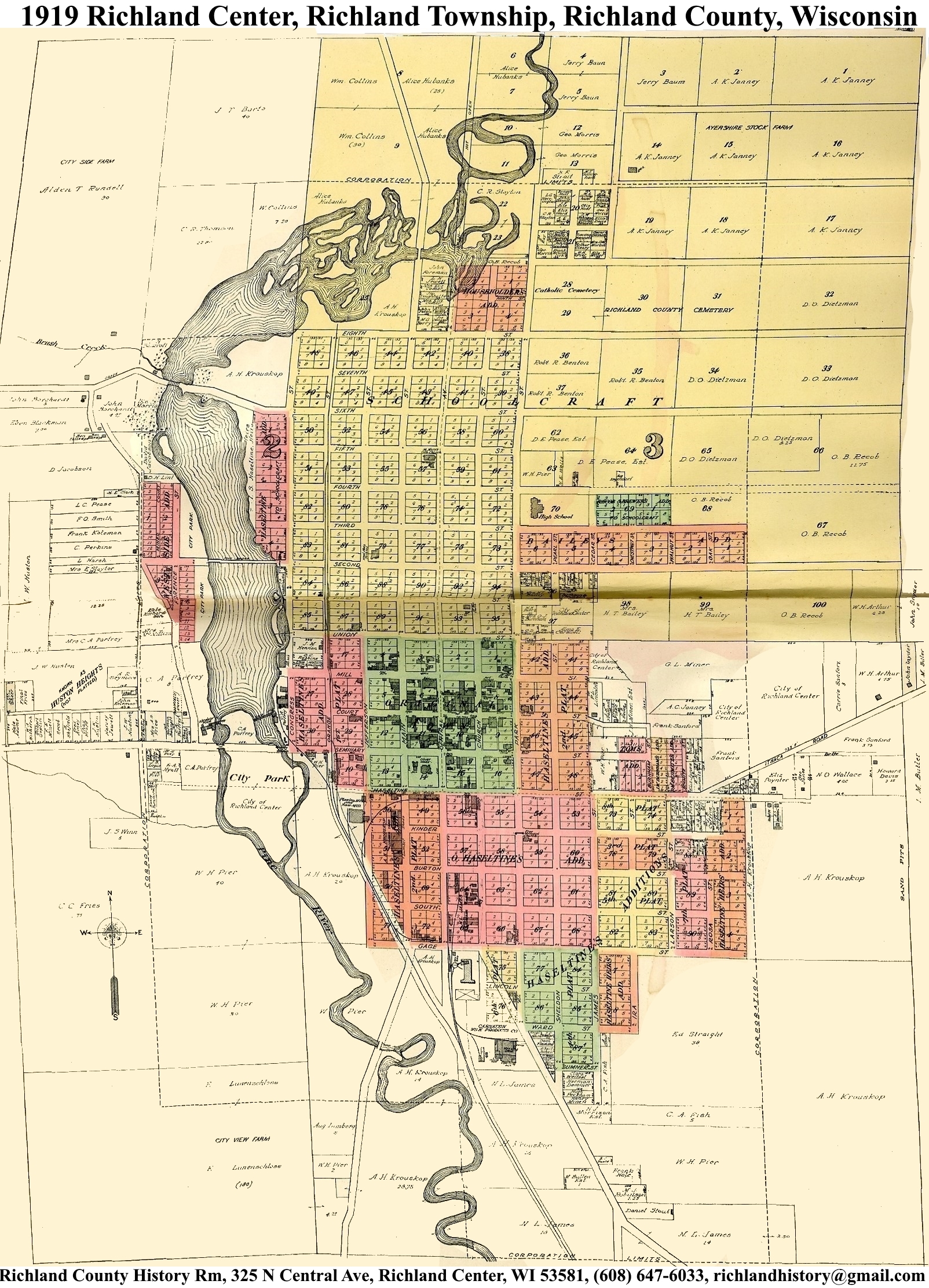
| Richland Center | 1853 | 1895 | 1919 | 1951 |
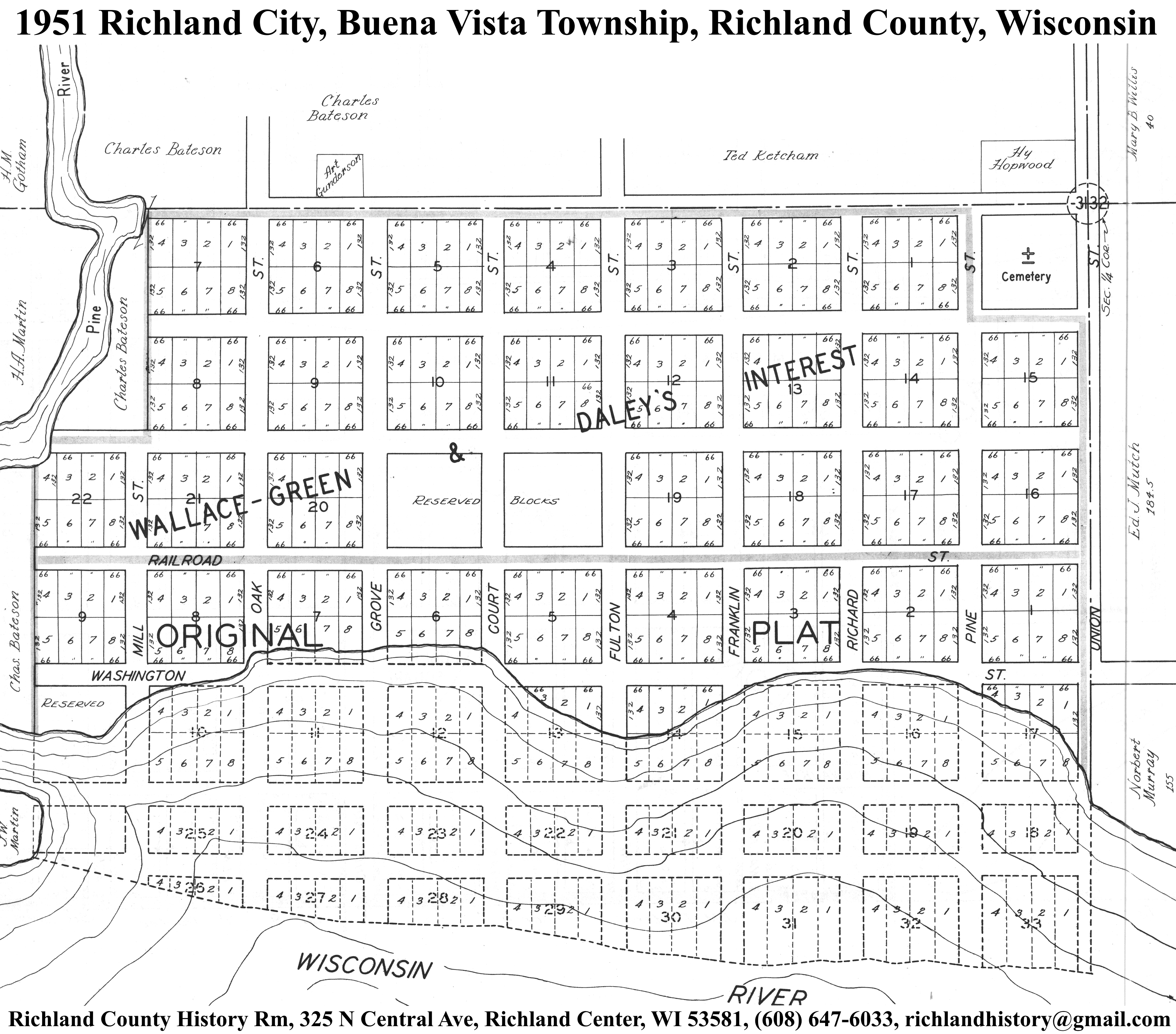
| Richland City | 1895 | 1919 | 1951 | |
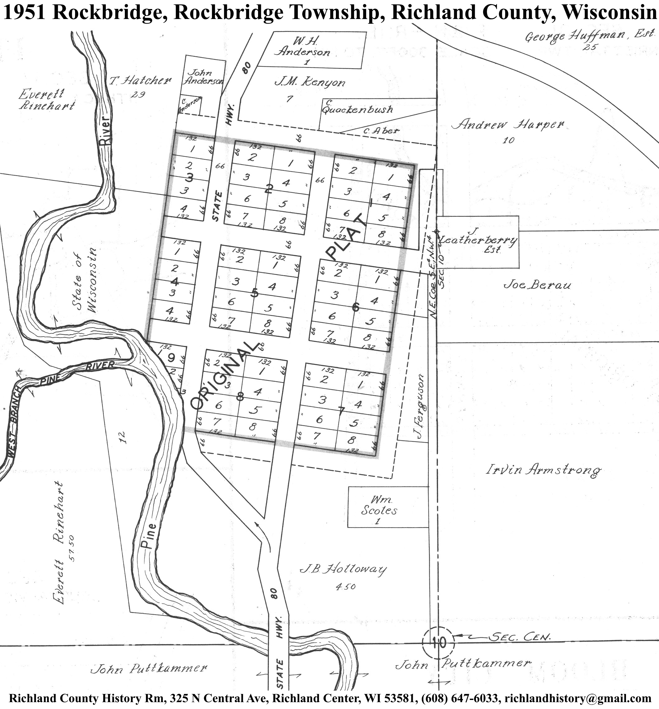
| Rockbridge | 1895 | 1919 | 1951 | |
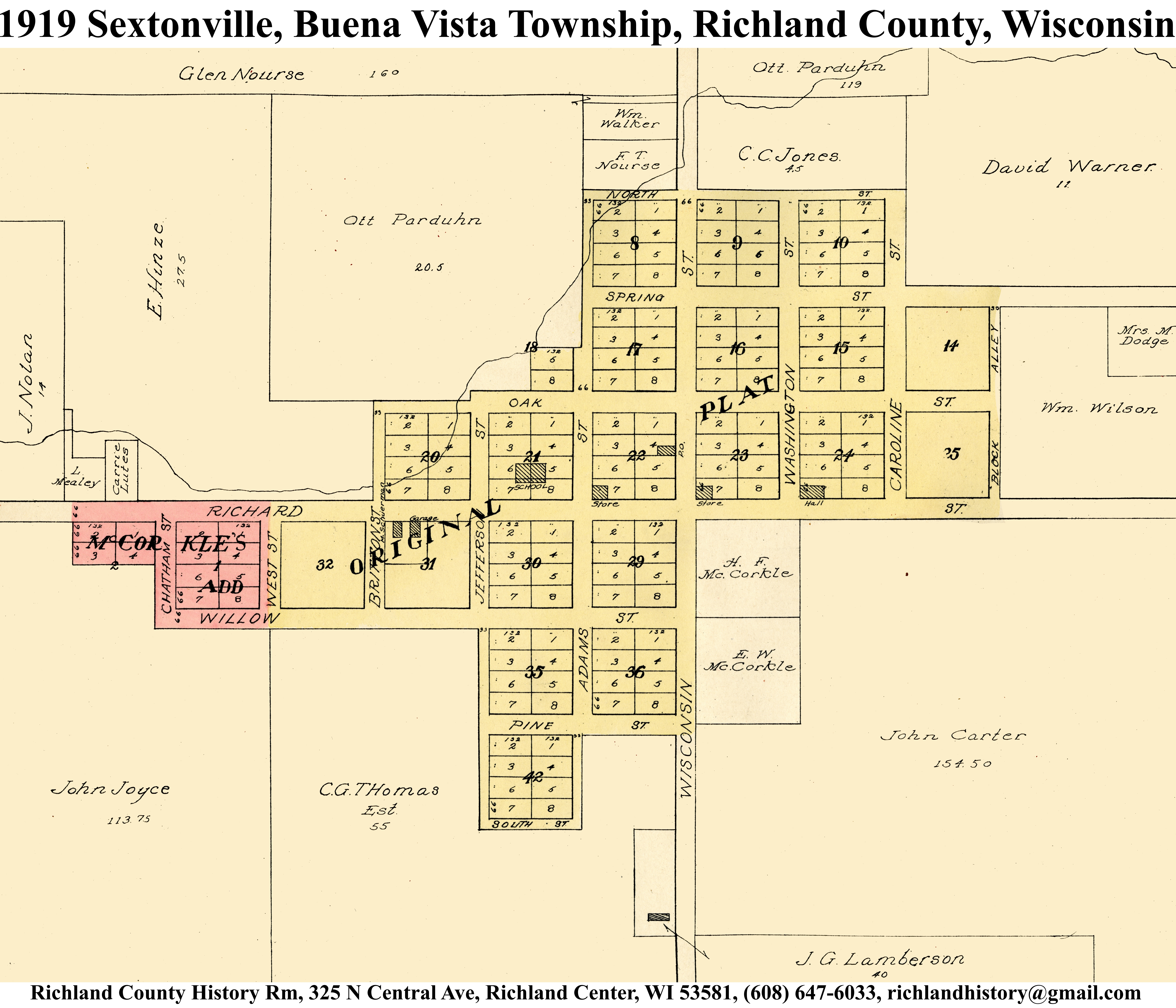
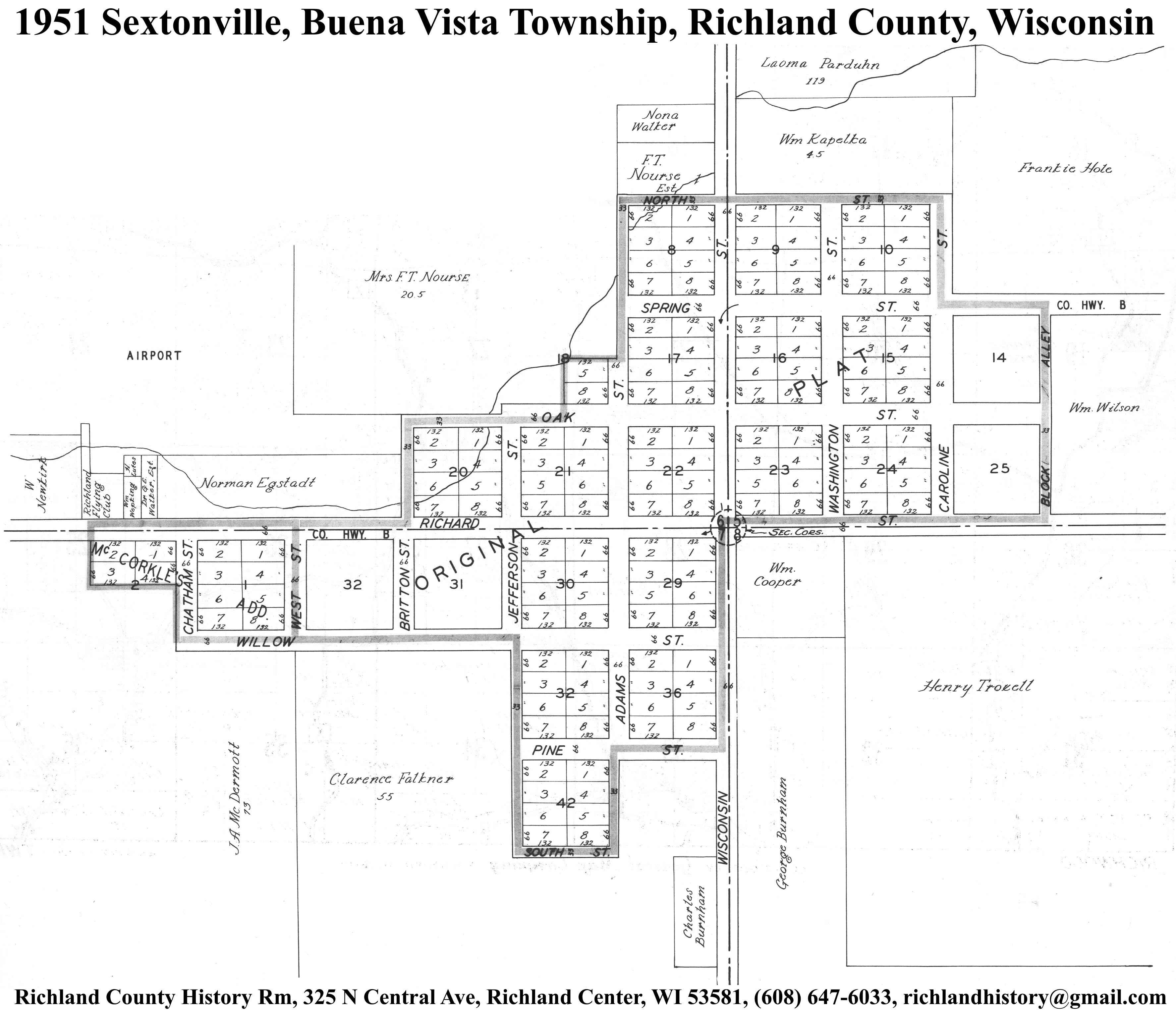
| Sextonville | 1895 | 1919 | 1951 | |
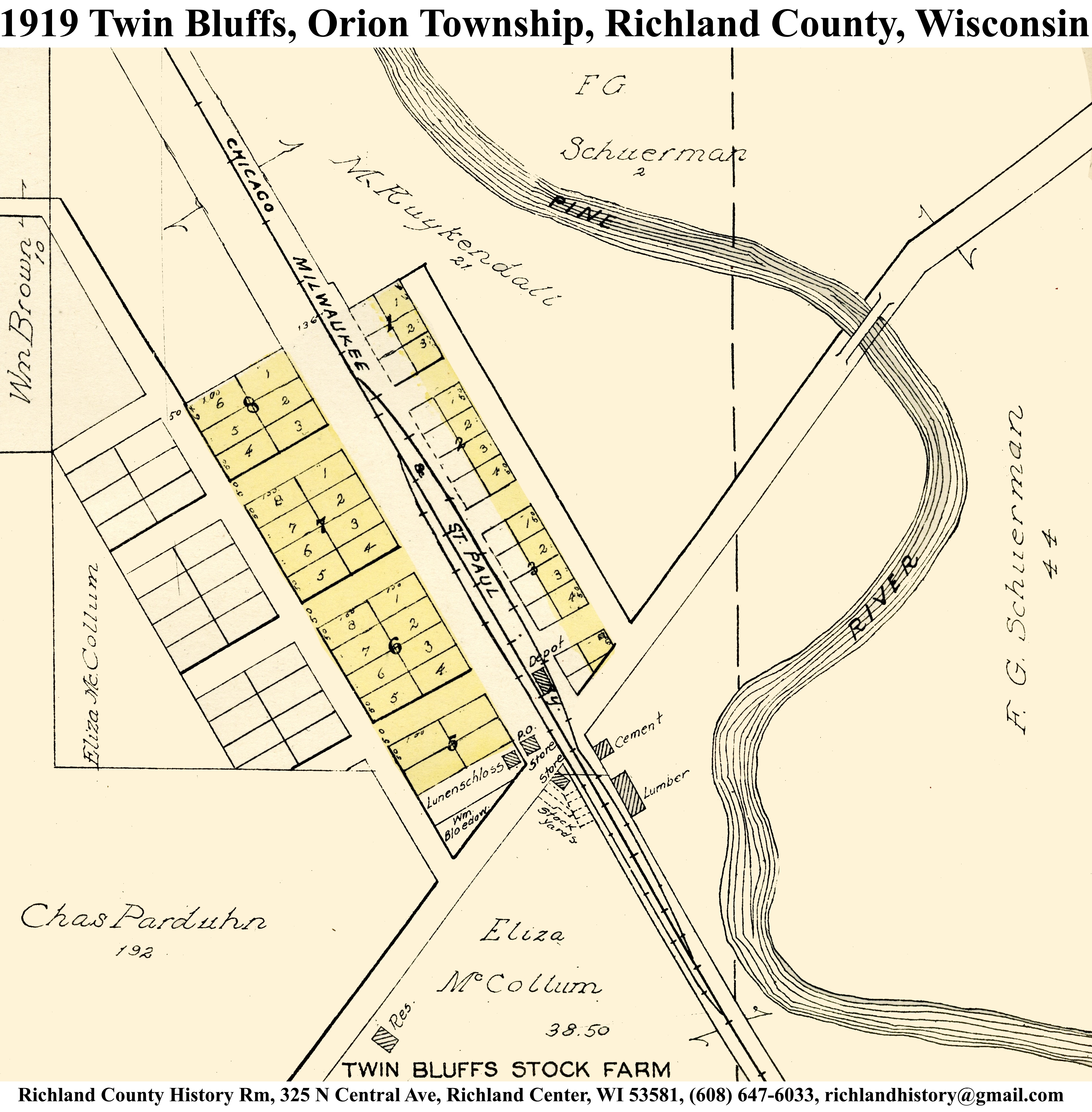
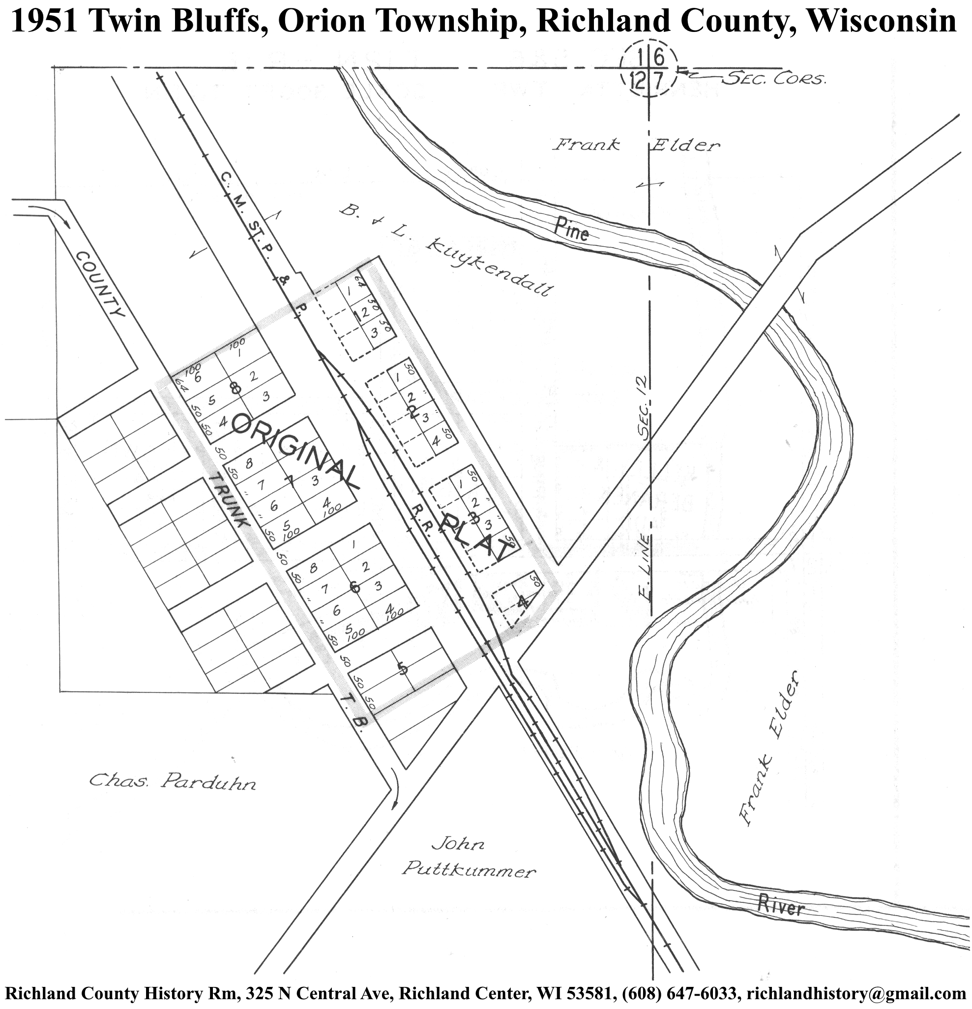
| Twin Bluffs | 1895 | 1919 | 1951 | |
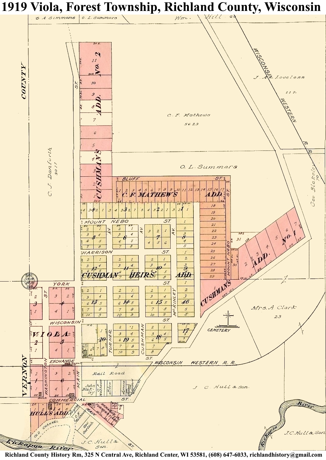
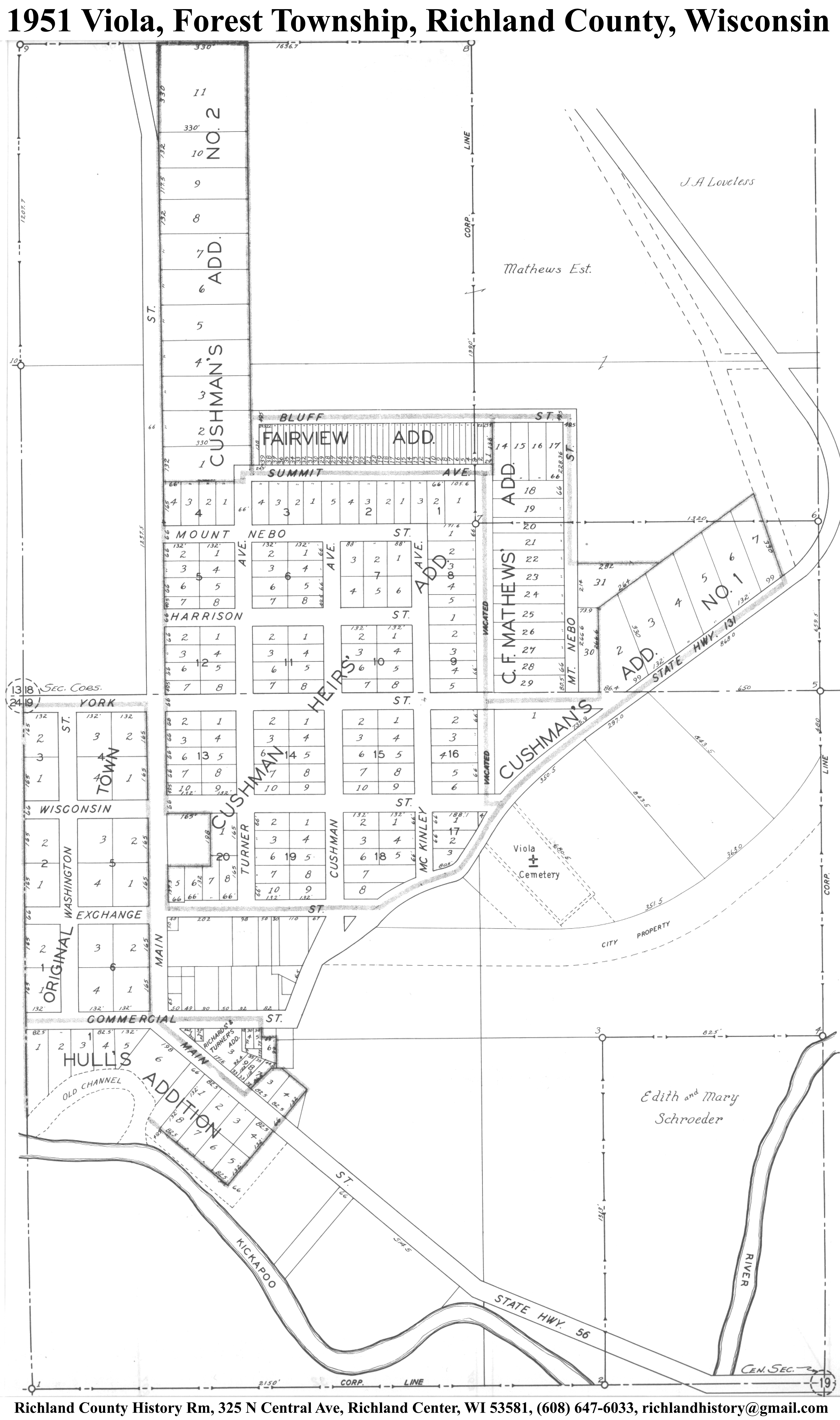
| Viola | 1895 | 1919 | 1951 | |
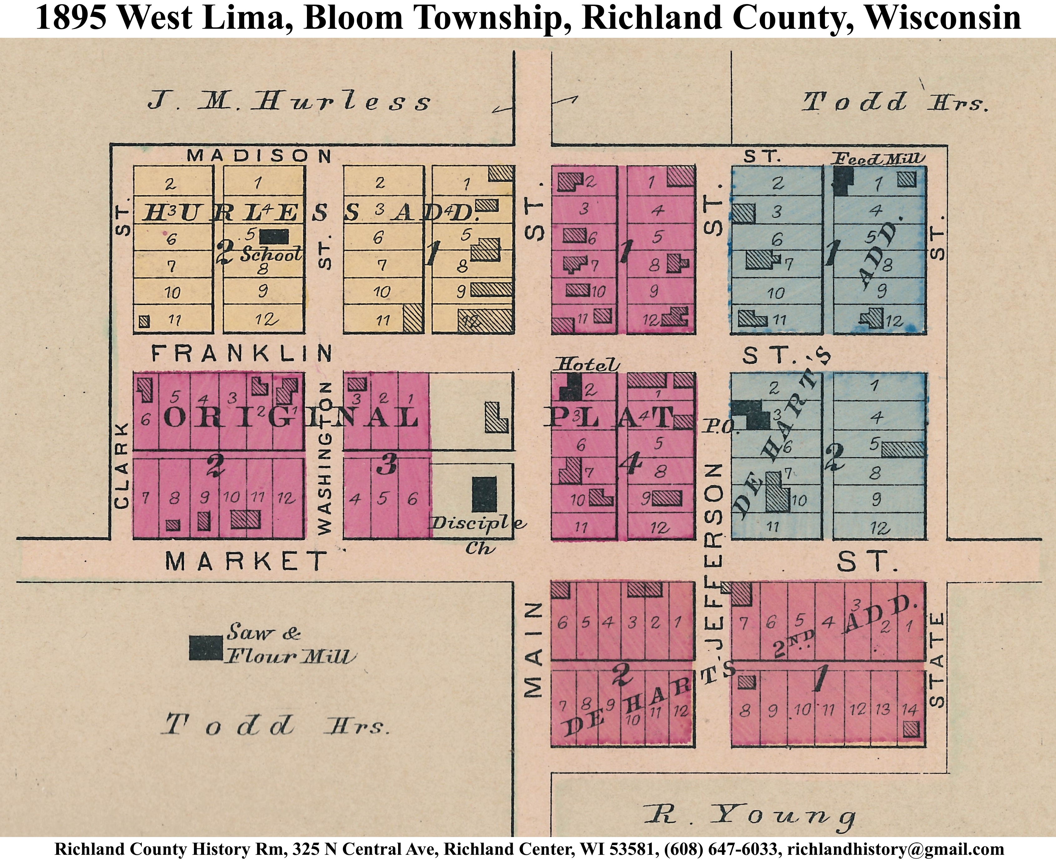
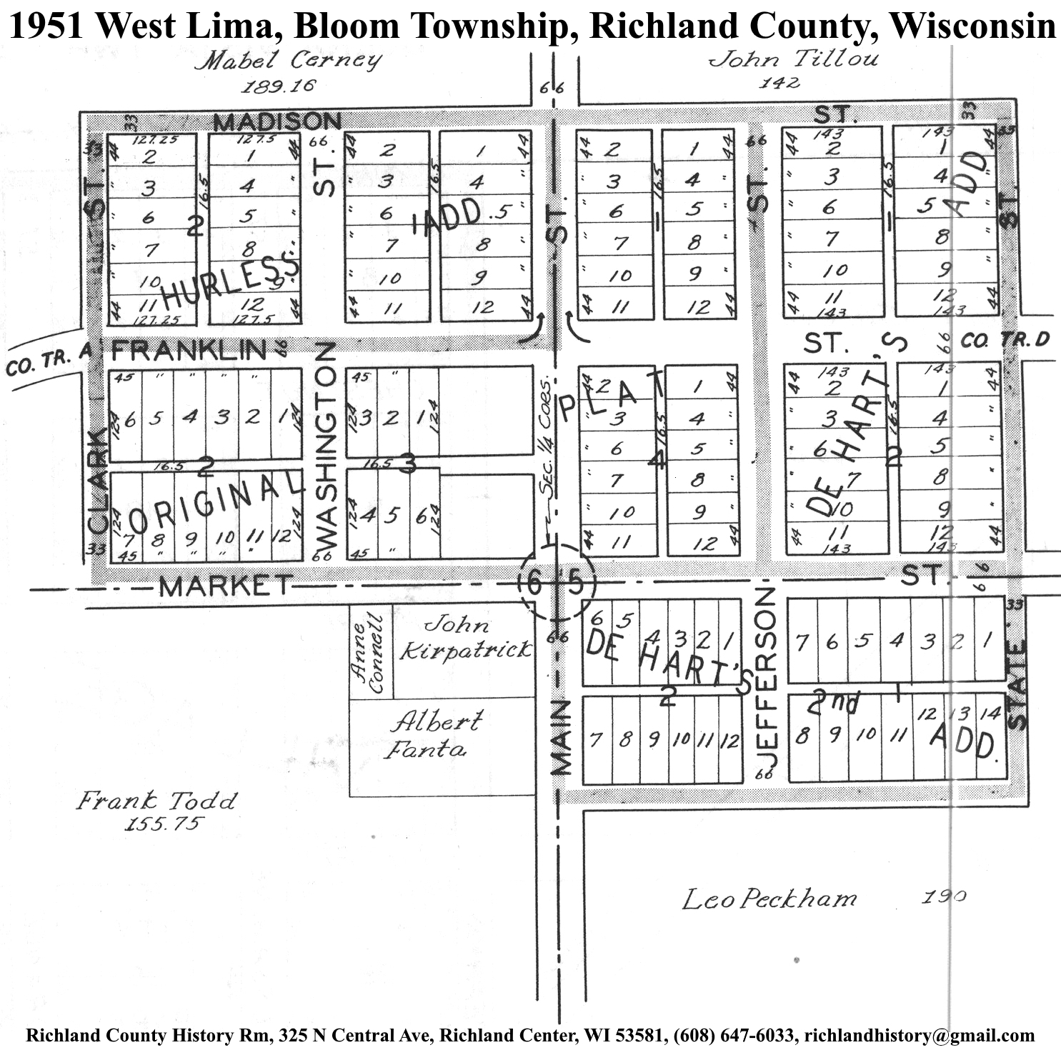
| West Lima | 1895 | 1919 | 1951 | |
| Woodstock | 1895 | 1919 | 1951 | |
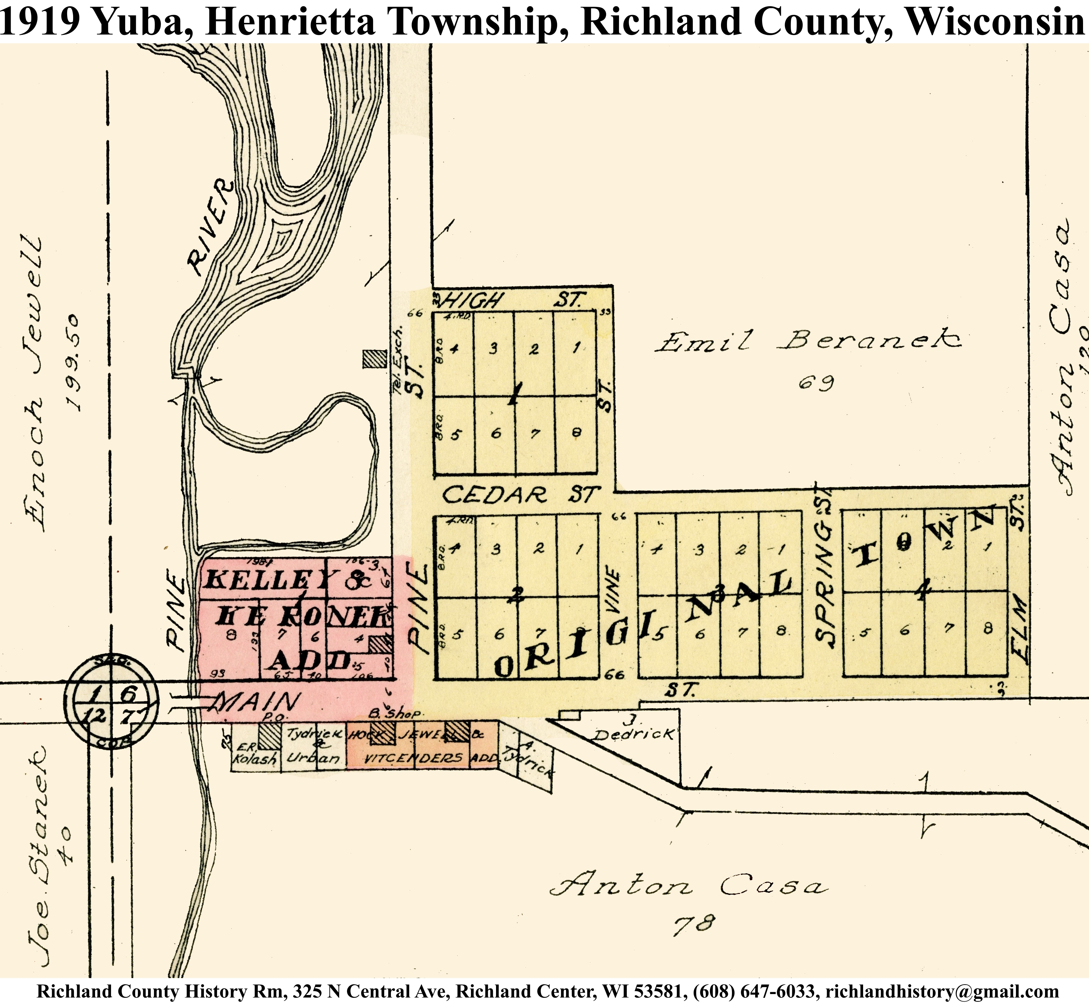
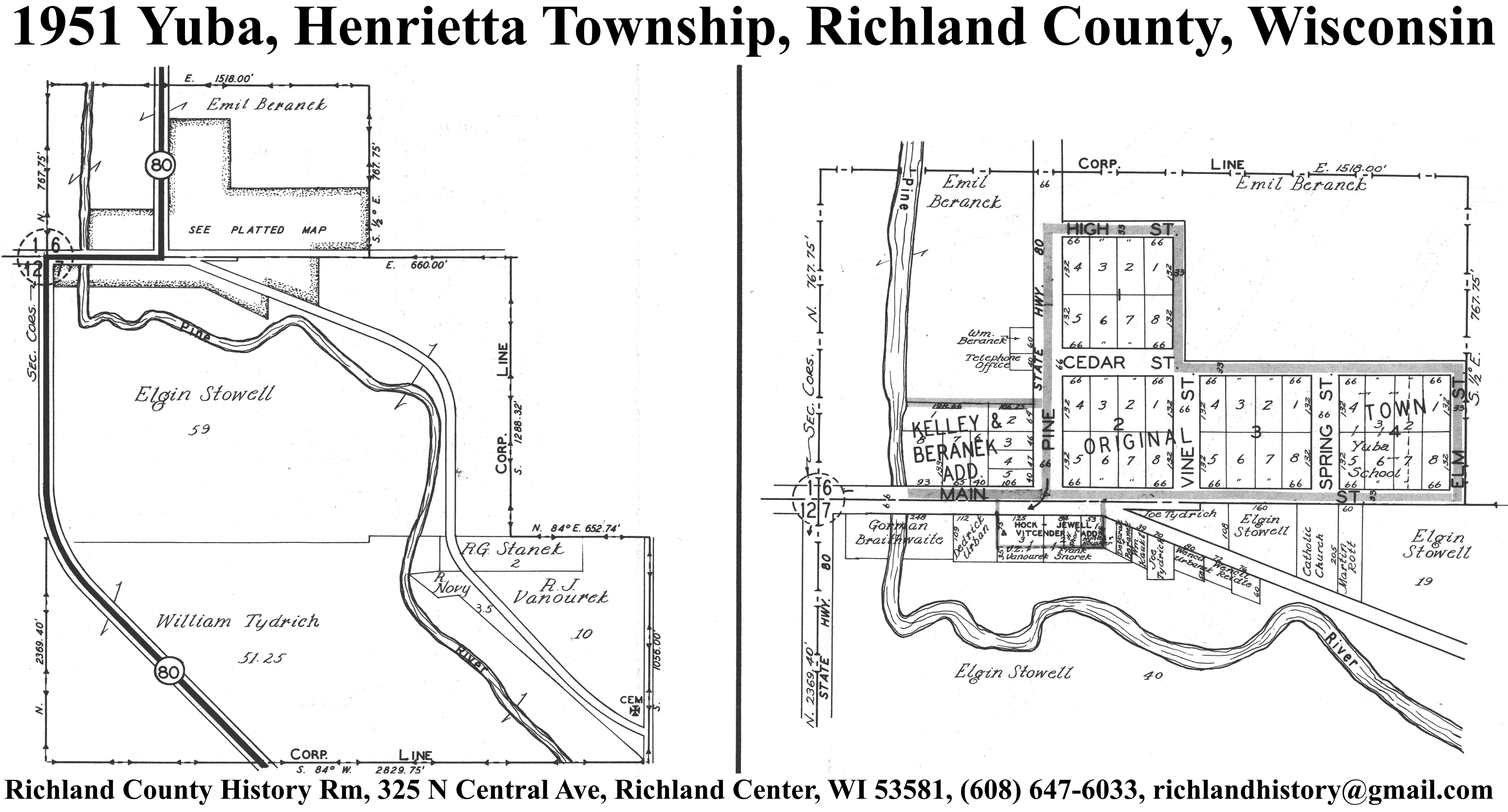
| Yuba | 1919 | 1951 | ||
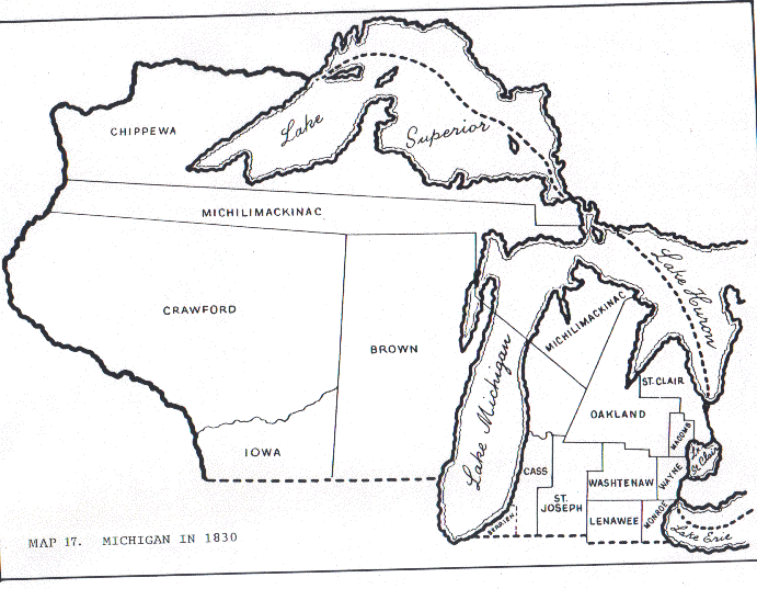
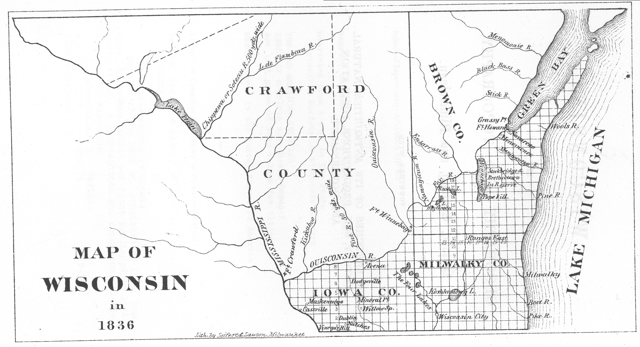
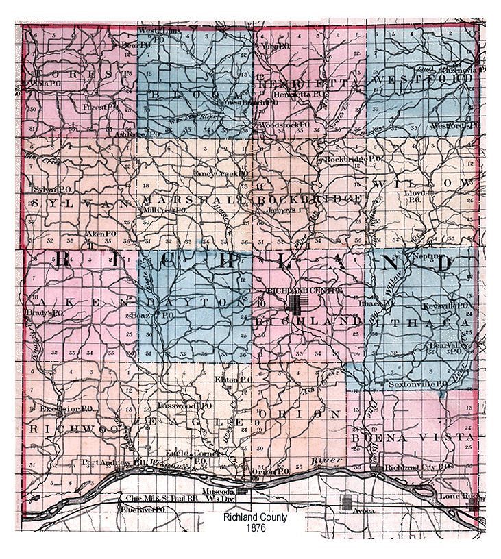
Richland County, Wisconsin Maps: 1830, 1836, 1876, 1895, 1901, 1919, 1949.